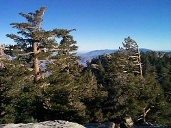
Water Report -- Humber Park to Laws Loop + Caramba

General Palm Springs area.

Postby Hikin_Jim » Fri Sep 05, 2008 9:27 am

mike joe wrote: Ok, cool. So it looks like "4 way junction" is an intersection of two trails? (I just got a map from REI)
Yes, exactly.

mike joe wrote: As far as water treatment...boiling still works, right?

Boiling is actually the #1 most effective water treatment. Far more reliable than chemical treatments, filtering, or ultraviolet sterilization. There's an old hiker's adage: "big bubbles, no troubles." In other words, bring it to a roiling boil ("big bubbles"), and it's safe to drink. The disadvantage of course is that a) the water is hot afterwards (not so fun on a hot day), b) it takes time to boil, and c) you have to carry extra fuel. Boiling isn't too bad on a BP, but on a day hike it's a lot of extra weight to carry a pot, stove, and fuel.
Backpacking stove reviews and information:  Adventures In Stoving
Personal hiking blog: Hikin' Jim's Blog
User avatar
Hikin_Jim
 
Posts: 4958
Joined: Mon Oct 30, 2006 9:12 pm
Location: Orange County, CA

Pipe source off 4-way

Postby trcar » Wed Sep 10, 2008 6:52 am

Jim, I took the same basic route last Friday with same intent of posting water update. Glad I didn't, I would have been near as thorough.

I couldn't find the pipe source described in earlier posts near the 4-way. Do you have some more details?
User avatar
trcar
 
Posts: 25
Joined: Wed Jul 02, 2008 8:58 am
Location: San Diego

Postby Hikin_Jim » Mon Sep 15, 2008 10:45 am

To find the spring near the four way junction:
From the four way trail junction in Tahquitz Valley, go south on the trail towards Little Tahquitz Valley and Tahquitz Peak. Perhaps two to three minutes walk south of the junction, you will come to a small drainage with a line of trees growing in the drainage. Just past this drainage as you proceed south, you come to the edges of Tahquitz Meadow. Prior to the drainage, it's still mostly pine needles on the ground, not meadow greenery. Perhaps twenty feet past the drainage with it's line of trees, look at a ninety degree angle from the trail east into the meadow. You will see a fallen log perhaps forty or fifty feet away that lies basically parallel to the trail. The north end of the log roughly points to the spring which flows out of a pipe into a small recessed hollow. The spring lies between the north end of the tree and the small drainage with its line of trees. The spring lies closer to the drainage than it does to the log, but the spring is not in the drainage. A fairly distinctive large, old tree is just NE of the spring. Walk toward the area just north of the fallen log and listen for the spring. It only becomes visible when you are close to it. The spring has some greenery around it, but I didn't see the greenery as being particularly distinctive. You can see that people have walked to the spring east from the trail, but there was not a distinct use trail. A relatively faint use trail does come in from the north.
Backpacking stove reviews and information:  Adventures In Stoving
Personal hiking blog: Hikin' Jim's Blog
User avatar
Hikin_Jim
 
Posts: 4958
Joined: Mon Oct 30, 2006 9:12 pm
Location: Orange County, CA

Postby mike joe » Wed Oct 01, 2008 8:26 am

Great instructions. I found it no problem.
mike joe
 
Posts: 4
Joined: Wed Sep 03, 2008 4:49 pm

Postby Hikin_Jim » Wed Oct 01, 2008 10:05 am

mike joe wrote:Great instructions. I found it no problem.
Wow. You mean my writing was actually intelligible? How cool is that? :)

I presume the spring was still running well? It was shooting out on the day I was there with enough force as to carry the water out over the little pool several inches.

On an interesting note, there's supposed to be another spring on the other side of the four way junction in a very similar setting. I haven't actually visited that one. I'll be up this weekend, so I'll see if I can find that one.
Backpacking stove reviews and information:  Adventures In Stoving
Personal hiking blog: Hikin' Jim's Blog
User avatar
Hikin_Jim
 
Posts: 4958
Joined: Mon Oct 30, 2006 9:12 pm
Location: Orange County, CA

Previous

Return to Mt. San Jacinto & Santa Rosa Mountains

Who is online

Users browsing this forum: No registered users and 2 guests