I sent a private note to Scout (guy inquiring).
Going from 2600 pairs of coordinates to a route in your Garmin is a bit painfull.
a) use Excel to say his pairs of coordinates in a CSV file
b) use GPSBabel to convert the pairs into a MPS file (gpsbabel is a public source program, i found via searchiing). Its pretty ugly and requires some computer expertise... but it worked (and it was free)
c) then inside mapsource convert the MPS files into GDB...that you then import into your unit.
Only hard part was the GPSbabel program....lots of trial and error
(oh yeah, the route for C2c that is up on the geocities cite has 2600 pairs of points, while max number of pairs for route in my garmin etrex is 250...so i had to make 9 or so routes (named them like "first250", "2nd250" etc.

Mt. San Jacinto Outdoor Recreation
Hiking, Climbing, Camping, Trail Running, Snowshoeing...
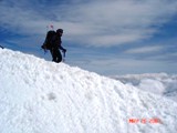
C2C Monday May 26th
21 posts
• Page 3 of 3 • 1, 2, 3
21 posts
• Page 3 of 3 • 1, 2, 3
Return to Mt. San Jacinto & Santa Rosa Mountains
Who is online
Users browsing this forum: No registered users and 46 guests