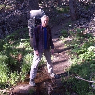
The last time we'd been there was in 2012, when we'd hiked in from Idyllwild. But when I was planning this trip, climbing the Devil's Slide Trail proved to be a deal breaker. Vicki insisted that we start at the Tram, instead. And I was glad we did.
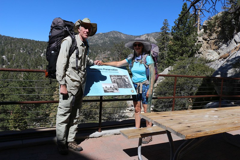
Vicki and I at the Palm Springs Tram Station, ready to hike
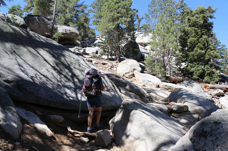
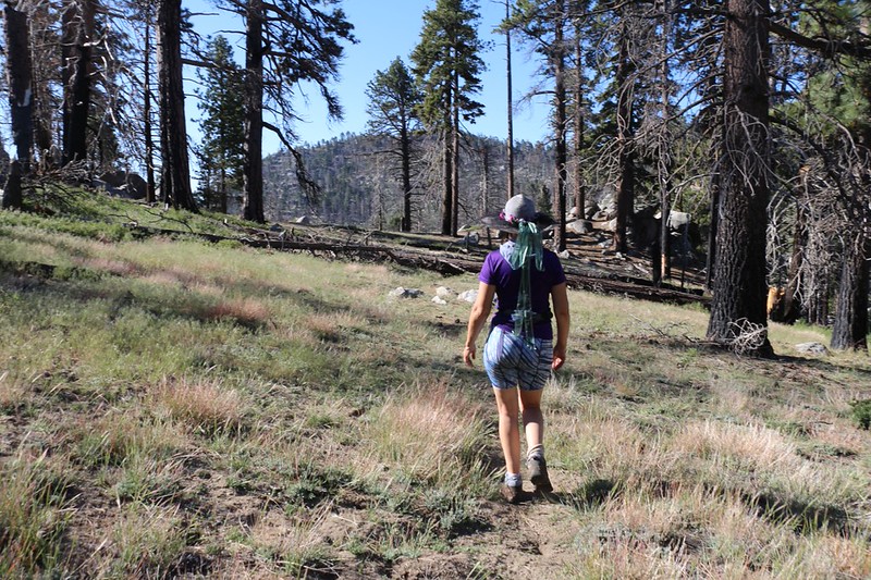
Heading south toward the Hidden Divide Preserve
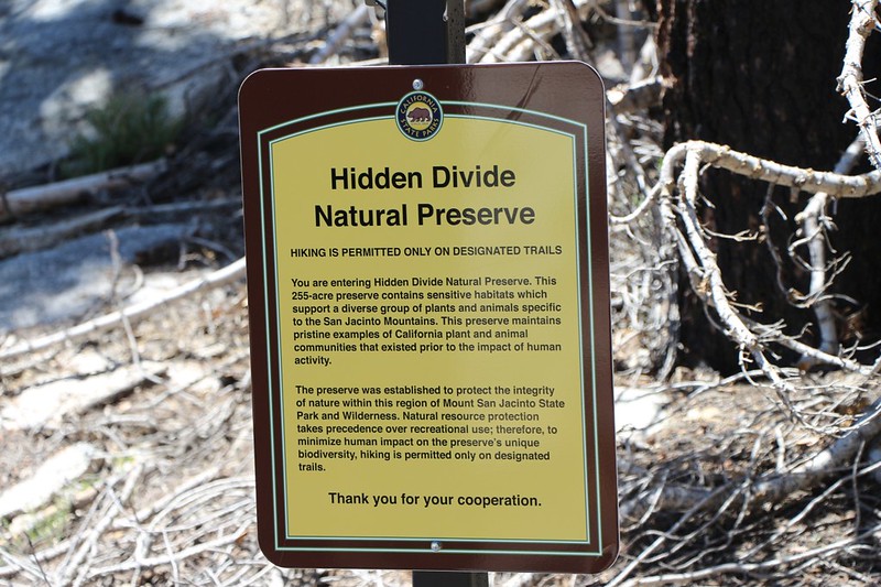
Hidden Divide Natural Preserve sign - No mention whatsoever of [Secret Area], its main attraction!
And there was no sign on the main trail directing visitors toward the newly constructed trail. I wonder why. After they spent all that money, don't they want people to visit? I don't get it.

Welcome to [Secret Area] sign - it's actually a Vernal Pool. But I've never seen it this full!
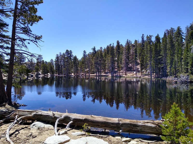
[Secret Area] in the Hidden Divide Natural Preserve, San Jacinto State Park
Question for Grandmaster Perry: I know that it is a longstanding tradition on the forum to not-quite-refer to this place using [Secret Area] but do we really have to do that any more, now that they've opened it back up to the public? Just wondering...
And I would strongly advise all of the forum members to check it out this year before it dries up. 2018-2019 was a great Winter for rain, with the possible exception of the Valentine's Day Flash Flood.

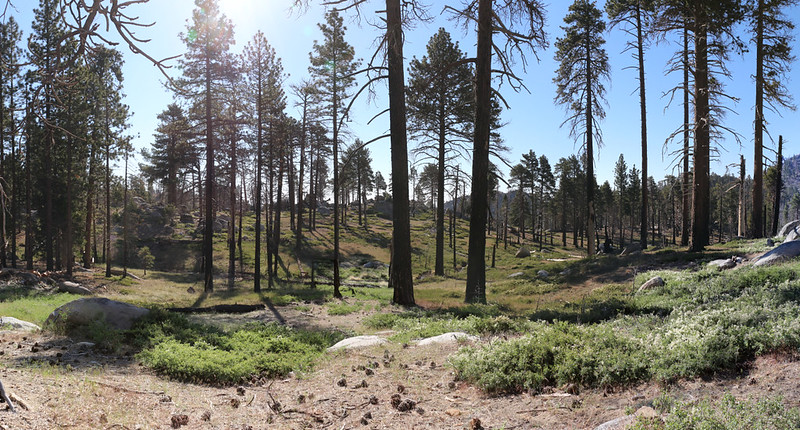
Looking east from Desert View in the Hidden Divide Natural Preserve
We ate some snack at the preserve then continued south, over the divide and down into Tahquitz Valley on the Willow Creek Trail.
The view toward Red Tahquitz and Tahquitz Peak from Hidden Divide

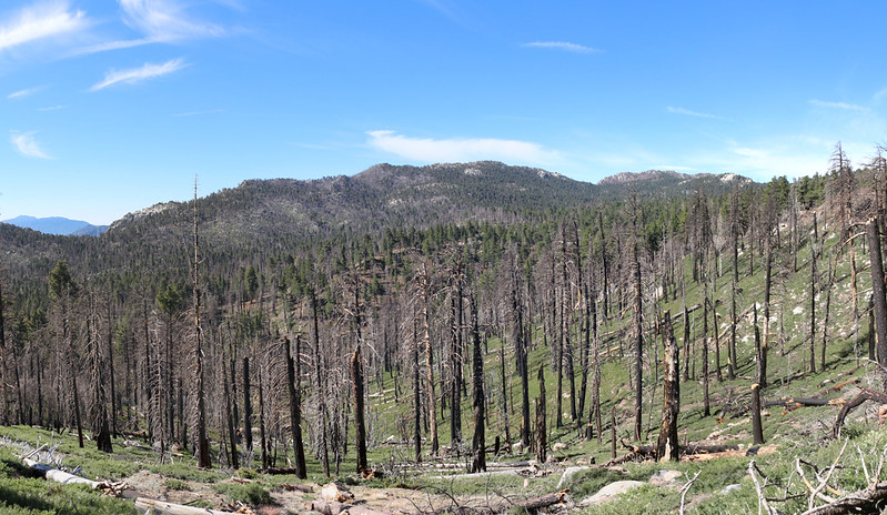
Burned trees in Tahquitz Valley due to the Mountain Fire, from high on the Willow Creek Trail

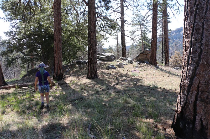
This section of open forest only burned partially during the fire

Burnt pine tree stump with a central pole remaining down low

Yet another downed tree across the trail - these were tough to climb up and around
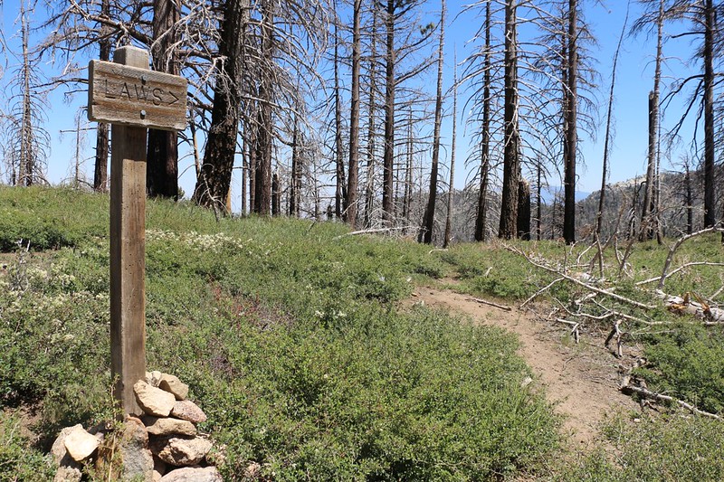
We reached the saddle where the Laws Trail joined the Willow Creek Trail, and turned left. I got out my GPS, which had the correct track loaded that I had made back in 2012. The USFS Topo Map showed a trail in a slightly different location, so if you want to try this hike yourself, please export a GPX file from my CalTopo Page and add it to your own GPS.
Disclaimer: I don't advise hiking on this trail unless you are an experienced cross-country hiker with map, compass, and GPS skills. Proceed at your own risk.
And wear long pants!
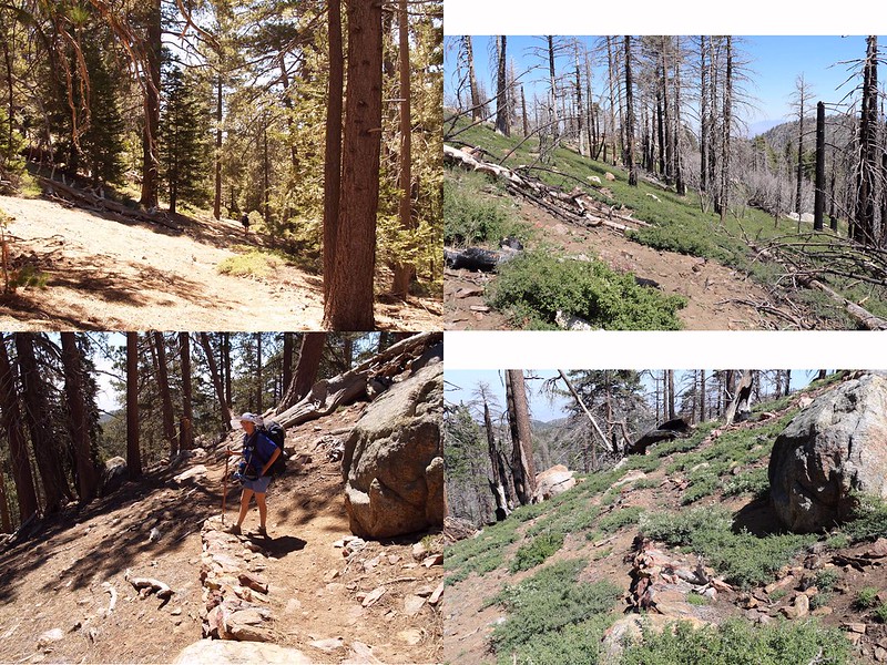
The Laws Trail is currently unmaintained, and it sure looks it - that's buckthorn growing everywhere

Vicki heading east at the top of the trail - it was very faint through low buckthorn bushes - ouch!

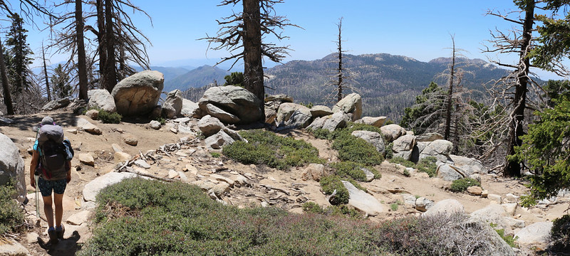
The trail follows a ridge and gave us some good views
Laws Trail Pre- and Post- Mountain Fire Comparison - 2012 vs. 2019
We tried our best to follow the old trail, and we mostly stayed on course, but the buckthorn was everywhere and Vicki's bare legs were getting scratched up. It was about one foot tall on this slope, which wasn't impassable and was perfectly stomp-able, but some of the thorns still got us. Eventually, we reached a point where we could see the flat area of Laws Camp directly below us, and we gave up on following the original shallow and lame switchbacks. We headed straight down the steeper slope, avoiding the buckthorn and downed trees. Standard cross-country bushwhacking, in other words. And it worked great!

Green grass along Willow Creek where the Laws Trail reaches Laws Camp

We took a well-deserved break at Laws Camp under the tall pines
We were happy to see that a significant portion of Laws Camp had escaped the fire. There were many tall trees and a pine-needle-covered forest floor. Very lovely. According to the USFS website, camping is currently allowed in Laws Camp, BTW...
Having made it to Laws Camp, we decided to continue onward to check out Caramba Camp. We knew that the Caramba Trail was also unmaintained, just like the Laws Trail, so we were a bit worried that it was going to be tough, but our fears proved to be largely unfounded. There were a few spots where it was difficult to make out the trail, and there were plenty of fallen trees across the path, but all in all, the trail was in surprisingly good shape. It had been well-built, and it showed it by its durability.

You can still see where the unmaintained Caramba Trail heads out of Laws Camp - but it's filled with pinecones!

The unmaintained trail almost disappears as it descends to the first of several creek crossings. Yep, more buckthorn.
Easy hiking on the unmaintained Caramba Trail
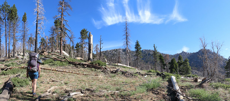
Panorama shot as we continued east
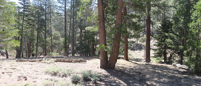
We were thrilled to see the lupines blooming everywhere, just like they were blooming the last time we were here. There also wasn't much buckthorn in this part of the valley, which was a huge relief. The forest hadn't burned as badly, either. Much of the lower growth was gone, but the crowns of the tallest pines had largely survived, so it didn't appear to be such a desolate wasteland as the other areas did.

Lupines blooming in June
We found a great spot to stop and take a break. We stopped here last time, too.

There were plenty of places where downed trees blocked the trail

Caramba Camp was down below us, and we could hear the creek flowing
We took a long break and ate our lunch at Caramba Camp. We were overjoyed to see that this area hadn't been greatly impacted by the Mountain Fire. There were a few random spots that showed signs of scorching, but none of the wholesale carnage. This would still be a great spot to camp even now. If you could get here, that is.
We cooled our feet in the water, and also wandered down Tahquitz Creek to check out the first small waterfall. We had already read stories of people continuing down this creek to their own destruction, because it gets waaayyy too steep and you can get trapped by the terrain if you aren't careful.
Caramba Camp itself - Tahquitz Creek is down to the right

Vicki sat on the shore of Tahquitz Creek and got ready to soak her feet
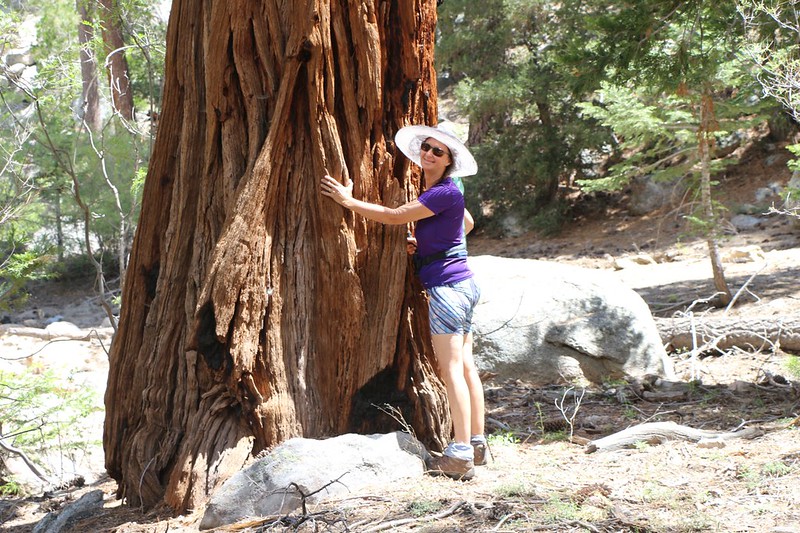
Vicki hugging a huge old Cedar Tree near the creekbed
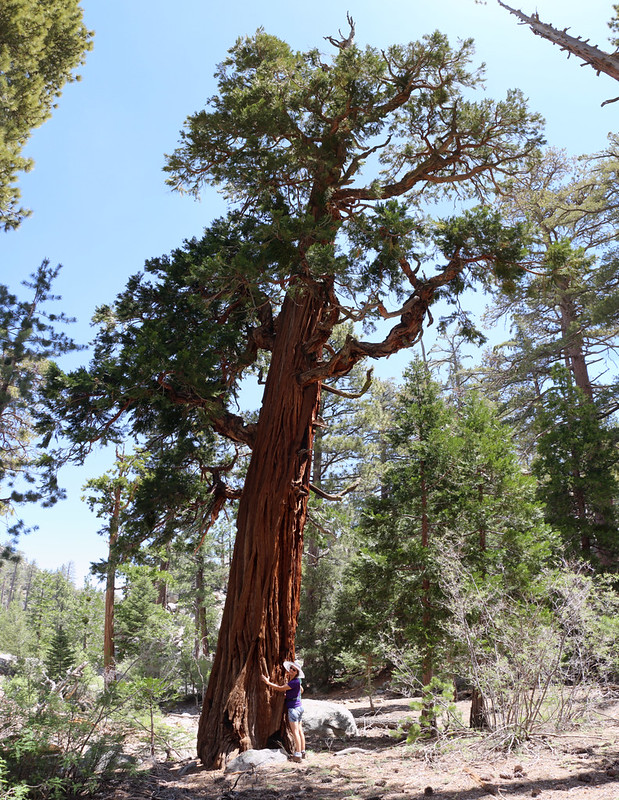
She really loves Cedar Trees, as you can see
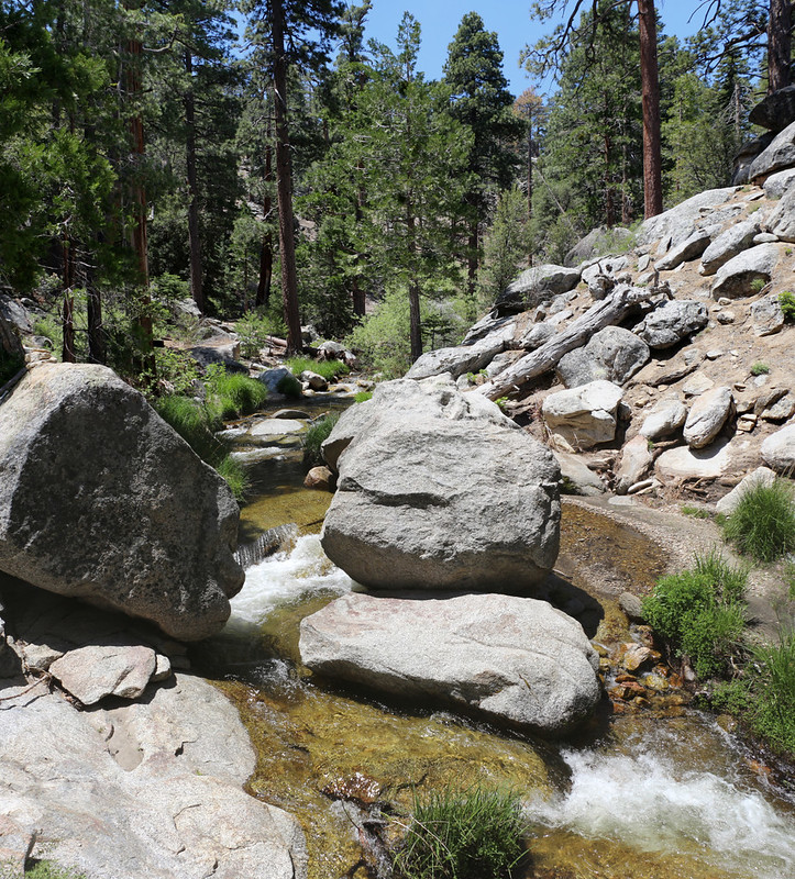
View upstream
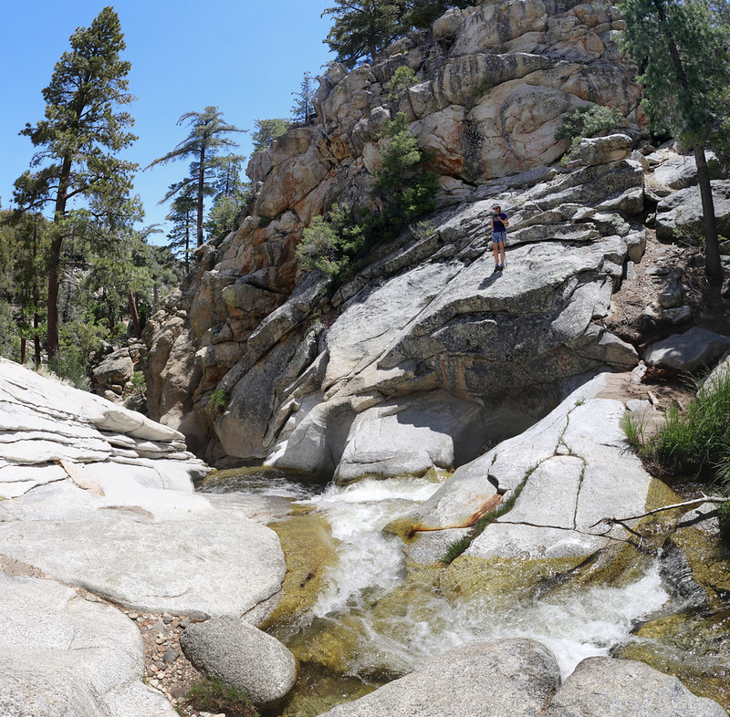
Vicki climbing on the granite slabs with the creek down below. Caramba overlook is up above her.

We spent some time enjoying the sound of the creek as it raced down into a pool
Eventually, of course, we had to leave. And it was quite sunny and warm. So we filtered some extra water from the creek and headed upward once more.

Vicki soaked her shirt to cool off in preparation for our climb out of Caramba Camp

As usual, the unmaintained trail was filled with pinecones. Not many people hike it now.
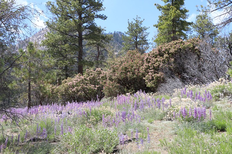
Blooming Lupines and Flowering Manzanita were everywhere

It was hot, so Vicki took a nap on a granite boulder in the shade while I read my book
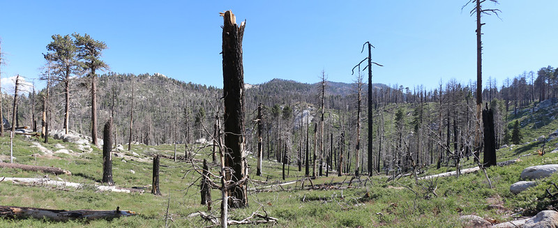
Panorama shot looking south toward Tahquitz Peak and Laws Camp in the burned zone
We made it back to Laws Camp and took a long break in the shade. Soon enough it would be time to climb uphill through the buckthorn.

Many of these trees in Laws Camp show scorched bark on their trunks from the fire, but it didn't burn their crowns
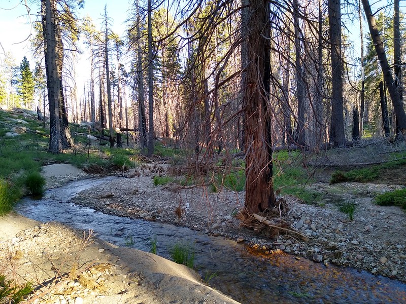
Willow Creek flowing in a channel through sandy sediment at Laws Camp. The flash flood ripped through here, too.

We learned our lesson and decided to head directly up the ridge rather than trying to find the old Laws Trail
The views opened up as we climbed the ridge, with Hidden Divide on the right

Panorama view south toward Red Tahquitz and Tahquitz Peak

We made it back to the traverse section of the Laws Trail - the Willow Creek Trail junction is ahead at that saddle
Once we regained the Willow Creek Trail we knew that everything would be easy again. Except for climbing over and around all the fallen tree trunks, of course.
Panorama view south toward Red Tahquitz (left of center)

View southeast toward Caramba, with Toro Peak in the distance

Vicki took yet another nap at Hidden Divide - the long climb was over
The only thing left to do was hike downhill into Long Valley, and it felt good to be back in an area that hadn't been burned by the fire.

Vicki played with a small stream, floating an impromptu wooden boat
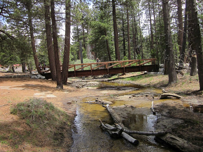
Me, posing on the big wooden bridge over Long Valley Creek

View south from the balcony at the Upper Tram Station in Long Valley
All in all, it had been a fun visit to the wilderness. We got to see what happened to parts of Tahquitz Valley after the Mountain Fire, and our curiosity was more than satisfied. I'm expecting that this trip report will satisfy some of the forum reader's curiosity, as well. Like most of us, I would love to be able to turn back time and prevent the Mountain Fire before it happened, but we all know what a pipe dream that is. The best we can do is realize that the forest will recover, given sufficient time, because life, like hope, springs eternal.
My photos and videos from this 2019 Trip can be found on this Flickr Album Page
The ones from the 2012 Trip (pre-Mountain Fire) can be found on this Flickr Page
The Topo Map from 2012 is here and the 2019 map is on this CalTopo Page
I searched the forum for my own posts, and it appears that somehow I didn't create a Trip Report for the original hike back in 2012, which is almost unheard of. Please accept my apologies, forum peeps! My only excuse is that I must have been too busy with other trips that Summer, and simply ran out of time. I have since written one, but it is on my website/blog page, if you care to read it.
Happy Hiking! And have a great Summer of 2019!
.