Wanted to get all of these into a single thread for easy reference.
If there are any Place Names I've missed, please let me know.
If there is any information I've listed incorrectly, please let me know.
*listed in chronological order*
Museum Trailhead
Elevation - 450 feet
The primary starting point for Skyline Trail located just behind the Palm Springs Art Museum. Until hitting the Rock Cairn further above, this is referred to as the Musesum Trail.
Picnic Tables
Elevation - 1,350 feet
A group of picnic tables encountered on the lower portion of Skyline Trail.
North Lykken Trailhead
Elevation - 500 feet
The alternate starting point for Skyline Trail located at the terminus of Ramon Road. This route is referred to as the North Lykken Trail, bypassess the Picnic Tables, and links up with Skyline Trail proper at the Rock Cairn.
Rock Cairn
Elevation - 1,400 feet
This mound of rocks marks the unofficial "official" beginning of Skyline Trail proper.
Enchanted Garden
Elevation - ??? to ???
Help, more info needed on this. What/where?
Neverending Ridge
Elevation - ??? to ???
Help, more info needed on this. What/where?
Flat Rock
Elevation - 5,900 feet
This flat, smoothed out patch of granite marks the two-thirds (or is it three-quarters) point on Skyline Trail and is a popular stopping point before taking on the most difficult sections of the trail further above.
The Traverse
Elavation - 7,500 feet to 8,000 feet
This would be considered the least steep section of Skyline Trail above Flat Rock, and proceeds northwesterly to Coffman's Crag.
Coffman's Crag
Elevation - 8,000 feet
A massive, nearly vertical outcropping of granite that marks the "beginning of the end" of Skyline Trail. 400 more vertical feet up the chute leading to the end of Skyline Trail and to our Final Place Name.
Grubb's Notch
Elevation - 8,400 feet
The point at which one crests into Long Valley. The terminus of Skyline Trail, but not the end of Cactus-to-Clouds.

Mt. San Jacinto Outdoor Recreation
Hiking, Climbing, Camping, Trail Running, Snowshoeing...
Skyline Trail Place Names
3 posts
• Page 1 of 1
Skyline Trail Place Names
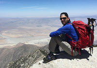
![]() by mattytreks » Mon Apr 27, 2015 12:56 pm
by mattytreks » Mon Apr 27, 2015 12:56 pm
-
mattytreks - Posts: 104
- Joined: Sun Apr 01, 2007 12:25 pm
- Location: San Diego, CA
Re: Skyline Trail Place Names
![]() by Ellen » Wed Apr 29, 2015 9:45 am
by Ellen » Wed Apr 29, 2015 9:45 am
Howdy Ohiker 
Doreen the Skyline Queen named the Enchanted Garden. It's that lovely flat area filled with ribbon wood that allows you to recover before you start switch backing up the Mars ridge (rocks are red) to 5 K.
I named the Never Ending ridge. After dropping down from 5 K, you start climbing again. However, the route goes up and down (mostly on the east side of the ridge). To me, it seems to take FOREVER to get to Tombstone Rock, the 2nd rescue box at 5.5 K, St. Florian's point (5,750) and finally Flat Rock. Often there is no breeze and the radiant heat from the sun is intense.
Names for other sections -- Shade Rock or the Shady Slope (past the first rescue box where the trail switchbacks up on the west side of the ridge in the shade.
I've heard Doreen call the beginning of the traverse (big pile of rocks on the right, huge pine on the left) the Thank You Jesus Rocks as well as Strap On Point. The later refers to donning traction gear when there's snow.
Other names for Coffman's Crag -- Potato Rock (got that from the Craigmeister) and the BFR.
Miles of smiles,
Ellen
- Ellen
- Posts: 2578
- Joined: Thu Mar 29, 2007 9:38 am
- Location: Riverside, CA
Re: Skyline Trail Place Names
![]() by Ed » Wed Apr 29, 2015 11:29 am
by Ed » Wed Apr 29, 2015 11:29 am
I think you missed the rock cairn at 4300'. Is it Doreen's? I thought I saw something posted that indicated it is.
Psychologically, I think Ellen's Never Ending Ridge is so well named. It is where I begin to wonder why I am doing this. I think we may have met there and I passed on the name to you. But when I started timing it, I found it is not that long, even at my turtle pace, e.g., from the saddle between the red-rock ridge and the NER to the 2nd Rescue Box. I find it easier now that I know how many minutes of pain and humiliation I have left.
Psychologically, I think Ellen's Never Ending Ridge is so well named. It is where I begin to wonder why I am doing this. I think we may have met there and I passed on the name to you. But when I started timing it, I found it is not that long, even at my turtle pace, e.g., from the saddle between the red-rock ridge and the NER to the 2nd Rescue Box. I find it easier now that I know how many minutes of pain and humiliation I have left.
- Ed
- Posts: 843
- Joined: Wed Oct 27, 2010 2:04 pm
- Location: San Diego Area
3 posts
• Page 1 of 1
Return to Mt. San Jacinto & Santa Rosa Mountains
Who is online
Users browsing this forum: No registered users and 31 guests