by guest » Sun Feb 22, 2015 4:13 pm
Hi Guys,
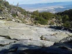
I went up the "Gordon trail" over 10 yr. ago from above Andreas Club.
We did follow some ridges, but what's left of the trail, was time consuming & challenging, to follow.
At about 3-4k I think, we found an old Nat'l Preserve metal circle, (similar to the newer ones used today).
Once we hit the inevitable thicker brush, we abandoned trail-finding-following, and headed up ridges & slopes, similar to what Skyline does.
You guys are fairly accurate in placing it on the map, (I do not remember are route).
I do know we stayed between Andreas & Tahquitz, hitting one of the canyons maybe 1k ft. before Carumba area.
My recollection is we topped out on the south side of the camp area.
After all that, you still after to climb to tram!
Unfortunately, it seems the Mt. fire was too far south, to have hit this area, otherwise it would be way easier, especially with navigation.
Some guy on here, who should go be the name "Mappin Jim"...., may be able to ID where the fire went
It was a long, arduous day, but fun & challenging too.
I've been up past Maynard Mine to 5 or 5.5k, where some cool water slides are, but the "brush zone" there is even worst.
Be interesting if you guys can uncover anything about an old Skyline Trail, (whether on the north or south side of Tahquitz.
Hal & Florian are probably only a few that may remember, (or have heard of) the old Shiller-Hack tr.(n side of W. Fork).
ss