Snow Creek to DWA Residence

General Palm Springs area.

Snow Creek to DWA Residence

Postby Hikin_Jim » Sun Dec 07, 2014 10:52 pm

I went out to Snow Creek again. My first trip dredged up some questions as to exactly where the DWA property in Snow Creek is, but more on that in a minute. For now, a simple trip report.

This time, I took my favorite hiking buddy, Hikin' Joyce.
Image

We went up the road that leads to the DWA property. The sign on the gate seems to imply that one can only use the road to get to the PCT, which is not true. Public access on foot is permitted in all of the land that is National Forest land (i.e. public land). The precise legal definition of the public land just north of the DWA property is Township 3 South, Range 3 East, Section 28.
Image

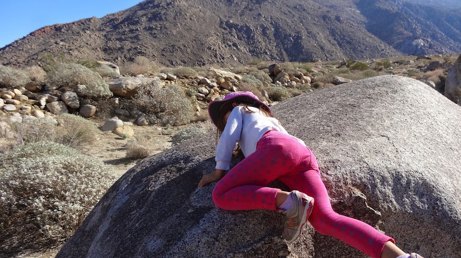
Heading up the road, Joyce unleashed her inner rock climber. Good thing her mother doesn't read this forum or she'd never let me take Joyce out again. ;)
Image

Image

Image

Heading up the road, we met Bob, the security guard, in his truck. Bob was quite cordial. When we started walking up the road past the drinking fountain he warned us that we were approaching private property. I told Bob that we knew where the property line was and I showed him my maps and satellite photos. He let us proceed. We therefore headed into terra incognita, that portion of Section 28 (which, remember, is public land) I had always heard that the DWA was keeping people out of. If the DWA has kept people out of the upper part of Section 28 in the past, I hope that the DWA lease renewal process has made all parties aware that public access on foot is permitted.
Image

Of course we probably don't quite look like Al Qaeda terrorists, so that may have helped.
Image

Further up the road is some interesting stuff like this oak tree which appears to be interior live oak (Quercus winslenzi), which is similar to the coast live oaks which grow near me where I live in Orange County. It was fun to observe the subtle differences.
Image

Heading further up, we saw historic Hicks Cabin. Recall that the Hicks family was instrumental in bringing water out of Snow and Falls Creeks to Palm Springs in the prior century. Hicks cabin is a residence, so out of respect, we did not approach.
Image

At long last, we neared the residence that the DWA maintains in Snow Creek Canyon.
Image

As we approached, who should come out but none other than Warren who is the DWA caretaker (hopefully that's the correct title). Now, I had heard many stories about Warren. I half expected something between Darth Vader and the Gestapo, but in real life Warren was quite personable. We had a nice chat. He even let my daughter play with his dog, Molly. Interestingly, Warren greeted me by name ("Hikin' JIm") as I approached even though we had never met. I had heard that the DWA reads the local forums. It would appear that what I have heard is true.

Now, on my last visit, I had noted that the DWA residence had what appeared to be a fence in front of it. I found this fence interesting because the USGS, USFS, and ESRI topographic maps all show the property line in back of the DWA residence, a discrepancy of about 30 yards. It seemed odd to me that the DWA would build a fence on public land.
Image

Here's an aerial photo. The purple line indicates the property boundary per the USGS, USFS, and ESRI topographic maps.
Image

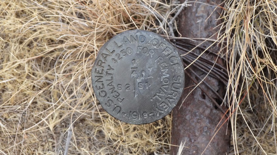
I asked Warren about this. Warren said that the property had been surveyed multiple times and that the fence was in fact on the property line. He said that surveyors had gone up on to the hillsides above Snow Creek Canyon, found the large boulder inscribed with an "+". This inscription was made during the official survey in 1896. Yes, that's 1896 not 1986, in other words, way before GPS, laser sighting equipment, etc. They did everything with surveyor's transits along lines of sight and used physical chains to measure distances, like the way the NFL uses a chain to measure a first down, but survey chains were much longer.
NW S33
3S3E300200 V407 P47 6/3/1896 Pearson 80.00 The point for the section corner 150 feet above gulch falls on flat top of boulder in place 40 feet N. and S. boundary 40 feet E. and W. on which I cut a cross (+) at exact corner point for the corner of sections 28, 29, 32 and 33 marked with 1 notch on the S. and 4 notches on E. sides and raised a mound of stone 4 feet base 2 feet high 4 feet W. of corner.


Well, I was at a bit of a loss here. How come the maps show the boundary 30 yards or so further south? I started to investigate a bit. Notice that the USGS topographic map shows a thin solid line almost exactly where the DWA fence is. This line is the UTM coordinate grid square. The UTM coordinate system breaks the world down into 1 kilometer squares. Land sections are often adjusted for practical reasons. Because of these adjustments, the survey lines don't always line up with "pure" latitudinal lines. In this case, the section boundary is some 30 yards south of the UTM grid line -- exactly the distance the DWA fence appears to be off by.

So, this is just a theory, but it's possible that in the 1896 survey, the boundary markers were incorrectly placed, that they were placed on the UTM grid line and were not placed in accordance with the adjusted section. Subsequent surveys using those markers verified the 1896 property line -- but since the boundary markers were misplaced, the same mistake was repeated, and the UTM line was used not the Section line. As I say, this is just a theory, but it seems no coincidence that the DWA fence lies almost exactly on the UTM grid line.

It would take much more survey work to confirm or refute my theory, survey work that would have to do more than simply rely on the 1896 boundary markers. Again though note that all three of the topo maps of the area show the Section boundary (and thus the DWA property line) as being south of the UTM grid line which places the DWA fence 30 yards into public land.

There are at least two possibilities* here:
1. The topo maps are wrong, and the DWA fence is on the property line.
2. There was some kind of error in the 1896 and/or subsequent surveys, and the DWA fence is incorrectly placed 30 yards north of the property line.

But, let's put it into perspective here. We're talking about a distance on the order of roughly 100 feet. Is there anything in that 100 feet that the public has some great interest in? Is there something in that 100 feet that would cause harm if the public were denied access? Probably not. So whether there is a map error or a survey error, it really doesn't make a material difference, at least not in my eyes. This to me is an interesting question but in a more academic rather than practical sense. At least I've come up with an explanation as to why the maps and the DWA's fence don't seem to line up properly.

All in a day's (map) work,

HJ

*Of course both the topo maps and the survey could be wrong as a third option, but since I'm trying to resolve the discrepancy between the two, I'm making the assumption that at least one is correct.
Backpacking stove reviews and information:  Adventures In Stoving
Personal hiking blog: Hikin' Jim's Blog
User avatar
Hikin_Jim
 
Posts: 4958
Joined: Mon Oct 30, 2006 9:12 pm
Location: Orange County, CA

Re: Snow Creek to DWA Residence

Postby OtherHand » Mon Dec 08, 2014 12:17 am

Jim, without doing a lot of research (I don't want to drag out my old surveying book) I'd say the difference is down to two factors. The first is simply an error in the original survey, but I suspect this would be small. Those old guys could do amazing things with the instruments they had.

I think the majority of the discrepancy comes down to the use of two different datums. A datum is geographic model of the world used to assign coordinates. The USGS topos typically use the North American Datum of 1927 (NAD27) It's all that fine print in the lower left corner of USGS topo maps. Google Earth uses the World Geodetic System of 1984 (WGS84). WGS84 is almost the same as NAD83, which is what most consumer grade GPS units default to.

If you pick a given coordinate lat/long point and compare it in the two datums, you will see two different locations for the same point, and just what the offset is depends on where in the country you are. It can vary from close to zero to several hundred feet. When doing SAR stuff it's VERY important to ensure everyone is using the same datum.

What the online mapping programs do is overlay the raster USGS topo images on to a lat/long grid, and they likely use the more recent WGS84 datum, but simply align the edges of the map to the lat/long lines. This means the topo is shifted just a bit from where it should be according to the newer datum. If you look in the fine print on the lower left of the topo maps you'll see it describes the NAD83 map corners as being shown by dashed tick marks. I'm not aware of any online mapping program that will let you align to these. There may well be one, but I haven't used it.

A good example of datum discrepancies was covered in a SAR training exercise I was involved with. A "victim" was trapped on the face of a rocky ridge and a team was sent in to do a technical rescue. It seemed like finding the victim would be easy as they were given the lat/long. But there was no victim to be found there. Turned out the coordinates were deliberately given in the wrong datum and the difference in the two datums put the victim a few hundred feet away on the other side of the ridge spine. The point of the exercise was to demonstrate the importance of knowing what datums are being used.
OtherHand
 
Posts: 291
Joined: Mon Dec 28, 2009 2:07 pm

Re: Snow Creek to DWA Residence

Postby Hikin_Jim » Mon Dec 08, 2014 8:25 am

Ah! Very good. That's a very good point. And I have heard of just those sort of datum based issues (SAR teams being dropped off at the wrong point when the ground team was using one datum but the helo pilot was using another).

But question: Why then do the topo maps show the caretaker's cottage as being north of the Section line? Yes, if I display the aerial photo in some online fashion (presumably WGS 84 based) and then superimpose a Section line on it (presumably NAD 27 based), I could get a discrepancy. But the maps when they were drawn in the 1950's were uniformly based on the North American Datum of 1927. The North American Datum of 1983 hadn't yet been created. Why do the maps show the DWA cabin in Section 28?

Here is the official USGS map. This is a screen capture of a pdf downloaded from USGS.gov. It is essentially a paper map. There is no raster projection and therefore I believe no chance of having a NAD 27/NAD 83/WGS 84 issue. I have annotated the map to show the two cabins in the southern portion of Section 28. The DWA caretaker's cabin is shown as clearly being north of the section line.
Image

It still seems that there must be either a survey error or a map error. The issue does not seem to be a datum issue -- or am I missing something?

Now, notice something. In the adjoining section to the east, Section 27, the southern boundary is clearly not an east west line. The eastern end of the line is farther north than the western end of the line. This is precisely the type of adjustment to sections that I mentioned earlier. If the original survey did not adjust the dividing line to dip down south (as shown by the southern boundary of section 27), a survey error would occur. Speculation, admittedly, but I'm trying to come up with a reasonable explanation as to why the surveys on the ground (assuming that I have accurate information; I haven't seen the surveys) show the DWA cabin south of the boundary line when the maps show the cabin north of the boundary line.

HJ
Backpacking stove reviews and information:  Adventures In Stoving
Personal hiking blog: Hikin' Jim's Blog
User avatar
Hikin_Jim
 
Posts: 4958
Joined: Mon Oct 30, 2006 9:12 pm
Location: Orange County, CA

Re: Snow Creek to DWA Residence

Postby Hikin_Jim » Mon Dec 08, 2014 10:08 am

OtherHand wrote: If you look in the fine print on the lower left of the topo maps you'll see it describes the NAD83 map corners as being shown by dashed tick marks.
You are indeed correct. Such verbiage is printed on the map, and there are in fact tick marks. Looking at the tick marks, see below, I notice an easterly shift. I do not see any north/south shift. This easterly shift is consistent at all four corners of the map. There is no north/south shift shown on any of the four corners of the map.

Image

I'm still thinking either a) survey error or b) map error.

HJ
Backpacking stove reviews and information:  Adventures In Stoving
Personal hiking blog: Hikin' Jim's Blog
User avatar
Hikin_Jim
 
Posts: 4958
Joined: Mon Oct 30, 2006 9:12 pm
Location: Orange County, CA

Re: Snow Creek to DWA Residence

Postby zippetydude » Mon Dec 08, 2014 2:36 pm

I've got a great idea for where and when we should hold our next get-together! How about at the very edge of public land by the Water District compound from, say 6:00 a.m. til around 10:00 p.m! We can have loud music and walk slowly, shoulder to shoulder down the road each time Warren tries to race out and check on where a hiker is going. Make him just as irritated as he and his silly enforcement antics make us. We could even film it and take his picture a hundred times like he does to intimidate hikers! Could be fun...

z
User avatar
zippetydude
 
Posts: 2751
Joined: Tue May 09, 2006 5:40 am

Re: Snow Creek to DWA Residence

Postby Hikin_Jim » Mon Dec 08, 2014 2:59 pm

:lol:

Well, Zip, I sincerely hope that the lease renewal process has made it clear to all that the public has a right to access the land in Section 28. I can't comment on what may or may not have happened in the past, but everyone connected with the DWA was very civil to me on Saturday.

HJ
Backpacking stove reviews and information:  Adventures In Stoving
Personal hiking blog: Hikin' Jim's Blog
User avatar
Hikin_Jim
 
Posts: 4958
Joined: Mon Oct 30, 2006 9:12 pm
Location: Orange County, CA

Re: Snow Creek to DWA Residence

Postby bluerail » Mon Dec 08, 2014 3:03 pm

Warrens a good guy, he doesn't deserve the harasment. Seriously
User avatar
bluerail
 
Posts: 2108
Joined: Thu Dec 11, 2008 10:30 am
Location: La Quinta

Re: Snow Creek to DWA Residence

Postby zippetydude » Mon Dec 08, 2014 4:46 pm

Warren was quite civil and personable when I talked to him myself. Is there someone else who is making him enforce the No Trespassing policy with such strong-arm tactics? Do you remember when a certain select group of people were caught in a sting operation and threatened with huge fines or potentially even jail time? Why on earth would such a thing happen just because a few hikers simply walked across a deserted section of unfenced land? I have nothing against Warren personally, but abuse of power, even by a nice guy, is still abuse of power.

By way of contrast, I was out exploring the hills of what I thought was part of the Wildwood State Park by my house. I came across a guy and his daughter, and we talked a few minutes. Turns out I was on private property - his private property - and I hadn't realized it because, as it turns out, regardless of how many times he posted signs people stole them or destroyed them. I told him I would keep off the property if it was his preference. "No." he said, "Here's my phone number. Just give me a call before you come up and I'll know it's you. You're not hurting anything. In fact, if you see someone doing any damage, will you let me know about it?"

Of course, I said yes and it was a very friendly encounter. Could not Warren have struck up the same deal with hikers? He could have enlisted them as friends and an extra set of watchful eyes rather than harrassing them. If he's really interested in protecting the water supply, then a small group (not many people are capable of doing Snow Creek) of insiders who keep an eye on the place would be ideal. Again, nothing personal, but unless someone of higher authority is making him do that, he's just a wolf in sheep's clothing. I dare say if you went ahead and walked across the property to climb Snow Creek again, he'd be more than happy to press charges. Is that a great guy?

z
User avatar
zippetydude
 
Posts: 2751
Joined: Tue May 09, 2006 5:40 am

Re: Snow Creek to DWA Residence

Postby OtherHand » Mon Dec 08, 2014 6:39 pm

Jim, I did a bit more digging and may have something closer to an answer. The USGS has online a very good collection of historical topo maps here. It's not the most intuitive of interfaces but you can download the old maps for free. Anyway, I pulled the topos of the Snow Creek area (Palm Springs Quad) for 1940 and 1957, and annotated screen grabs are attached below.

If you look at the boundaries for Sec 33 you can see the northerly border was moved south from the 1940 map to the 1957 map. And in looking at your current map, it's moved yet again. From looking at these maps, one might get the idea that Sec 33 moved out from under the DWA facilities. But that's probably not the case.

I have limited understanding of real estate law but I seem to recall that the location of property markers on the ground trumps lines drawn on a map. Especially a USGS map as it's not a legal plat. So if surveyors were able to locate the Section corner markers for Sec 33, that IS their location despite where the section lines might be shown on a topo map.

So maybe a clue here....If I remember my USGS topo stuff right, where the section corners meet on a map and there's a small break and then a solid X at the intersection that means that section comer was located in the field and the location accurately displayed on the final map. If you look at the 1957 map, there appears to be a located section corner in the Snow Creek community, the NW corner for Sec 28, and also a located NE corner. Those corners may not have been located in the 1940 map, especially since it moved the line south (or maybe the clever Snow Creekers just moved it themselves!). The 1957 map preparers then put the northerly boundary of Sec 33 exactly 1 mile south of the two located Sec 28 boundary corners, a reasonable thing to do. This may explain the big southerly jump. I suspect that if someone went up on the westerly slope of the canyon it might be possible to find the original NW Sec 33 corner from the 1896 survey and that it would be several hundred feet north of where today's map shows it. Hmmmm....That could be a fun hunt and would provide a better understanding of where Sec 33 is exactly.

BTW, I have the 1901 San Jacinto map prepared from the original 1896 survey, but it's a much larger scale map and shows no structures at all in the canyon to reference, so it's of little use in this discussion.
Attachments
Snow Creek USGS.jpg
OtherHand
 
Posts: 291
Joined: Mon Dec 28, 2009 2:07 pm

Re: Snow Creek to DWA Residence

Postby Hikin_Jim » Tue Dec 09, 2014 8:00 am

OtherHand wrote:I seem to recall that the location of property markers on the ground trumps lines drawn on a map. Especially a USGS map as it's not a legal plat. So if surveyors were able to locate the Section corner markers for Sec 33, that IS their location despite where the section lines might be shown on a topo map.
Ah, now THAT makes sense. So the discrepancy I'm seeing is map error -- or at least the limitations of how accurate a USGS map is.

OtherHand wrote:So maybe a clue here....If I remember my USGS topo stuff right, where the section corners meet on a map and there's a small break and then a solid X at the intersection that means that section comer was located in the field and the location accurately displayed on the final map.
I've noticed those before and assumed that there must be a more solid determination of the position than with other section corners. That makes sense that a "+" at the section corner indicates that the surveyors were able to locate the physical boundary marker.

OtherHand wrote:I suspect that if someone went up on the westerly slope of the canyon it might be possible to find the original NW Sec 33 corner from the 1896 survey and that it would be several hundred feet north of where today's map shows it.
Actually, that was my thought too, that the mystery wouldn't be resolved until one could locate the physical marker on the ground -- which is exactly what Warren, the DWA caretaker, said that the more recent surveys had done. He said that it was atop a large boulder which is consistent with Pearson's survey notes from 1896.

As an aside, I've been able to find some obscure survey markers. On top of the San Jacinto "plateau":
Image
The above is the Section corner monument for Sections 20, 21, 28, and 29, elevation roughly 10,120 feet.

Eastern Mojave desert, a 1/4 Section corner:
Image
The above is for T12N, R15E, quarter corner between sections 2 and 1

OtherHand wrote:Hmmmm....That could be a fun hunt and would provide a better understanding of where Sec 33 is exactly.
Which brings up an important point: Even those who make an honest effort to avoid Section 33 could wind up trespassing by accident. Even those with a really good GPS could stray on to Section 33 since the maps displayed in a GPS are going to reflect a Section 33 further south than it really is.

The California Penal Code, Section 602, requires that "No Trespassing" type signs be placed three to a mile AND that all roads and trails entering a parcel have "No Trespassing" type signs posted. If one were to infringe by accident, it would be hard for the DWA to prosecute on the basis of CPC 602 unless those signs are present. I would think it would be in the DWA's best interests to have the land clearly marked, but I've heard complaints that the boundaries are not so marked; I have no personal knowledge as to how well (or not) the boundaries overall are marked or if the markings comply with CPC 602. I can say on the main access point to Section 33, the boundary is clearly marked by signs and a fence.
Image

HJ
Backpacking stove reviews and information:  Adventures In Stoving
Personal hiking blog: Hikin' Jim's Blog
User avatar
Hikin_Jim
 
Posts: 4958
Joined: Mon Oct 30, 2006 9:12 pm
Location: Orange County, CA

Next

Return to Mt. San Jacinto & Santa Rosa Mountains

Who is online

Users browsing this forum: No registered users and 6 guests