Anybody hiking Skyine Trail on march 30th? I am hiking it for the first time and wanted some advice on not getting lost. Also if anyone is hiking that day if we could possibly follow you.
Thank You

Mt. San Jacinto Outdoor Recreation
Hiking, Climbing, Camping, Trail Running, Snowshoeing...
skyline trail
17 posts
• Page 1 of 2 • 1, 2
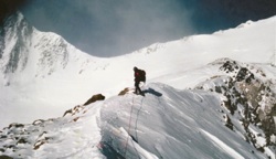
![]() by neverwashasbeen » Tue Mar 18, 2014 5:25 pm
by neverwashasbeen » Tue Mar 18, 2014 5:25 pm
There should be plenty of people going on that Sunday. You won't be alone.
Happy Trails!
-
neverwashasbeen - Posts: 437
- Joined: Tue May 19, 2009 6:34 am
- Location: Palm Springs
skyline
![]() by kenbenoit » Fri Mar 21, 2014 12:37 pm
by kenbenoit » Fri Mar 21, 2014 12:37 pm
How was the trail when you hiked it on 16 March? Was there ny snow or ice up top?
I went up about half way yesterday but turned around as i was alone and have never been up so was concerned about getting lost.
Is anyone planning to go this weekend.?
Ken 760-459-3284
I went up about half way yesterday but turned around as i was alone and have never been up so was concerned about getting lost.
Is anyone planning to go this weekend.?
Ken 760-459-3284
- kenbenoit
- Posts: 10
- Joined: Fri Mar 21, 2014 12:32 pm
trail not well marked?
![]() by jonSanDiego » Fri Mar 21, 2014 4:42 pm
by jonSanDiego » Fri Mar 21, 2014 4:42 pm
wow is this trail not well marked? I wish to try this one day!
- jonSanDiego
- Posts: 8
- Joined: Tue Mar 18, 2014 9:17 am
My Skyline hike Thursday 20 marcrh
![]() by kenbenoit » Sat Mar 22, 2014 10:04 am
by kenbenoit » Sat Mar 22, 2014 10:04 am
I have been reviewing all of the literature on the skyline for the past couple of hours...something i should have done before the hike! After studying the aerial and topographical maps I now know that I made it to approx 5800 feet as i was on a hill looking at a slight drop of maybe 50 feet before ANOTHER MODEST CLIMB TO WHAT WOULD HAVE BEEN FLATROCK at 6000 feet.
A little history...I am from Angus Ontario, just north of Toronto. Arrived here on 10 March, going home 24 March. Since i arrived i have done North and South Lykken, Araby/Murray Peak and Araby to the Trading Post in the Indian Canyons via Murray Peak via a bike trail that led to the Fern valley Trail. On Tuesday I climbed to the flat section approx the 3000 ft level of the skyline with a friend. It was so beautiful and challenging that i wanted to go higher so off i went on thursday by myself.
I started at the Museum at 7:30 at a fast pace and got to the picnic tables in 20 min, to the 3000 foot flat spot we had been to on Tues in one hour, and to the 5800 foot level (I think) at 2:27. At this point i had a half liter of water left and wasn't sure where I was, but could see the trees and what looked like the top. I am a 66 year old fit triathlete/squash player but my eyes are are little suspect (short sighted) so I should have been able to see the tram if i had known where to look.
At that point I phoned my friend who told me I couldn't possibly be that far as it takes 9 hours to do the hike and that she didn't want me to die getting lost, and I didn't have enough water and I was alone. So I came down. Damn that was a long way! After getting up there in only 2:27, it took 3:05 to get down complete with big blisters on both of my big toes, sore knees and tired legs.
Personally, I think it would have been much easier to go up another 2600 feet than to go down 5800! I had not read about the proper place to go up at Coffman's Crag so that could have been a problem!
So did I make the correct decision? I may never have another opportunity to try this hike. I am not getting any younger and I may not get another opportunity to come here. I feel like i am recovered enough to make an attempt tomorrow except for the blisters which I could cover with some second skin...the left is healed already,the right has a bubble about the size of a fingernail.
Comments??
- kenbenoit
- Posts: 10
- Joined: Fri Mar 21, 2014 12:32 pm
![]() by zippetydude » Sat Mar 22, 2014 11:09 am
by zippetydude » Sat Mar 22, 2014 11:09 am
I'd absolutely go for it. There will be people on the trail and you can follow the beaten path pretty much the whole way nowadays. You've already done a great scouting job, and going on up is going to be hard even from where you were, but getting lost is unlikely. Post a TR after you make it!
z
z
-

zippetydude - Posts: 2751
- Joined: Tue May 09, 2006 5:40 am
Skyline Trail
![]() by Allison » Sat Mar 22, 2014 12:10 pm
by Allison » Sat Mar 22, 2014 12:10 pm
Sure, you could go for it but please note that the hardest part of the hike is the bit from Flat Rock to the top. And it is very hard! It is much steeper than most of the trail (except the very beginning) and you will also start to feel the effects of the altitude. The sun is intense, no matter what the temperature so if you do attempt it please make sure you take plenty of water (easier to dump excess than not have enough), take food, and start early.
- Allison
- Posts: 7
- Joined: Fri Oct 18, 2013 3:59 pm
17 posts
• Page 1 of 2 • 1, 2
Return to Mt. San Jacinto & Santa Rosa Mountains
Who is online
Users browsing this forum: Baidu [Spider] and 7 guests