
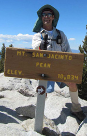
Mt. San Jacinto Outdoor Recreation
Hiking, Climbing, Camping, Trail Running, Snowshoeing...
Fire in Mountain Center darkens Palm Springs ...
Palm Springs is blanketed in ash this morning
![]() by Screerider » Tue Jul 16, 2013 7:08 am
by Screerider » Tue Jul 16, 2013 7:08 am
...and 10* cooler.
- Screerider
- Posts: 137
- Joined: Sat Mar 02, 2013 4:31 pm
![]() by zippetydude » Tue Jul 16, 2013 9:04 am
by zippetydude » Tue Jul 16, 2013 9:04 am
Thanks for all the informative posts everybody. I've been watching in dismay from my semi-distant vantage point in Yucaipa. Here's what it looks like from my house:
http://www.flickr.com/photos/zippetydud ... 662150685/
(Incidentally, that last pic was taken a few minutes later of the moon in conjunction with Spica.)
Note that just as the sun was setting the fire made a run and the plume looks like a bomb went off. Looks scary and sounds pretty negative on the inciweb update from this morning. Hope all the fire crews can stay safe.
z
-

zippetydude - Posts: 2751
- Joined: Tue May 09, 2006 5:40 am
San Jacinto area fire
![]() by bytebit » Tue Jul 16, 2013 9:15 am
by bytebit » Tue Jul 16, 2013 9:15 am
Life is too short - make the most of your day!
-
bytebit - Posts: 29
- Joined: Thu Apr 18, 2013 8:06 am
- Location: Palm Springs
![]() by cynthia23 » Tue Jul 16, 2013 11:45 am
by cynthia23 » Tue Jul 16, 2013 11:45 am
Just saw on KESQ.com that they are ordering an evacuation of the "stone houses" (Andreas Canyon Club) on the lower slopes in South Palm Canyon. They say they don't think the fire will actually burn down into South Palm Springs but they are dropping fire retardant and preparing in case it does. It's now at eight thousand acres. Air quality here in the valley is very bad. You can't spend more than a few minutes outside without eyes smarting.
Q: How many therapists does it take to screw in a light bulb? A: Only one, but the light bulb has to want to change ...
- cynthia23
- Posts: 1289
- Joined: Tue Nov 07, 2006 3:33 pm
- Location: Rancho Mirage
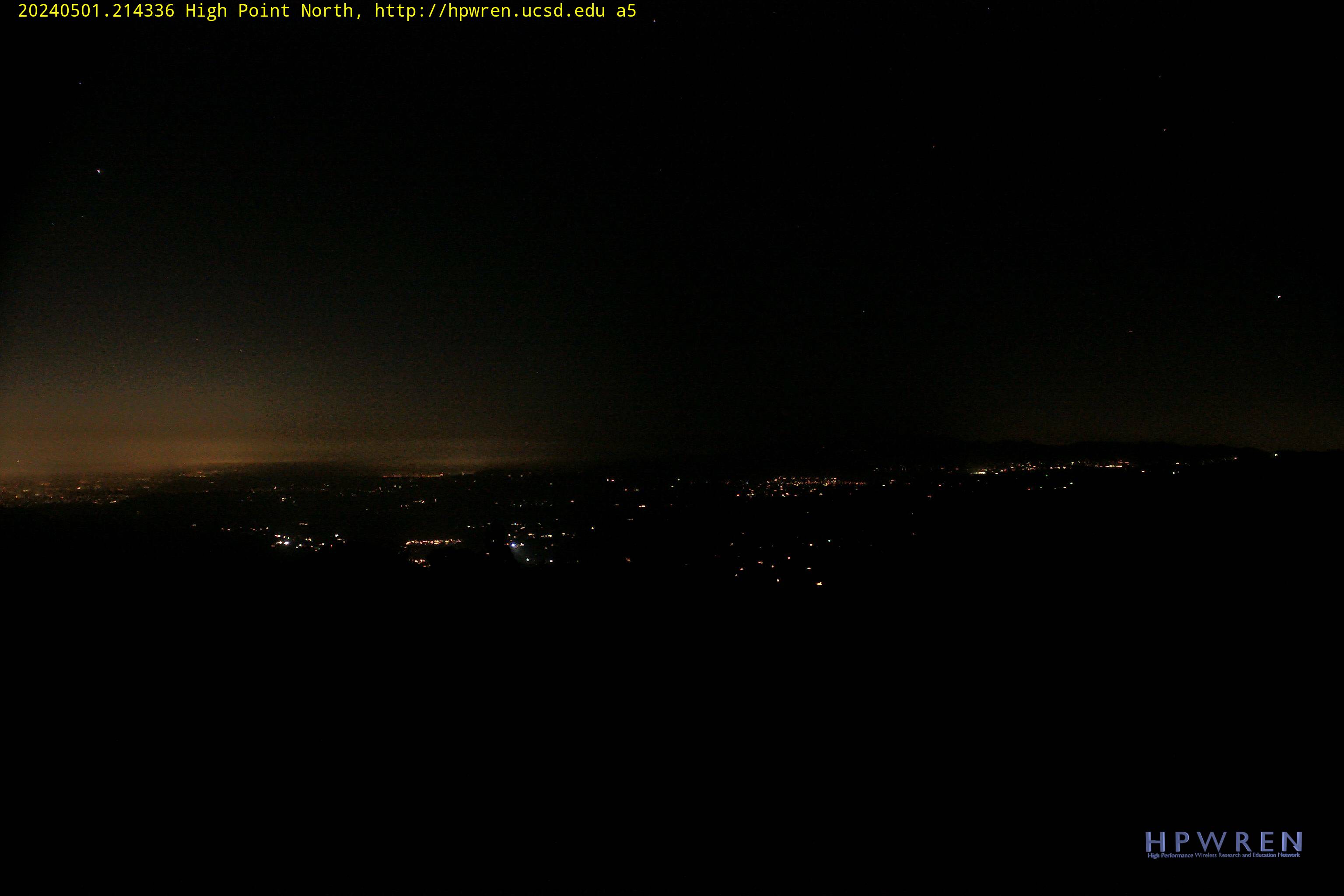
View from Palomar High Point Webcam
![]() by Jill G » Tue Jul 16, 2013 12:20 pm
by Jill G » Tue Jul 16, 2013 12:20 pm
Here's the view from Palomar Mtn High Point webcam.
http://hpwren.ucsd.edu/cameras/L/hp-n-mobo-c.jpg
I took pictures this a.m. from the GlenOak Hills east of Temecula 2000' elevation, will post later.
Fire is burning in the Garner Valley from Apple Canyon to what looks like Fobes Ranch Rd area and just flared up again at 11:30 a.m
http://hpwren.ucsd.edu/cameras/L/hp-n-mobo-c.jpg
I took pictures this a.m. from the GlenOak Hills east of Temecula 2000' elevation, will post later.
Fire is burning in the Garner Valley from Apple Canyon to what looks like Fobes Ranch Rd area and just flared up again at 11:30 a.m
- Jill G
- Posts: 46
- Joined: Sun Apr 08, 2012 6:56 pm
![]() by scottmac » Tue Jul 16, 2013 1:00 pm
by scottmac » Tue Jul 16, 2013 1:00 pm
Very cool Google Earth file to track fire:
MODIS website: http://activefiremaps.fs.fed.us/googleearth.php
MODIS website: http://activefiremaps.fs.fed.us/googleearth.php
Last edited by scottmac on Wed Jul 17, 2013 11:41 pm, edited 1 time in total.
-
scottmac - Posts: 125
- Joined: Mon Mar 31, 2008 7:33 pm
- Location: Palm Springs
![]() by Hikin_Jim » Tue Jul 16, 2013 1:42 pm
by Hikin_Jim » Tue Jul 16, 2013 1:42 pm
Dang. This sucks. I just hiked through that area over Memorial Day. 
HJ
HJ
Backpacking stove reviews and information: Adventures In Stoving
Personal hiking blog: Hikin' Jim's Blog
Personal hiking blog: Hikin' Jim's Blog
-

Hikin_Jim - Posts: 4958
- Joined: Mon Oct 30, 2006 9:12 pm
- Location: Orange County, CA

![]() by cynthia23 » Tue Jul 16, 2013 3:12 pm
by cynthia23 » Tue Jul 16, 2013 3:12 pm
ScottMac, that visual is awesome. Thanks so much for posting. I was just down in South Palm Canyon. You can actually see small fires starting down at around 1800-2000 feet in the Murray Canyon/Maynard Mine area. There isn't all that much vegetation there and they'll probably burn themselves out. More disconcerting is the wide range of the fire. It's all along the ridge line and very wide.
Q: How many therapists does it take to screw in a light bulb? A: Only one, but the light bulb has to want to change ...
- cynthia23
- Posts: 1289
- Joined: Tue Nov 07, 2006 3:33 pm
- Location: Rancho Mirage
![]() by Sally » Tue Jul 16, 2013 7:09 pm
by Sally » Tue Jul 16, 2013 7:09 pm
This is just heartbreaking. I've been keeping an eye on the smoke all day from Temecula. I'm sending good thoughts to the firefighters and people and critters that live in the area. I'm grateful that I've had the opportunity to see that beautiful area in its un-burned state, and will hopefully still be hiking when it has been able to recover somewhat.
-

Sally - Posts: 1125
- Joined: Thu Sep 17, 2009 8:27 pm
- Location: Temecula
Return to Mt. San Jacinto & Santa Rosa Mountains
Who is online
Users browsing this forum: Baidu [Spider] and 5 guests