Anybody ever go straight up from Deer Springs to Marion Mountain and then down the other side to Wellman Cienega and then XC down Willow Creek? Something like what I've marked on this map.
I want to go up the Seven Pines Trail to Deer Springs "Camp" (you can't camp there because it's a "fragile area" but the state can build a trail maintenance campground there; harumph). I then want to go directly up the ridge X-country to Marion Mountain, possibly getting water at the actual springs called Deer Springs (not the camp), and then drop down to Wellman Cienga and descend Willow Creek to the vicinity of Willow Creek Crossing, spending the night somewhere near the flat spot on the ridge above Willow Creek (point "T").
QUESTIONS:
1. If you've gone direct to Marion Mountain from Deer Spgs Camp, how was the steepness, and more importantly how was the brush?
2. If you've ever descended from Wellmans Cienega down Willow Creek, how was the brush?
HJ

Mt. San Jacinto Outdoor Recreation
Hiking, Climbing, Camping, Trail Running, Snowshoeing...
Deer Spgs to Marion Mtn to Wellman Cienega?
27 posts
• Page 1 of 3 • 1, 2, 3
Deer Spgs to Marion Mtn to Wellman Cienega?
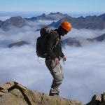
![]() by Hikin_Jim » Wed Jun 26, 2013 9:01 pm
by Hikin_Jim » Wed Jun 26, 2013 9:01 pm
Backpacking stove reviews and information: Adventures In Stoving
Personal hiking blog: Hikin' Jim's Blog
Personal hiking blog: Hikin' Jim's Blog
-

Hikin_Jim - Posts: 4958
- Joined: Mon Oct 30, 2006 9:12 pm
- Location: Orange County, CA
Re: Deer Spgs to Marion Mtn to Wellman Cienega?
![]() by Brad P » Wed Jun 26, 2013 9:35 pm
by Brad P » Wed Jun 26, 2013 9:35 pm
Jim, I have not specifically done the route that you are proposing but I have hiked down from Marion Mtn to the Deer Springs site in the summer and up to Marion Mtn from the same area in the winter. Very doable, nothing impassable or daunting on that side of the mountain. I have also done some cross country on the Southern Slope of Marion Mtn. Definitely steeper and more difficult but again, doable. Have fun.
Got Bordeaux?
- Brad P
- Posts: 12
- Joined: Sun Feb 10, 2008 12:40 pm
- Location: Orange County
![]() by OtherHand » Wed Jun 26, 2013 10:03 pm
by OtherHand » Wed Jun 26, 2013 10:03 pm
The area between L and O is full of nasty brush and difficult to traverse. However, if you look at the saddle just NE of K, there is a line down to the trail junction on Wellman Divide that is clear. You come out right at the trail intersection.
- OtherHand
- Posts: 291
- Joined: Mon Dec 28, 2009 2:07 pm
![]() by arocknoid » Wed Jun 26, 2013 10:14 pm
by arocknoid » Wed Jun 26, 2013 10:14 pm
Jim, I did a similar stretch last year.
The sections up from DSC to Marion and the X-C down to Wellman's Cienega are somewhat of PITA scrambles, with the brush and the jumbled terrain. Even the game trail I partially followed to WC wound up leading into thick stuff, without a readily discernible path of least resistance to continue. Read: Mill about smartly. Grabby brush.
(Jean to Marion is a cupcake route, in comparison.)
'Twas not so fun with an overnight pack/gear. Still would be a scramble with only a daypack. During a good snow year, I'd 'spect it to be smoother going during winter.
If you plan to drop down to WC and Willow Creek, might I suggest cueing up Diana Krall's version of "Willow Weep For Me."
half-kidding as usual,
Arocknoid
-

arocknoid - Posts: 342
- Joined: Thu Aug 26, 2010 11:36 pm
![]() by Lermo » Thu Jun 27, 2013 4:38 pm
by Lermo » Thu Jun 27, 2013 4:38 pm
In May, I was hoping to go cross country up to Marion from the vicinity of Wellmans Cienega . One of the guys at Nomad Ventures in Idyllwild said he thought there might be a use trail between the PCT intersection & Wellman Divide. Once I got to the PCT intersection, I walked slowly & took a few offshoot trails, but they all terminated in that thick brush. Next time I'll try the saddle just NE of K that OtherHand mentioned unless someone has another option they know about?
-
Lermo - Posts: 128
- Joined: Thu Mar 03, 2011 7:43 pm
- Location: Fallbrook, CA
![]() by OtherHand » Thu Jun 27, 2013 5:05 pm
by OtherHand » Thu Jun 27, 2013 5:05 pm
OK, I just reviewed my old GPS tracks and found I was slightly off with my description. Trying to descend from the saddle I mentioned (just NE of HJ's K) is a no go. The brush is far too thick to head down and we looked for a while. There be dragons below.
Instead we headed about 500' further NE and found a path down through the brush all the way to the trail junction on Wellman's divide. It was a really nice route!
If you look at HJ's map, the start of this descent was between the "M" and "O" and just to the left of the printed "10,400". Descend toward the trail junction staying on the easterly side of the ridge spine. It's easier going down than up (for the usual reasons!) because you can see the clear path through the brush below.
- OtherHand
- Posts: 291
- Joined: Mon Dec 28, 2009 2:07 pm
![]() by lilbitmo » Thu Jun 27, 2013 5:30 pm
by lilbitmo » Thu Jun 27, 2013 5:30 pm
HJ - I did the a version of L-M-N-O but on the north side of K's bump, that's a no go, it had manzanita higher than my head in some places. It did bring me out on the main trail right by the big tree just 100 yards up from the Wellman's Divide split. It was a slow go and lots of bush whacking. There was remnants of an old faint use trail near the bottom but I was so beat up coming down from Marion that I didn't want to investigate going back that way.
I have a machete you can borrow

Good luck and I hope you do find a faint use trail, I've heard that there was one in the area you laid out but I've never found it or seen it, in that particular area.
I have a machete you can borrow
Good luck and I hope you do find a faint use trail, I've heard that there was one in the area you laid out but I've never found it or seen it, in that particular area.
-

lilbitmo - Posts: 550
- Joined: Sun Feb 03, 2008 11:37 pm
![]() by Hikin_Jim » Thu Jun 27, 2013 9:32 pm
by Hikin_Jim » Thu Jun 27, 2013 9:32 pm
Thank you all for your feedback and shared experience. I did something along the lines of L-M-N-O maybe 4 years ago and still remember the brush. Ugh.
Well, this is my July 4 holiday plan assuming I can get a permit for the North Rim or Skunk Cabbage Zones (and assuming I'm still jobless and don't have to work the 5th or 8th). Just had a very good job interview in Irvine. I"m not a shoe in, but it went reasonably well.
I'm hoping to XC down the upper reaches of Willow Cr after traversing the summit plateau of the SJ's and then take the Willow Cr Trail back to my starting point. Looks interesting -- if there's any flesh left on my bones after the brush is done with me.
HJ
Backpacking stove reviews and information: Adventures In Stoving
Personal hiking blog: Hikin' Jim's Blog
Personal hiking blog: Hikin' Jim's Blog
-
Hikin_Jim - Posts: 4958
- Joined: Mon Oct 30, 2006 9:12 pm
- Location: Orange County, CA
![]() by RMRUpete » Fri Jun 28, 2013 8:37 am
by RMRUpete » Fri Jun 28, 2013 8:37 am
I have done the two sections of cross country many times and if you follow the correct route it is easy going. You can be down to the Cienega in 15-20 minutes of fast hiking. From the saddle between Marion Mt. and 10,388 (Shirly Peak) you should find markers (Piles of Rocks) showing you the way down to Wellman Cienega. Go basicly East and you should hit the trail about 100 yards up above the Cienega. Stay in the bigger trees and aviod the brush.
Once at the Cienega follow the trail towards the State Park sign near the trail to Strawberry Cienega. Here the brush and plants thin out and you can decend to Wellmans Cabin in a meadow of ferns and usually water. As you decend past the Cabin stay on the left or North side of the water by several 100 feet and you will have a easy decent to Willow Creek crossing. This section takes me about 50 minutes to 1 hour.
Have a great trip, this is a wonderfull area and I have never seen anyone else on the route at the same times I have been on it.
How can I be lost if I don't care where I am?
RMRU member 50 years
RMRU member 50 years
-
RMRUpete - Posts: 34
- Joined: Fri May 14, 2010 9:26 am
27 posts
• Page 1 of 3 • 1, 2, 3
Return to Mt. San Jacinto & Santa Rosa Mountains
Who is online
Users browsing this forum: Baidu [Spider], Google [Bot] and 5 guests