anyone know if there is much snow? can this be done in running shoes with little issues?
thanks.

Mt. San Jacinto Outdoor Recreation
Hiking, Climbing, Camping, Trail Running, Snowshoeing...
conditions from tram to summit
17 posts
• Page 1 of 2 • 1, 2
conditions from tram to summit
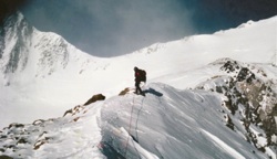
![]() by bdog » Tue Nov 13, 2012 7:10 pm
by bdog » Tue Nov 13, 2012 7:10 pm
- bdog
- Posts: 27
- Joined: Tue May 19, 2009 10:12 pm
![]() by neverwashasbeen » Tue Nov 13, 2012 10:54 pm
by neverwashasbeen » Tue Nov 13, 2012 10:54 pm
There was no snow to speak of and very little ice on the trail today. Running shoes should be fine until the next storm.
Happy Trails!
-
neverwashasbeen - Posts: 437
- Joined: Tue May 19, 2009 6:34 am
- Location: Palm Springs
![]() by Hikin_Jim » Tue Nov 13, 2012 11:10 pm
by Hikin_Jim » Tue Nov 13, 2012 11:10 pm
Backpacking stove reviews and information: Adventures In Stoving
Personal hiking blog: Hikin' Jim's Blog
Personal hiking blog: Hikin' Jim's Blog
-

Hikin_Jim - Posts: 4958
- Joined: Mon Oct 30, 2006 9:12 pm
- Location: Orange County, CA
![]() by zippetydude » Wed Nov 14, 2012 11:53 am
by zippetydude » Wed Nov 14, 2012 11:53 am
Actually, if you're really looking for a fast time, go again after the snow pack has built up. The winter route is still legitimate (at least IMHO) and if you choose your time, say a few days after the most recent snowfall, and go up on the first tram on a Sunday morning the trail will be clear, straight, and packed as firm as a sidewalk. Of course, it's steeper, but my best winter time is way faster than my summer best because it's only 2.9 miles instead of 5.5. Of course, none of this makes any difference but it sure is fun to play with. Good luck, the weather should be perfect.
z
z
-

zippetydude - Posts: 2751
- Joined: Tue May 09, 2006 5:40 am
![]() by Hikin_Jim » Wed Nov 14, 2012 12:48 pm
by Hikin_Jim » Wed Nov 14, 2012 12:48 pm
You probably know about it, but the most direct route to the summit is the "Sid Davis" route.
The Sid Davis route cuts off maybe a mile each way. There's a use trail for part of the route and an old, abandoned (but still followable) trail for part of the route.
HJ
The Sid Davis route cuts off maybe a mile each way. There's a use trail for part of the route and an old, abandoned (but still followable) trail for part of the route.
HJ
Backpacking stove reviews and information: Adventures In Stoving
Personal hiking blog: Hikin' Jim's Blog
Personal hiking blog: Hikin' Jim's Blog
-
Hikin_Jim - Posts: 4958
- Joined: Mon Oct 30, 2006 9:12 pm
- Location: Orange County, CA
![]() by greatshaitan » Wed Nov 14, 2012 1:29 pm
by greatshaitan » Wed Nov 14, 2012 1:29 pm
Hikin_Jim wrote:You probably know about it, but the most direct route to the summit is the The Sid Davis route.
I tried that route once. Ended up boulder hopping and bushwacking through 6ft tall shrubs. Very easy to lose it.
-
greatshaitan - Posts: 98
- Joined: Thu Sep 20, 2012 6:49 am
![]() by KathyW » Wed Nov 14, 2012 2:22 pm
by KathyW » Wed Nov 14, 2012 2:22 pm
greatshaitan wrote:Hikin_Jim wrote:You probably know about it, but the most direct route to the summit is the The Sid Davis route.
I tried that route once. Ended up boulder hopping and bushwacking through 6ft tall shrubs. Very easy to lose it.
Unless there's good snow coverage, the standard route via Round Valley/Wellman's Divide is just as fast, if not faster, and easier to follow.
- KathyW
- Posts: 1138
- Joined: Wed Dec 27, 2006 6:17 pm
![]() by Hikin_Jim » Wed Nov 14, 2012 2:35 pm
by Hikin_Jim » Wed Nov 14, 2012 2:35 pm
It took me a couple of shots before I got the route down.
In my experience it's faster even when there's no snow. Last Thursday, we were following two guys down from the Miller Saddle area. They were just slightly faster than we were. We cut off on the Sid Davis Route, and they continued on the main route to Wellman Divide. We stopped in Tamarack Valley to reconnoiter some of the camp sites. We still beat them back to the tram by around 15 minutes even though they were slightly faster.
I've had the same experience on the ascent: I'll see someone in the tram that I know is faster than I am. I'll go up the Sid Davis Route. I'll then see the faster people summit after I do.
HJ
Backpacking stove reviews and information: Adventures In Stoving
Personal hiking blog: Hikin' Jim's Blog
Personal hiking blog: Hikin' Jim's Blog
-
Hikin_Jim - Posts: 4958
- Joined: Mon Oct 30, 2006 9:12 pm
- Location: Orange County, CA
![]() by bdog » Wed Nov 14, 2012 2:43 pm
by bdog » Wed Nov 14, 2012 2:43 pm
thanks for the advice. unfortunately i don't know the direct route well. i did it once a long time ago. something came up and i wasn't able to go today, but i might go tomorrow instead before the next storm hits. if so then i'll probably decide at the tram whether to continue or not and i would probably take the regular trail.
- bdog
- Posts: 27
- Joined: Tue May 19, 2009 10:12 pm
17 posts
• Page 1 of 2 • 1, 2
Return to Mt. San Jacinto & Santa Rosa Mountains
Who is online
Users browsing this forum: No registered users and 5 guests