Story of missing hiker in Joshua Tree NP

Southern California and far-away places. Hiking, wildlife, cycling etc.

Postby Hikin_Jim » Mon May 21, 2012 5:22 pm

Pitownpi wrote:impressive sheep!

the one turned away has the largest horns I've ever seen!
and they are all gnarly and torn up!!!
Thanks. That was pretty cool to see them and even cooler that I got a half way decent photo. That one with the beat up horns has definitely been around.

I also saw this rather strange looking desert dweller, a Hikinus Jimus I believe. Rather odd creatures in the desert, don't you think?
Image

covington flats is 20 minutes away from my cabin...
I hike there all the time looking/always searching for something on every and any hike!
Yeah, I kind of figured something like this would be right up your alley, you being the cross country fanatic that you are. I was thinking about you when I passed the road to Pi Town. I half wondered whether or not if I went to Pappy and Harriets if I might find you playing your guitar. :)

It's just as well that I don't live in Pi Town. All those views of magnificent San Gorgonio would drive me to distraction.
Image
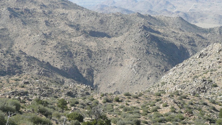
Notice how you can see Middle Fork JO? And I think that's Mill Creek JO right behind it (partially obscured), yes?

What an amazing contrast! Joshua Tree NP in the foreground and the San Gorgonio Wilderness only a scant few miles away.

Here's my trip from three weeks ago (South Fork Santa Ana River):
Image

And then this weekend (Smith Water Canyon):
Image

Now THAT's a contrast!

HJ
Backpacking stove reviews and information:  Adventures In Stoving
Personal hiking blog: Hikin' Jim's Blog
User avatar
Hikin_Jim
 
Posts: 4958
Joined: Mon Oct 30, 2006 9:12 pm
Location: Orange County, CA

Postby Hikin_Jim » Mon May 21, 2012 5:46 pm

Now for theories:
Well, if we've checked the exits, and Bill isn't there, maybe he's still inside?

I mean if he's so injured that he can't retreat to Juniper Flats and his vehicle, maybe he holed up hoping that the shade would protect him for another day against the ravages of the blazing sun? What if he early Sunday morning in an act of sheer determination, dragged his injured body to the nearest high point and turned on his phone in a last ditch effort to call for help? And the phone, battery dead, turned off a split second after he turned it on -- just long enough to emit a single ping. Disconsolate, he crawled back to his sheltered spot. Yes, he'd be hard to find in his sun-protected spot, but to be out in the sun was certain death. He'd have no other choice.

There were dozens of rock piles out there near the ridge tops that lead to Quail from the WSW, rock piles with all kinds of spots where one could have shade no matter the time of day.
Image

Image

Image

Image

Maybe instead of thinking outside the box, we need to think inside the rocks? I don't know how thoroughly all the rock piles have been checked around Quail and approaches/exits, but maybe it's worth checking out. I checked out quite a number but had to move on in order to do any reasonable amount of searching of the route to Smith Water and get back to my car before nightfall.

HJ
Backpacking stove reviews and information:  Adventures In Stoving
Personal hiking blog: Hikin' Jim's Blog
User avatar
Hikin_Jim
 
Posts: 4958
Joined: Mon Oct 30, 2006 9:12 pm
Location: Orange County, CA

Postby drndr » Mon May 21, 2012 9:44 pm

nice pics! Did you stick to your planned route? I'd like to see one of your maps where you went. Was the north westerly side of SWC still pretty unrealistic?

I was out there Sunday strictly sticking to the roads and drove out towards keys view to get a peek to the west towards Stubbe. Lots of lonely desert out there.
"Everywhere is walking distance if you have the time"
drndr
 
Posts: 236
Joined: Mon Oct 15, 2007 11:10 am
Location: Riverside

Postby Hikin_Jim » Tue May 22, 2012 7:13 am

drndr wrote:nice pics! Did you stick to your planned route? I'd like to see one of your maps where you went. Was the north westerly side of SWC still pretty unrealistic?

I was out there Sunday strictly sticking to the roads and drove out towards keys view to get a peek to the west towards Stubbe. Lots of lonely desert out there.
I didn't have a real detailed route, but basically I followed the Sierra Club HPS route from Lower Covington to Quail Mtn except that I went on the right hand (East) side of pt 5787 where the HPS route says stay left. I figured Bill would have come from the east (the direction of Juniper Flats and his vehicle), so I wanted to look there.

From Quail to the intervening ridge between Quail and Smith Water, I followed my instincts and the terrain. I dropped down from the intervening ridge via the saddle one left of the "obvious" one (major saddle visible from Quail and environs) because I thought the map indicated a better route. I wanted to stay on top of the ridge that juts out like a penninsula into Smith Water rather than to follow the drainage which looked a little rough.

One has to be more particular on the way down from the intervening ridge to Smith Water. The terrain is steeper and in my opinion trickier. Your nav has to be fairly "on" in order to avoid getting a bad line. Some of the lines down that canyon could easily be class 4 or 5 which is way over my head. You're fairly committed once you leave that intervening ridge. If however you study the map, there is descent line that is class 1 and really not that bad. You just have to really be diligent about sussing out what you've planned on your map and not be diverted by what looks promising. The topo knows what it's talking about.

The far wall (NW side) of Smith water is some really steep, rugged terrain. No way is an injured guy going to climb up that. Pics to follow as time permits.

HJ
Backpacking stove reviews and information:  Adventures In Stoving
Personal hiking blog: Hikin' Jim's Blog
User avatar
Hikin_Jim
 
Posts: 4958
Joined: Mon Oct 30, 2006 9:12 pm
Location: Orange County, CA

Postby Hikin_Jim » Tue May 22, 2012 9:32 am

NW wall of Smith-Water. Pretty rugged and definitely steep:
Image

HJ
Backpacking stove reviews and information:  Adventures In Stoving
Personal hiking blog: Hikin' Jim's Blog
User avatar
Hikin_Jim
 
Posts: 4958
Joined: Mon Oct 30, 2006 9:12 pm
Location: Orange County, CA

Postby drndr » Tue May 22, 2012 11:27 am

Did you go far enough north into SWC where you saw or actually went down the very smooth, polished, waterfall like rock.? It's probably the toughest technically part to handle if you go all the way through SWC.

Lets say you fall down that rock, break your leg and then just sit and wait for two days and no one shows. You can't turn around because a healthy person would have trouble getting up that rock. Your topo shows a few hundred feet north in SWC, around a sharp bend, there's a ravine heading west. You drag yourself to it and start up, high enough to get a ping out but then gets trapped because of weakness and terrain.

I think if i ever get out there, that's where I'm looking. Google Earth doesn't make that ravine look too bad, maybe he thought the same thing.
"Everywhere is walking distance if you have the time"
drndr
 
Posts: 236
Joined: Mon Oct 15, 2007 11:10 am
Location: Riverside

Postby Hikin_Jim » Tue May 22, 2012 2:02 pm

OK, here's a photo looking into Smith Water as I descended into the canyon:
Image

It's fairly rough country. If you're a decent route finder, you can find a doable line through, but I thought the route finding while not extreme was definitely something where I had to pay attention.

So, my suspicion is that if Bill tried for Smith Water, he didn't make it. It's hard for me to envision an injured man travelling successfully through.

This (below) is the good route into the canyon, and it's still fairly steep. All other routes are much tougher. Not bad on two good legs, but injured? Good luck.
Image

I went down Smith Water past the landmark veined rocks.
Image

I went as far as the "spring,"
Image
but that's as far as I went. I didn't feel the need to get below the (typically) dry falls. I just don't think an injured guy could get that far. If he was in good enough shape to get that far, why the heck didn't he just go back to his car? And if he got to the water in the above photo, he wouldn't leave. Why on earth would an injured person waiting to be rescued leave a spring in the desert?

My theory, for what it's worth, is that if Bill set out for Smith Water, he never got there, but if he did somehow miraculously get there, he'd stay close by the water.

Smith Water gets a fair amount of traffic by the way. I saw very few fresh tracks on the CR&H Trail, no fresh tracks the entire time en route to Quail or Smith Water, but I saw quite a number of fresh tracks in Smith Water itself. I even saw someone's shelter/bug tent thingy. Nobody home though.
Image

If Bill had gotten into the bottom of Smith Water, I believe that he would have been found by now.

HJ
Backpacking stove reviews and information:  Adventures In Stoving
Personal hiking blog: Hikin' Jim's Blog
User avatar
Hikin_Jim
 
Posts: 4958
Joined: Mon Oct 30, 2006 9:12 pm
Location: Orange County, CA

Postby OtherHand » Tue May 22, 2012 3:01 pm

Hikin_Jim wrote:Smith Water gets a fair amount of traffic by the way. I saw very few fresh tracks on the CR&H Trail, no fresh tracks the entire time en route to Quail or Smith Water, but I saw quite a number of fresh tracks in Smith Water itself. I even saw someone's shelter/bug tent thingy. Nobody home though.


Uh oh....I believe that's a no-no. IIRC, Smith Water is one of the few spots in JTNP that's day use only, no camping. I suppose human presence might discourage animals away from the water.
OtherHand
 
Posts: 291
Joined: Mon Dec 28, 2009 2:07 pm

Postby Hikin_Jim » Tue May 22, 2012 3:47 pm

OtherHand wrote:
Hikin_Jim wrote:Smith Water gets a fair amount of traffic by the way. I saw very few fresh tracks on the CR&H Trail, no fresh tracks the entire time en route to Quail or Smith Water, but I saw quite a number of fresh tracks in Smith Water itself. I even saw someone's shelter/bug tent thingy. Nobody home though.


Uh oh....I believe that's a no-no. IIRC, Smith Water is one of the few spots in JTNP that's day use only, no camping. I suppose human presence might discourage animals away from the water.
Yeah, that thought ran through my mind as well. Not good. But there was no one there at the time, so I just went on my way. Hope the animals are OK.

HJ
Backpacking stove reviews and information:  Adventures In Stoving
Personal hiking blog: Hikin' Jim's Blog
User avatar
Hikin_Jim
 
Posts: 4958
Joined: Mon Oct 30, 2006 9:12 pm
Location: Orange County, CA

Postby HikeUp » Tue May 22, 2012 4:24 pm

Is that Bill's tent perhaps? :wink:
HikeUp
 
Posts: 203
Joined: Sun Jul 01, 2007 8:17 pm
Location: Pasadena, CA

PreviousNext

Return to Outdoors-Related Topics

Who is online

Users browsing this forum: No registered users and 2 guests