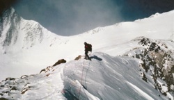
First winter hike/snowshoe - tramshoeing this Friday?

General Palm Springs area.

First winter hike/snowshoe - tramshoeing this Friday?

Postby pBerg » Tue Mar 20, 2012 12:04 pm

Long time lurker first time poster here :)

All winter I've wanted to try snowshoeing and do what I'd consider a proper winter hike. San Jacinto has also been on my to-do list, so with my spring break (grad school) starting Friday, I'm thinking of driving out from LA and giving it a shot. I worry if I wait longer I'll have missed my chance this winter!

I consider you folks the experts, so I was hoping to get your thoughts on (a) whether snow pack conditions and Friday forecasts look favorable for snowshoeing from the tram and (b) whether the route from the tram to the peak is a sensible endeavor for a first time snowshoer/winter hiker.

Since I've never done any winter hikes, my main concerns are situations like taking a step onto what I think is a rock ledge covered with snow when it's actually just snow with no rock underneath. I'm also nervous-excited (in a good way!) at the thought of trying to navigate over a snow-covered area. I'll have a GPS with me and hopefully another buddy, but yea.

Gear-wise, I intend to bring microspikes and a pair of rental snowshoes along with my trekking poles. I think I'll go ahead and pull the trigger on purchasing a pair of gaiters for it, too.

Thanks for your consideration!
Patrick
pBerg
 
Posts: 6
Joined: Tue Mar 20, 2012 10:02 am
Location: Brentwood

Postby lilbitmo » Tue Mar 20, 2012 12:52 pm

Patrick

This posting is from one of the regulars on the board it's in another section, though I don't know why it pertains to exactly what you need to know
Ellen wrote:Howdy All :)

Headed up yesterday with Indie Jack, Krai, Hiroko, Perry Andrus and Marilyn. It took over two hours to break in a route through the right side of the Sid Davis drainage to the sunny meadow in [sensitive area]. Then we headed up the traditional winter route, hoping that the new snow had covered the chinqapin.

We discovered quickly that although the snow covered the brush, the snow was not firm enough to keep us from post hole hell. We were sinking in up to our waists at times. Started looking for brush peeking through the snow so at least we could walk on that and not sink as much. We finally reached the little forest. Rather than heading up the gully to Miller Saddle (feared it would be full of soft snow over rocks and brush),
we headed up the left side of Miller.

This was a mistake. The snow just kept getting deeper as we ascended. It was very slow going. I would fall on the snow in front of me to flatten it a bit, then step on it to flatten it more. While this system worked, we were barely moving and creating a waist-high tench. After about five hours and only reaching 10 K, we called it. Headed back down to the little forest for a bite to eat before retracing our steps back to the tram.

If we'd had a crystal ball, we would have broken in the Ranger Overland route to the base of the gully that heads up to the ridge near Jean. Sally and I will head back out tomorrow and attempt to break in the route to the Miller saddle and summit of San Jacinto.

Miles of smiles,
Ellen


I'm sure Ellen will update this board come tomorrow or Thursday on conditions so look through all the topics or maybe she can add her update to this posting? Ellen?
What you need to know is this, not that many people go on Fridays but some do, if the snow is still super soft and you've never done a summit in snow shoes that might be too much to bite off on the first try (not trying to tell you not to, just suggesting youo go as far as you feel comfortable and call it for another day), the Sid Davis Drainage is a shortcut that all of most people use to go cross country to the summit during winter months over the snow, it splits with the main trail at the first creek crossing (second set of signs pointing that you find our there, giving you in the right direction and giving you mileage). It's easy to get confused in the snow if you have not been there before.

If different groups have gone out there and some have taken the main trail out to Wellmans Divide that trail (which is the main trail in the non-snow seasons) goes to the left, while the Sid Davis Trail goes to the right up the drainage at the first creek crossing. It would be nice if someone on the board could give you a GPS file you could preload for both routes.

It would also be great if you could piggy back on someone else's snowshoe trip on Friday? Anyone? but if not, you might have much more success and fun by waiting for Sat and going then, there will be a "boatload" of folks going out then and it's a lot easier following the footprints of a group then just one or two who are very fast on snowshoes.

Whatever you decide be safe and have fun :D One of the other Patrick's AKA/Lilbitmo

User avatar
lilbitmo
 
Posts: 550
Joined: Sun Feb 03, 2008 11:37 pm

Postby Ellen » Tue Mar 20, 2012 1:07 pm

Howdy Patrick :)

I'll post a trip report on Thursday after Sally and I go up tomorrow 8)

As my buddy Lilbitmo pointed out, there should be a bunch of folks out on Saturday.

Miles of smiles,
Ellen
Ellen
 
Posts: 2578
Joined: Thu Mar 29, 2007 9:38 am
Location: Riverside, CA

Postby pBerg » Tue Mar 20, 2012 3:04 pm

Brilliant. Thank you for such helpful responses.

Regarding the Sid Davis drainage, is it roughly the path as seen here? I'm trying to find an exact GPS log on EveryTrail that has mention of "Sid Davis," but it's not turning up anything.

Also, is there something special about Fridays that deters people from going Fridays, or is it one of things like "Well, instead of going Friday we might as well just wait another 24hr and go Saturday when the tram opens earlier and more people are off of work?"

Ellen's snow slogging TR sounds pretty disappointing, haha. I look forward to hearing how things go Ellen!
pBerg
 
Posts: 6
Joined: Tue Mar 20, 2012 10:02 am
Location: Brentwood

Postby lilbitmo » Tue Mar 20, 2012 4:07 pm

pBerg wrote:here


Yes, that's the Sid Davis Drainage all the way up and into Tamarack Valley.

Most people cannot get work off on Fridays to go, doesn't mean that no one will go, just more go on the weekends, as stated by you the tram goes up earlier so you have more time to reach the summit and get back to the tram before dark.

Collectively, Saturdays are easier in another way, if you let more people get out ahead of you, then they beat the path down more as well. If 5 groups of two go ahead of you, that's like a group of ten going together, they are spread out so it's easy to talk to them about directions and things like that.

Ellen's TR while it sounds like pure pain the snow is going to sink the most when it's fresh like that because the water content has not had enough time to bond the snow together to the older layers - it's typically at it's fluffiest until someone comes along and pushes it down - someone has to do it, so the fact she's done it once and is going back again tomorrow makes your life and everyone that follows a little easier.

Hope you have a blast out there, enjoy. :D
User avatar
lilbitmo
 
Posts: 550
Joined: Sun Feb 03, 2008 11:37 pm

Winter route up San Jacinto

Postby Ellen » Thu Mar 22, 2012 10:01 am

Howdy PBerg :)

Sally and I melted yesterday. We could have snowshoed in shorts and t-shirts. On the positive side, the snow had consolidated a bit. We wore microspikes up the Sid Davis drainage as the snow was already melting out in spots. Continued wearing micros all the way to the sunny meadow in upper Tamarack valley, then donned snowshoes.

We stayed in the snowshoe track that we broke in on Monday up to where it started going through visible chinqapin. I thought I'd test out the white stuff and was pleasantly surprised to find that I didn't sink much. So, rather than shrubshoe, we broke in a new route up the side of the ridge to the right side of the gully heading up to Miller Saddle, zig zagging around rocks and exposed brush.

Once we reached Miller Saddle, it was a straight forward trek up to the peak. I love making fresh tracks on the ridge. Took us 3.5 hours to summit. We enjoyed lunch on top and were joined by Jeff and Mike, who had followed our tracks up. On the way down, we met two other folks coming up to Miller saddle. Rather than retrace our ascent, we headed right down the gully, zig zagging to avoid exposed brush. A few times we sank past our knees but never post holed as badly as Monday. This is the route I recommend taking up.

Once back in the little forest, we made our way back to Tamarack and wandered around in Tamarack valley back to the Sid Davis drainage. We toyed with the idea of breaking in the oppossite side (better quality snow and fewer rocks) but opted to retrace our path to get back sooner. We said hi to Tram Tim before heading down and enjoying a lovely meal at Las Casuelas.

Miles of smiles,
Ellen
Ellen
 
Posts: 2578
Joined: Thu Mar 29, 2007 9:38 am
Location: Riverside, CA

Postby pBerg » Thu Mar 22, 2012 3:54 pm

Thanks for the TR Ellen!

Using the map picture I linked to earlier (link), I think I understand the path you took to from Tamarack through Miller Saddle to the peak. However, I don't quite follow what you mean by "down the gully." Is this gully on the south side of the peak, rather than the east side of the peak from which you ascended?
pBerg
 
Posts: 6
Joined: Tue Mar 20, 2012 10:02 am
Location: Brentwood

Postby pBerg » Sat Mar 24, 2012 5:57 pm

Such an adventure yesterday, wow!

Because I ended up venturing out alone, I elected to follow the main trail from the tram all the way to Round Valley. I figured if something went wrong on the main trail then it'd be easier for people to find me. But once I made it around the Round Valley Loop, I felt antsy to head for the peak. So I ditched the main trail and blazed a new path north out of Round Valley hoping to find some traces of this Sid Davis Drainage business (and ideally some existing snowshoe trail).

At around 9000ft I found what I'm guessing is the trail that Ellen and the others made on Mon/Tue via Sid Davis. I followed their path towards the saddle. And yea, it was MISERABLE. Her TR from earlier this week was perfectly accurate. However, for lack of knowing a better route. I tried it anyway.

I fought and toiled my way up to 10000 ft. It was exhausting man! I'd take a step forward and sink a half step back. Just shy of 10000ft I took a step and started feeling dizzy. It freaked me out cuz (a) I had never felt that dizziness before (b) I was alone and (c) I wasn't near what I'd consider a major trail where people might find me. I thought about it for a few minutes and ultimately decided my trip to the summit would have to wait until next time. I felt so close! It bummed me out. I booked it back down and started feeling better about 30 minutes later.

I started hiking in June. This is the first time I've ever failed to reach a point on a mountain that I had set out to reach. It was really humbling--in a good way.

The reason I share that humbling bit is because I don't think I'd have turned back if I didn't hear your voices in my head telling me that if the trip didn't work out, don't force it. The mountain will be there another day. The idea of "there will always be another day" is simple to grasp but so damn hard to follow-through for me.

So thank you, regardless of whether you intended to do so or not, for being that good voice in my head!
pBerg
 
Posts: 6
Joined: Tue Mar 20, 2012 10:02 am
Location: Brentwood

Postby neverwashasbeen » Sat Mar 24, 2012 6:06 pm

Good call on listening to the voices in the head. Altitude sickness may have been the issue and it can be a bad thing.
Happy Trails!
User avatar
neverwashasbeen
 
Posts: 437
Joined: Tue May 19, 2009 6:34 am
Location: Palm Springs

Postby Sally » Sat Mar 24, 2012 7:04 pm

Hi pBerg, Congrats on your first snowshoe trip, and thanks for the Great TR! I'm sorry you didn't hook up with our snowshoe tracks. It would have made your journey a little easier. The important thing was you got out there, and you knew when to head back. Ellen and I have had a few non- summitting trips lately because the conditions weren't in our favor, but we usually eventually get our revenge! I hope you get to give it another try soon.
User avatar
Sally
 
Posts: 1125
Joined: Thu Sep 17, 2009 8:27 pm
Location: Temecula

Next

Return to Mt. San Jacinto & Santa Rosa Mountains

Who is online

Users browsing this forum: Baidu [Spider], Bing [Bot] and 3 guests