
I'll get a GPS then.
I do not know anybody hiked this route before

My hiking plan is a 3AM start at the museum parking lot on May 14. Hope I'm lucky to tag with an old-timer that day.
Thanks again for all the advice
P

Hiking, Climbing, Camping, Trail Running, Snowshoeing...
 by Polis » Thu Mar 10, 2011 1:33 pm
by zippetydude » Thu Mar 10, 2011 2:06 pm

by mattytreks » Thu Mar 10, 2011 3:49 pm
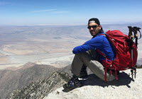
by Polis » Fri Mar 11, 2011 8:54 am
Took me 8 hours to ascend Mt Whitney. Cannot believe someone done the Skyline in 3 
by Hikin_Jim » Fri Mar 11, 2011 10:58 am
I'm not a GPS guy, so I won't try to address that, but the trail from the tram to the summit is pretty well marked -- except for the last couple hundred yards. The summit itself is a big pile of rocks, and there's no trail per se. Pay attention to your surroundings, and you should be fine.Polis wrote:Thank you for all the great advice
I'm a slow hiker
I'll be driving into Palm Springs the afternoon before the hike, so probably no time to recon the area.
Right now I'm looking to buy a GPS to keep me on the Skyline route.
How about using an iPhone as the GPS on this trail? I don't need to worry about the tree canopy blocking the GPS signal on the Skyline, while the upper summit trail should be easy to follow, right?
Thank you
P

Return to Mt. San Jacinto & Santa Rosa Mountains
Users browsing this forum: Baidu [Spider] and 27 guests