thats funny Cameron, thanks I needed the laugh.
http://www.sun-sentinel.com/news/local/ ... 9271.story

Mt. San Jacinto Outdoor Recreation
Hiking, Climbing, Camping, Trail Running, Snowshoeing...
Compass Recommendations ?
16 posts
• Page 2 of 2 • 1, 2

 by 93ludegirl » Mon Feb 21, 2011 6:43 pm
bluerail wrote:that compass thing looks cool...whats it do ?
It points you toward success, the easiest way of achieving goals, etc.. so I'm guessing you don't have one...

-

93ludegirl - Posts: 112
- Joined: Mon Jan 24, 2011 8:43 pm
- Location: palm springs
by phydeux » Mon Feb 21, 2011 7:15 pm
I had a declination-adjustable compass, but the thing kept shifting when it got bounced around in my pack or when around my neck on a lanyard. I stopped using it and went back to putting a strip of colored electrical tape on the bottom of the dial of a regular compass. The angle doesn't change enough to make a difference unless you're traveling long distances.
As for a references for declination angles - the USGS topo maps have them printed in the margins for both degree and grid systems. Tom Harrison maps don't have them (the two I have).
As for a references for declination angles - the USGS topo maps have them printed in the margins for both degree and grid systems. Tom Harrison maps don't have them (the two I have).
3 of the 5 voices in my head are telling me to "Go for it!"
-

phydeux - Posts: 348
- Joined: Sat May 13, 2006 5:32 pm
- Location: Orange County, CA.
by Hikin_Jim » Mon Feb 21, 2011 10:24 pm
12.5 degrees. Sorry.HikeUp wrote:Hikin_Jim wrote:about 13.5 degrees in Southern California

Yeah, that's where I go to get my numbers. The scales on topo maps can be decades old -- although they usually do include information as to how fast it's changing.HikeUp wrote:Neat online calculator, just enter your location or even zip code.
HJ
Backpacking stove reviews and information: Adventures In Stoving
Personal hiking blog: Hikin' Jim's Blog
Personal hiking blog: Hikin' Jim's Blog
-

Hikin_Jim - Posts: 4958
- Joined: Mon Oct 30, 2006 9:12 pm
- Location: Orange County, CA
by Hikin_Jim » Thu Mar 10, 2011 3:04 pm
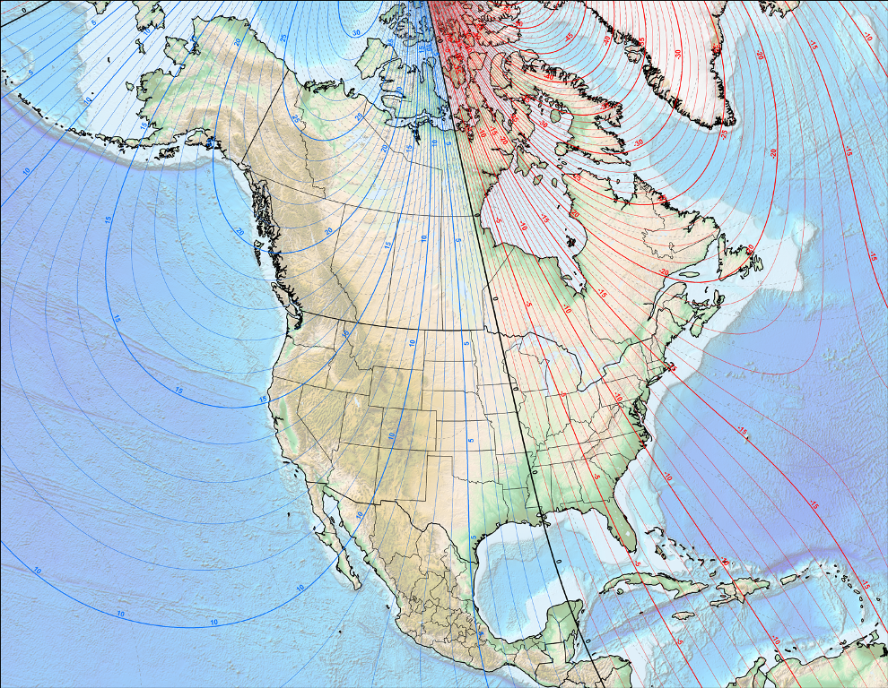
I saw this chart of declinations (below) on the NOAA site. Interesting how much it varies within California. Down here, it's about 12.5 degrees east. In the southern sierra, it's about 13.5 degrees east. Around Tahoe, it's around 14.5 degrees east. Two degrees isn't much, but if you're trying to find the exact right place to drop off a ridge...
HJ
HJ
Backpacking stove reviews and information: Adventures In Stoving
Personal hiking blog: Hikin' Jim's Blog
Personal hiking blog: Hikin' Jim's Blog
-
Hikin_Jim - Posts: 4958
- Joined: Mon Oct 30, 2006 9:12 pm
- Location: Orange County, CA
16 posts
• Page 2 of 2 • 1, 2
Return to Outdoors-Related Topics
Who is online
Users browsing this forum: No registered users and 8 guests