Mission Creek and Target Practice -- On the PCT!

Southern California and far-away places. Hiking, wildlife, cycling etc.

Mission Creek and Target Practice -- On the PCT!

Postby Hikin_Jim » Tue Nov 30, 2010 11:13 pm

On Saturday, I went to Mission Creek Preserve to do a little hiking.
Image

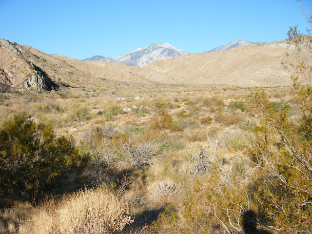
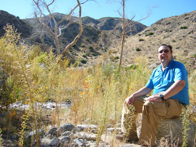
It's got some great views of the San G high county.
Image

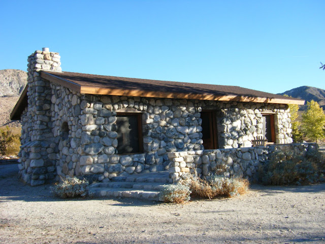
A really cool old stone house (that's been refurbished).
Image

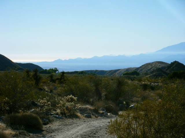
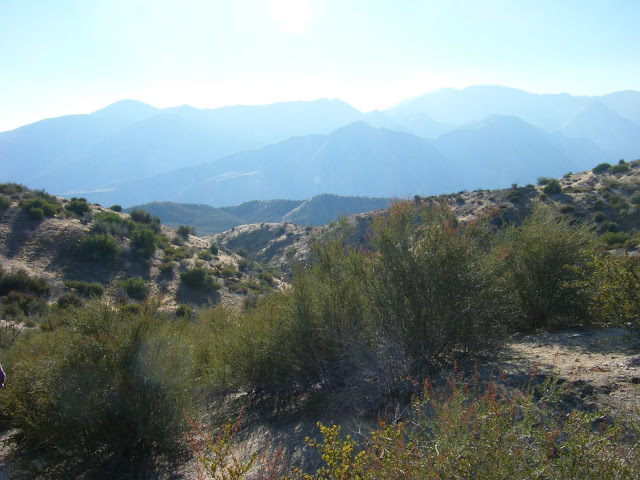
Some great views of the Salton Sea and surrounding environs.
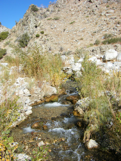
Image

And plenty of water
Image

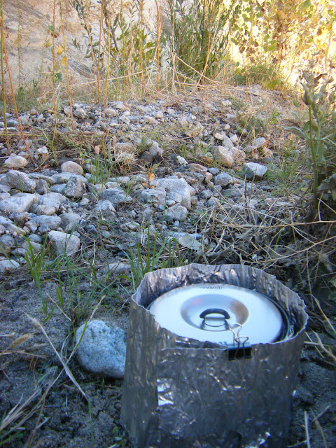
It's a great place to brew up a cup of tea or make some soup.
Image

And hang out a while...
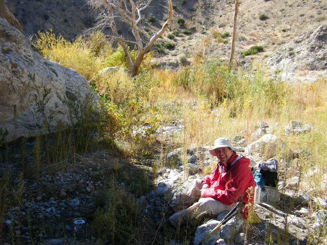
Image

...by the water.
Image

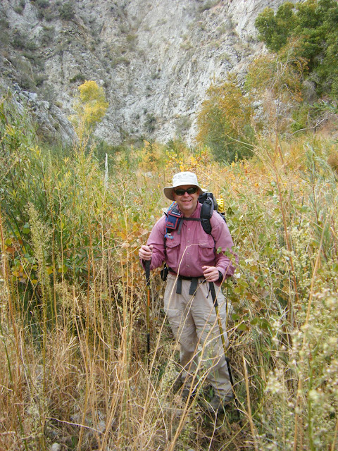
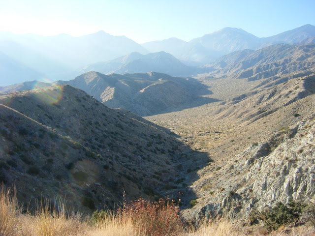
Although the trail is getting seriously overgrown in places.
Image

And you're definitely in earthquake country.
Image
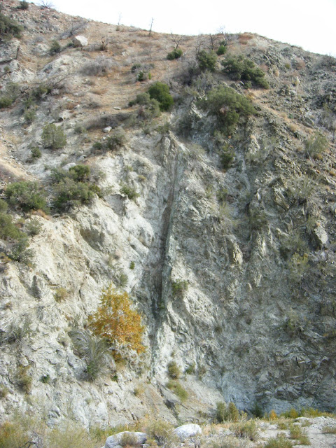
(the sycamore tree to the left of the fault is about 25 feet tall).

All of which is fine and good, BUT there's some private land in the N Fork of Mission Creek and some people were camped there, people with lots and lots of guns (judging by the sounds).

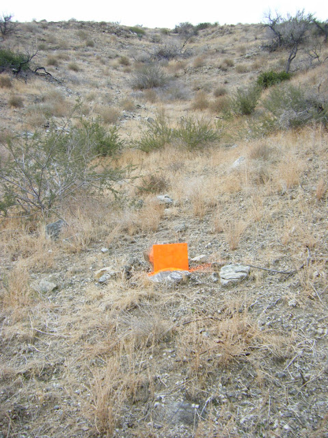
I've got no problem with guns per se, but these guys had set up a target above the PCT, a target that would require firing across the PCT in order to hit the target. This target (below) was just above the second switchback in the PCT as it climbs out of the N Fork of Mission Creek towards the W Fork of Mission Creek.
Image

They were firing, again judging by the sounds, all kinds of ordinance, both large and small caliber including some weapons with fairly high rates of fire.

I was operating under the assumption that they were firing into the canyon wall opposite their position but got really alarmed when I saw the target above the PCT -- the very trail I was hiking on.

Thank God, they stopped firing when they saw us. Freakin' morons. It's not like the PCT is a trail you could miss. They even used the trail to put their targets in place. After we passed through, they hastily retrieved their target.

The target didn't have any holes in it. It may be that they were planning to open up on it but we came along. Not sure.

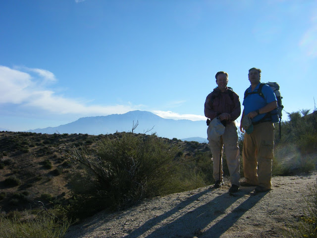
Shooters aside, there are some great views from the PCT of San Jacinto.
Image

Image

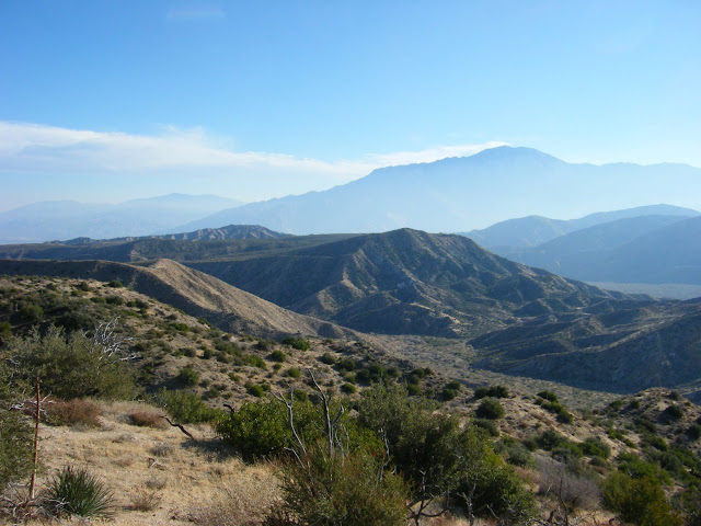
and of the mysterious south eastern section of the SGW which is now little visited since access through Indian land is now restricted.
Image

Image

Well, thanks for coming (virtually) on a little hike with me. Just remember if you're on the PCT entering the N Fork of Mission Creek -- DUCK! and keep moving.
Image

HJ
Backpacking stove reviews and information:  Adventures In Stoving
Personal hiking blog: Hikin' Jim's Blog
User avatar
Hikin_Jim
 
Posts: 4958
Joined: Mon Oct 30, 2006 9:12 pm
Location: Orange County, CA

Postby Ulysses » Wed Dec 01, 2010 11:05 am

Thanks for posting the trip report and pictures Jim. I'm quite interested in exploring that area. I went north on the PCT from Whitewater Creek to the west fork Mission Creek last Friday (needed a break from the snow and ice in Idy). My first time in that area. Very nice and quiet. Thankful I didn't encounter the target shooters.
Ulysses
 
Posts: 279
Joined: Mon May 03, 2010 6:16 pm
Location: Idyllwild

Postby Hikin_Jim » Wed Dec 01, 2010 11:42 am

Looks like I missed you by one day. The shooters were in the N Fork. There's an area marked as private land.

Here's a map marked with our route.

A = The approximate location of the locked gate in my photos. Apparently, if you call ahead, they will sometimes give you the combo to the lock and issue you a permit so that you can drive another 1.6 mi into the canyon and park at the Stone House. There are some little stone houses at the gate but these little houses are not the Stone House.
B = The Stone House.
C = The wooden foot bridge shown in my photos.
D = The remains of an old road you pick up that goes up the W Fork. The road eventually goes to Catclaw Flat which I'd like to use some time to check out some of the old trails in the SGW that are now basically inaccessible since the reservation is off limits.
E = The point at which you intersect the PCT, 3.6 miles from the gate.
F through P = The (ridiculous) re-route of the PCT. It is so dumb. They've routed the PCT to be much longer for no reason at all. The old trail can still be seen and I think is a much better bet or just walk the ridge.
Q = The map shows the PCT heading north here. News to me. There is no such trail. The PCT follows the black line on the map.
R = The approximate location of the target in my photos.
S = The approximate location of the shooters.
T = Where the PCT meets the canyon bottom and turns hard left to go up canyon.
U = Where the trail that doesn't exist supposedly intersects the PCT.
V through W = a sketchy section of the PCT which is very overgrown in spots. We lost the trail a couple of times in here although all you have to do is follow the creek up and you'll eventually find the trail.
X = Our lunch spot. We turned around here and didn't go any further up the canyon.

By the way, the stove I was using in the lunch photo is a pop can (home made) ultra light model. It boils about 2 cups of water per ounce of denatured alcohol. The pot is a 1L Ti pot from REI. You definitely have to use a windscreen (as shown) with this set up. The pop can stoves generally aren't super efficient, and alcohol isn't normally a very hot burning fuel, so you really need a good windscreen. Squeeze bottles with a little flip top spout work best for dispensing alcohol in my experience although I've used bottled water bottles, little hotel shampoo bottles, etc. to hold alcohol. The flip top ones are really really handy if you have a closed jet type alcohol stove.

HJ
Backpacking stove reviews and information:  Adventures In Stoving
Personal hiking blog: Hikin' Jim's Blog
User avatar
Hikin_Jim
 
Posts: 4958
Joined: Mon Oct 30, 2006 9:12 pm
Location: Orange County, CA

Postby Andy » Wed Dec 01, 2010 2:57 pm

Jim,

as always, a great report. Thanks for sharing!
Andy
 
Posts: 350
Joined: Mon Feb 04, 2008 4:21 pm
Location: Temecula

Postby drndr » Wed Dec 01, 2010 3:34 pm

Jim,

Always enjoy reading your maps and their markers on your trips.

You mention you don't know why the map shows the PCT going another direction (north).

I am far from being a map master and you may have addressed this before and I may have missed it. Does it say what year the topo is published on ACME mapper. I'm wondering how old it is? Using it I have found lots of differences to what is really out there, especially when it comes to roads, buildings, anything man-made etc.

Dan
"Everywhere is walking distance if you have the time"
drndr
 
Posts: 236
Joined: Mon Oct 15, 2007 11:10 am
Location: Riverside

Postby Hikin_Jim » Wed Dec 01, 2010 6:34 pm

drndr wrote:Jim,

Always enjoy reading your maps and their markers on your trips.

You mention you don't know why the map shows the PCT going another direction (north).

I am far from being a map master and you may have addressed this before and I may have missed it. Does it say what year the topo is published on ACME mapper. I'm wondering how old it is? Using it I have found lots of differences to what is really out there, especially when it comes to roads, buildings, anything man-made etc.

Dan
Dan,

In the area where the PCT drops into the N Fork of Mission Creek, I'm convinced the map is just plain wrong. The USGS on occasion does just plain mess up. The trail shown contouring into the canyon does not and has never existed to the best of my ability to determine.

HJ
Backpacking stove reviews and information:  Adventures In Stoving
Personal hiking blog: Hikin' Jim's Blog
User avatar
Hikin_Jim
 
Posts: 4958
Joined: Mon Oct 30, 2006 9:12 pm
Location: Orange County, CA

Mission Creek

Postby wb » Thu Dec 02, 2010 12:36 am

Thanks for posting your trip. Looks like you had a really great day, despite the knuckleheads with the firearms. I've been back there a few times and really enjoyed the area. Would've been better pre-fire, of course. Well done, Jim.
wb
 
Posts: 81
Joined: Sun Nov 14, 2010 3:41 am
Location: Orange, CA

Postby Sally » Thu Dec 02, 2010 9:02 am

Excellent pictures and narrative as always. It got me thinking I should wear one of those blaze orange beanies when I hike so I'd be visible to the shooters. But those guys may have thought I WAS the target (being as their target was orange!)
User avatar
Sally
 
Posts: 1124
Joined: Thu Sep 17, 2009 8:27 pm
Location: Temecula

Postby Hikin_Jim » Fri Dec 03, 2010 9:08 am

Sally wrote:Excellent pictures and narrative as always. It got me thinking I should wear one of those blaze orange beanies when I hike so I'd be visible to the shooters. But those guys may have thought I WAS the target (being as their target was orange!)
Thanks, Sally.

Well, orange target or no, I'd still rather be visible! I was really glad my friend Will was wearing a bright blue shirt that day.

HJ
Backpacking stove reviews and information:  Adventures In Stoving
Personal hiking blog: Hikin' Jim's Blog
User avatar
Hikin_Jim
 
Posts: 4958
Joined: Mon Oct 30, 2006 9:12 pm
Location: Orange County, CA

Postby Ellen » Fri Dec 03, 2010 11:25 am

Howdy HJ :)

I love your photojournals of your hikes 8)

Guns give me the willies -- those target shooters were way too close for comfort :evil:

Miles of smiles,
Ellen
Ellen
 
Posts: 2578
Joined: Thu Mar 29, 2007 9:38 am
Location: Riverside, CA

Next

Return to Outdoors-Related Topics

Who is online

Users browsing this forum: No registered users and 27 guests