The History of Climbing Mt San Jacinto

General Palm Springs area.

Postby jfr » Fri Oct 30, 2009 6:40 pm

cynthia23 wrote:Thanks Cy, that was fascinating and useful. As some of you know I am writing about the mountain, so I love to see/receive stories like this ...

I've always wondered about some of the strange iron pieces near the Round Valley Ranger Cabin (just uphill from the spring pipe); what were those things?

Also, when camping a few weeks ago in Tamarack Valley, not far from Cornell Peak, my wife discovered two connected walls of rocks, each about eight feet long and two feet high, angled at about 120 degrees, cemented along the top. It almost looks like a foundation for walls on a small hut, as the rocks are on the uphill side. Were there people living up there in the good old days (that used cement)? Could it have been from a CCC trail crew when they were making the "other" trail up to the peak?

I tried to google some history of the mountain, but wasn't able to find much - if there is an answer to be found, it's probably in an old book in a small local library.

I'm going to try to add a photo here:
Image
User avatar
jfr
 
Posts: 145
Joined: Sun Jul 12, 2009 11:10 am
Location: 32N 117W

Postby Hikin_Jim » Fri Oct 30, 2009 6:59 pm

jfr wrote:
cynthia23 wrote:Thanks Cy, that was fascinating and useful. As some of you know I am writing about the mountain, so I love to see/receive stories like this ...

I've always wondered about some of the strange iron pieces near the Round Valley Ranger Cabin (just uphill from the spring pipe); what were those things?

Also, when camping a few weeks ago in Tamarack Valley, not far from Cornell Peak, my wife discovered two connected walls of rocks, each about eight feet long and two feet high, angled at about 120 degrees, cemented along the top. It almost looks like a foundation for walls on a small hut, as the rocks are on the uphill side. Were there people living up there in the good old days (that used cement)? Could it have been from a CCC trail crew when they were making the "other" trail up to the peak?

I tried to google some history of the mountain, but wasn't able to find much - if there is an answer to be found, it's probably in an old book in a small local library.
There are the remains as I recall of a boiler in the general vicinity of the ranger cabin. It sounds like that's what you're referring to. That boiler was connected with the old CCC camp that during the Great Depression occupied Round Valley.

I don't know what those cement and rock walls are from, but my best guess would be something to do with the CCC activity in the 1930's. That construction style certainly harkens back to that era. Post-war building techniques were far different. There was a cabin built by Frank Wellman for cattle ranching and another by George Laws for personal recreation, but both of those cabins were in Tahquitz Valley and not near Tamarack.
Backpacking stove reviews and information:  Adventures In Stoving
Personal hiking blog: Hikin' Jim's Blog
User avatar
Hikin_Jim
 
Posts: 4958
Joined: Mon Oct 30, 2006 9:12 pm
Location: Orange County, CA

The History of Climbing Mt. San Jacinto

Postby neverwashasbeen » Sat Oct 31, 2009 10:02 am

If you are counting ascents from the tram, I can think of at least two individuals who easily have over a thousand. Former Ranger Eric Hanson and tram employee John Wallace. I doubt that either of them have kept track though.
User avatar
neverwashasbeen
 
Posts: 437
Joined: Tue May 19, 2009 6:34 am
Location: Palm Springs

Postby jfr » Sat Jul 31, 2010 8:27 pm

Hikin_Jim wrote:
jfr wrote:
cynthia23 wrote:Thanks Cy, that was fascinating and useful. As some of you know I am writing about the mountain, so I love to see/receive stories like this ...

Also, when camping a few weeks ago in Tamarack Valley, not far from Cornell Peak, my wife discovered two connected walls of rocks, each about eight feet long and two feet high, angled at about 120 degrees, cemented along the top. It almost looks like a foundation for walls on a small hut, as the rocks are on the uphill side. Were there people living up there in the good old days (that used cement)? Could it have been from a CCC trail crew when they were making the "other" trail up to the peak?
I don't know what those cement and rock walls are from, but my best guess would be something to do with the CCC activity in the 1930's. That construction style certainly harkens back to that era.

More info has been uncovered!

This past weekend while camping in the same place, I met up with Jack and his wife Priscilla, along with an SAR gentleman (sorry, but I forgot his name!) and his rescue dog (one of the few types of dogs allowed in the State Park). Jack said that he was 79 years old, still backpacking and hiking, and, as a former USGS worker he'd been all over the wilderness out west. He said that this rock wall structure was made by the CCC and used to have a spring pouring over the top of it. Just to the left (beyond the picture) is the head of the Tamarack Stream, and just up the hill is the meadow whose water table is the source of the spring. The stream was still flowing this year, even in late July, but the CCC spring is silent. Maybe they tore out the pipe?

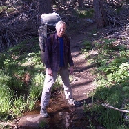
Here's a shot of Jack and the (nameless) SAR man at the old spring:

Image
User avatar
jfr
 
Posts: 145
Joined: Sun Jul 12, 2009 11:10 am
Location: 32N 117W

Postby Florian » Sat Jul 31, 2010 8:46 pm

John, where is the wall in relation to where you were camped last week? I'd like to find it.

-Florian
User avatar
Florian
 
Posts: 1441
Joined: Sat May 16, 2009 4:49 pm
Location: Palm Springs

Postby jfr » Sun Aug 01, 2010 6:42 am

If you hike uphill on the trail from the Andesite to Diorite campsites, it is just off the trail on the left-hand side, about mid-way between the two campsites. Diorite is the furthest uphill campsite in Tamarack Valley. I doubt that you'd miss it if you were looking for it actively.
User avatar
jfr
 
Posts: 145
Joined: Sun Jul 12, 2009 11:10 am
Location: 32N 117W

Postby Florian » Sun Aug 01, 2010 4:02 pm

I was wandering around from the tramway today and checked out the rock wall near the Tamarack Andesite campsite. I found some lettering in the concrete right where the SAR man is sitting in JFR's photo that reads as follows ..

OAK GLEN
7-67 J.C.C.
CREW

Junior Conservation Corp i'm guessing? Or maybe the initials of their crew leader? The writing is hard to read and not noticeable at first glance. Angled side lighting would have helped. I'm thinking the wall was just to provide a bit of up-slope protection for what may have been a tent site. Maybe the mess tent as it's near water in the creek. Didn't find any evidence of a spring or piping. Assuming i read the date correctly the wall was built in July 1967 when i was 12 years old.

-Florian
User avatar
Florian
 
Posts: 1441
Joined: Sat May 16, 2009 4:49 pm
Location: Palm Springs

Previous

Return to Mt. San Jacinto & Santa Rosa Mountains

Who is online

Users browsing this forum: Baidu [Spider] and 56 guests