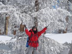
Jo Pond and the Lost Weekend

General Palm Springs area.

Jo Pond and the Lost Weekend

Postby Ellen » Tue Apr 13, 2010 5:39 pm

Howdy All :)

On Saturday, several of my San Jacinto hiking friends were unjustly seized and prohibited from climbing a particular route. I was at a conference in Austin and became outraged when I received a text about the debacle from the loveable mountain babe.

On Sunday, I hiked the Jo Pond trail with Kathryn, Mark, and Karin -- Team Loco Lobo. Keep reading and you'll understand why I titled this post "the lost weekend."

We were the first to arrive at Indian Canyon and started hiking about 8:15. It was a beautiful day but I was suffering from a serious case of jet lag and sleep deprivation. Mark led us out at a good pace and we reached the Jo Pond trail in under an hour. As we continued to climb, we started flagging a bit due to the increasing temperature and lack of wind. A good sized rattler gave us a start before it headed off the trail.

We stopped at lunch rock (where we had our repast last year) for about 45 minutes. Refueled and refreshed, we continued up and shortly popped out on Garnet Ridge where we were treated to a chilly, gusty wind. We followed the trail over to the distintive trees and water trough at Cedar Spring. It was 1 PM. There was some snow on the ground (though less than last year), dead fall, and overgrown brush which obliterated the trail.

We had a discussion regarding the route and started heading uphill rather than around the hill. We periodically saw footprints, which gave us a false sense of security. Before long, our way was blocked by dead fall, manzanita and buckthorn -- regardless of which direction we went. We backtracked a few times, then finally decided to head for higher ground to get our bearings. The demonic cougars were out in force and my invective turned the air even bluer than normal as I made my blood sacrifice to the Santa Rosa gods.

We finally topped out on Vomit Peak (you had to be there) and looked around -- there was no sign of either the Jo Pond trail, the PCT or the the notch where the two trails meet. We pulled out Mark's map and Kathryn's compass, continued to look around, and asked each other if someone had a plan of where to go. At this point, our general consensus was "we've got nothing." The wind was bitterly cold and blowing hard, so we knew we needed to at least MOVE.

We finally decided to drop down off Vomit Peak into a canyon and then traverse along another hill. On the way down, we tried to either step on top of the manzanita or pull it aside. The brush was not being cooperative and would catch on our clothes and/or push us backwards. Kathryn was behind me when I stepped down and was flung backwards. I landed on my back with both arms out to my sides. I realised that my right arm really hurt -- it was both pinned and impaled by the brush.

I finally extracted myself and pulled a big sticker out of my right forearm. We headed out to catch up with Mark and Karin but I had to keep stopping because my right hand was wet and slippery with blood. Kathryn tied my bandana around the wound and we continued on. I had stored my poles in my pack's side-pockets but the brush and trees kept snagging them so I had to take them out and carry them. I screamed with frustration as we crouched, crawled and dragged ourselves through the blasted brush.

Karin suddenly let out a whoop -- she had found a trail marker. We climbed up a bit more and were rewarded with the PCT. It was 4 PM and we all gave a prayer of thanks. We had lost 3 hours to bushwhacking -- a misnomer as the bushes were doing all of the whacking. We discussed which direction to go on the PCT and (you guessed it) initially went the wrong way. Reversed direction and were shortly rewarded with the junction of the Jo Pond trail and the PCT. When Kathryn found out that it was only 1 mile from Cedar Springs to the PCT junction, she almost fell down laughing.

On the way down to Morris Ranch road and Kathryn's blessed van, Mark was able to reach the folks at Indian Canyon. They were extremely kind and said they would not tow his car even though we had missed the 5 PM deadline. A heart felt thanks to the Agua Caliente Indians from team Loco Lobo.

By the time we reached Kathryn's vehicle, I looked like I'd been in a knife fight. Karin noted that she didn't like my red pants. We recounted moments of the challenging day as we headed back to Palm Springs. I was desperate for a meal at Las Casuelas and my friends were kind enough to oblige. After arriving home, I started on Keflex due to the risk of infection from loss of skin and iron to replace the blood loss.

Thus, the Lost Weekend.

Miles of smiles,
Ellen

Last edited by Ellen on Tue Apr 13, 2010 8:20 pm, edited 1 time in total.
Ellen
 
Posts: 2578
Joined: Thu Mar 29, 2007 9:38 am
Location: Riverside, CA

Postby Vnthali » Tue Apr 13, 2010 6:06 pm

After all of the serious talk and heated discussion about the Snow Creek problem, it was refreshing to read another one of your wonderfully detailed trip reports. Thank-you Ellen, and I hope you heal-up quickly.
Vnthali
 
Posts: 92
Joined: Thu Dec 24, 2009 8:41 am
Location: San Diego County

Postby halhiker » Tue Apr 13, 2010 7:19 pm

Where the hell did you go? Did you end up on Palm View Peak? I can only imagine that you headed up from Cedar Spring and went through hellish chaparral on the way to the PCT. Quite the adventure.

Oh, BTW, it's Morris Ranch Road (with an M) and not Norris.
User avatar
halhiker
 
Posts: 1260
Joined: Mon Oct 16, 2006 12:00 pm
Location: La Quinta, CA

Postby Sally » Tue Apr 13, 2010 7:23 pm

Holy Moly, Ellen. Great TR and glad to have you back. I hope you won't have too many battle scars. Is it typical for the Jo Pond trail to be overgrown? Who generally does trail maintenance - Forest Service workers or volunteers? I have been contemplating doing the Jo Pond trail for some time but now I'm not so sure!
I ran into a badly overgrown trail (Wildhorse trail) in the Agua Tibia Wilderness last month and had to abort my plan to summit because of all the brush.
User avatar
Sally
 
Posts: 1125
Joined: Thu Sep 17, 2009 8:27 pm
Location: Temecula

Postby Ellen » Tue Apr 13, 2010 8:28 pm

Howdy Vnthali :)

Thanks for your kind words 8) I'm glad that my trip report provided some needed comic relief.

Howdy Hal :)

Heck, I'd have to look at Mark's map (which is now stained with my blood) to figure out the actual location/name of Vomit Peak. You would think I'd have learned my lesson about bushwhacking after my 2007 Tamarack trip :oops: At least my friends have tougher skin and/or wore pants. Thanks for the correction re: Morris Ranch Road.

Howdy Sally :)

The Jo Pond trail is fine as long as you stay on it :lol: I'm pretty sure I know where we went off trail at Cedar Springs but I have no desire to test that assumption until my skin heals :roll:

Miles of smiles,
Ellen
Ellen
 
Posts: 2578
Joined: Thu Mar 29, 2007 9:38 am
Location: Riverside, CA

Postby Marknhj » Tue Apr 13, 2010 8:34 pm

halhiker wrote:Where the hell did you go? Did you end up on Palm View Peak? I can only imagine that you headed up from Cedar Spring and went through hellish chaparral on the way to the PCT. Quite the adventure.


We ended up about a third of the way between Palm View Peak and the Cedar Spring Trail (I've figured it out now, at the time we had no idea). Karin and I thought we remembered where we went last year after hitting the water troughs at Cedar Springs, basically keep going in the same direction. But last year there was a lot of snow and we followed foot prints.

However, after about 50m the trail simply disappeared so we turned back and saw what we thought was a trail heading uphill. Then the fun started. It really was hellish for three hours, with all of us crawling around on our hands and knees in some areas. We popped up on several ridges hoping to at least see something resembling a trail, but to no avail. By this stage Ellen was bleeding profusely and my lower legs were getting trashed as well; it got increasingly worse as we got further and further into the bastard chaparral. Of course, the most worrying aspect was the weather coming in. I certainly didn't fancy spending the night up there, although we did have gear and Ellen's Spot.

It was a huge relief to find PCT although we did initially head the wrong way (that was my mistake). I'd already resolved myself to my car being towed so it was a nice surprise to find an Indian Canyons telephone number on my map and and even greater one in getting a cell signal. I'll echo Ellen's thanks to the Rangers! When I picked it up yesterday Ranger Mike told me if they hadn't heard from us they would have called SAR (there was a SAR rescue that night on Black Mountain). The guys I spoke to on the phone, and then met, couldn't have been more professional and helpful. If you're reading this, thank you once again!

It was an adventure and a (literally) bloody relief to pop out on PCT. I was out of action for half of January and most of February with an IT band attachment problem. Been training a lot between 3-4mph in the mountains since then, but didn't imagine my three miles per hour would end up as one mile per three hours crawling around bleeding on Jo Pond! Ellen, I'm trying to decide whether to wash the blood off my map or keep it as a souvenir!
Marknhj
 
Posts: 179
Joined: Thu Feb 07, 2008 12:03 pm
Location: Palm Springs

Wow

Postby halhiker » Tue Apr 13, 2010 10:16 pm

That is just brutal. If you'd been below the Cedar Spring trail it wouldn't have been as bad because the trail was used as a firebreak in the Pinyon Fire way back when and it's not as thick as above the trail. That chaparral is nasty stuff and I can only imagine the HELL of going about a mile in three hours.

Time for someone to get a GPS.
User avatar
halhiker
 
Posts: 1260
Joined: Mon Oct 16, 2006 12:00 pm
Location: La Quinta, CA

Postby tinaballina » Wed Apr 14, 2010 4:19 pm

Glad you are all safe and sound. I think we need to write off last weekend or give it to a higher power because the stars were just not aligned.
Thanks again for lunch today pain sister.
:)
User avatar
tinaballina
 
Posts: 1107
Joined: Tue Jan 08, 2008 11:21 am
Location: Riverside

Postby Ellen » Wed Apr 14, 2010 9:15 pm

Howdy Tina :)

At least this was our navigation error -- we weren't hassled by the Gestapo.

Howdy Hal :)

GPS :oops: uh yes, no arguement there.

Howdy All :)

What happens when a blond loses to brush:

[img][img]http://img5.glowfoto.com/images/2010/04/14-2052114314T.jpg[/img][/img]

Miles of smiles,
Ellen
Ellen
 
Posts: 2578
Joined: Thu Mar 29, 2007 9:38 am
Location: Riverside, CA

Postby Kathryn61 » Wed Apr 14, 2010 10:07 pm

I just want to thank Ellen, Karin and Mark for dealing with our situation so well. I think it was really cool how everyone stayed completely calm and no one ever got angry, depressed or emotional. Nobody ever complained even once. At times, we even laughed and that helped to keep us in a very positive state. The teamwork was exceptional and I think that the main reason we made it to the car before dark and didn't have to spend the night out there or walk all the way back to Indian Canyons was because everyone was given the opportunity to contribute their knowledge and skills. This may sound weird, but you guys were great people to get lost with and I really appreciate how you kept it together and got us out of that mess! Also, I really learned a lot from this experience.
"We have only this moment, sparkling like a star in our hand... and melting like a snowflake."
User avatar
Kathryn61
 
Posts: 98
Joined: Fri Oct 30, 2009 8:03 pm
Location: La Quinta CA

Next

Return to Mt. San Jacinto & Santa Rosa Mountains

Who is online

Users browsing this forum: Baidu [Spider] and 4 guests