20100116 Dobbs Peak, West and East in the San Bernardino's

Southern California and far-away places. Hiking, wildlife, cycling etc.

20100116 Dobbs Peak, West and East in the San Bernardino's

Postby lilbitmo » Mon Jan 18, 2010 4:20 pm

Headed up Vivian Creek Saturday morning around 6 AM with Tina and Ellen from this board, they affectionately call each other "The Pain Sisters", from what I've seen they are not kidding, they love great uphill hikes and are willing to do just about any of them :D it's the downhill they despise :D .

Anyway after reaching Vivian Creek Trial Camp we headed up to the left across the river to that ridge that is just slightly to the south - from there we traversed due north to where it intersects another ridge that goes uphill from West to East directly to the summit of "West Dobbs" - I like to call this "bumble bee ridge" because when the wind blows the "bees get stuck to the ice on the very crest of the ridge when they try to land in the winter" - you see hundreds of them stuck in the edge of the ridge, frozen in time - the ladies laughed when I pointed this out.

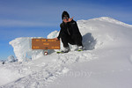
The ridge is about 2.5 miles long from the turn off to the summit of Dobbs and within a hundred feet of making the turn at the bottom we were all putting on our crampons, the snow was very compact and icy all the way up, the clouds threatened rain all morning, they were dark and ominous but when we reached the summit at 11:15 AM and took a break for 30 minutes they blew away on a soft breeze and we were left with a beautiful sunny Southern California morning.

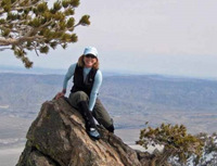
From the top of West Dobbs we headed over to East Dobbs as I thought there was a second easy saddle leading up to Jepson and thus San G but when we came over that ridge it appeared to be a lot steeper than I remember from doing this same hike three years ago, the ladies were game in trying to descend but after 15 minutes we all thought the better of it as we didn't want to have to come down in the dark and we all had made plans to meet some other hikers (that started on another hike at the trial head at the same time) for dinner down in Forst Falls. We took some summit shots and headed back down at a nice pace - the snow was slicker going down than coming up as now the sun make it wet in the areas that were exposed to the sunshine but very icy where it was shady.

All and all we had a great day and I'm glad we got out there before this next set of storms set in, it's going to take a whole lot more to do that ridge now :D

Pictures here -http://s908.photobucket.com/albums/ac287/CharlieMacbob/Dobbs%20Peak%20with%20Pain%20Sisters%2001-16-2010/?albumview=slideshow
User avatar
lilbitmo
 
Posts: 550
Joined: Sun Feb 03, 2008 11:37 pm

Postby zippetydude » Mon Jan 18, 2010 6:18 pm

Hi Patrick! It was good seeing you at the ranger station - one of these days we'll have to do some trail time together as well! Cool pics from Dobbs.

Hey, I agree with you about the way those clouds looked - kinda spooky. Even though no rain was forecast for Saturday, it sure looked ominous.

Great job on your adventure!

z
User avatar
zippetydude
 
Posts: 2751
Joined: Tue May 09, 2006 5:40 am

Postby calicokat » Mon Jan 18, 2010 8:00 pm

Great trip report. I have done this route in the summer and have been wanting to try it in the winter. After these storms it should be something else up there :o
User avatar
calicokat
 
Posts: 91
Joined: Wed Oct 15, 2008 6:45 am
Location: Ventura County

Postby NormaR » Tue Jan 19, 2010 5:19 pm

niceeeee! :D sorry i missed it! great photo's Patrick. loved watching the change in the clouds. you know the only peak i have done in the SG Wilderness is San G. i gotta get out there more!
User avatar
NormaR
 
Posts: 216
Joined: Thu Dec 13, 2007 5:22 pm
Location: Ventura County, CA

Postby bluerail » Tue Jan 19, 2010 9:33 pm

well gee zip, I hope you had a good time too on saturday. I know I did. are you ignoring my text about this weekend, or is your poor cell phone buried in your car under all those running shoes and shorts?

Patrick, it was nice running into you guys at the ranger station in the morning...kinda sorry we all headed to different sides of the same mountain. I've really come to enjoy that north side of San G in the snow, it's a playground back there.
User avatar
bluerail
 
Posts: 2108
Joined: Thu Dec 11, 2008 10:30 am
Location: La Quinta

Postby zippetydude » Tue Jan 19, 2010 10:42 pm

bluerail wrote:well gee zip, I hope you had a good time too on saturday. I know I did. are you ignoring my text about this weekend, or is your poor cell phone buried in your car under all those running shoes and shorts?


I thought I texted back - maybe it's in Drafts - Sorry, you know I'm no good with tech gadgets. Half the time I'm missing phone calls, texts, emails...but you already know that, don't you?

Think this'll clear up enough on Saturday to let us get out and play? Or are you and the F man going to do another Skyline 17 hour epic adventure?!

I'll talk to you tomorrow.

Sorry about the hijack. Back to the topic.

Patrick, have you gone up to Dobbs from the north side? I'm with Steve, I like that north face, even though it's about 15 minutes more driving time. That might be a fun climb and traverse, approaching from the far west chute, then come down over on the northeast ridge of San G above Dry Lake.

z
User avatar
zippetydude
 
Posts: 2751
Joined: Tue May 09, 2006 5:40 am

North Side

Postby lilbitmo » Wed Jan 20, 2010 12:18 am

Yes the north side has it's beauty and I've done the bowl between Jepson and San G in consolidated snow late winter two years ago, but not in the deep, deep snow. That's a two day trip unless you are into slugging through the snow for hours on end then switching to crampons in the higher elevations which I was prepared to do but did not need to when I did it that time. I was lucky in that the lower elevations were compact and easy to cross, more than likely the same way you found them on Saturday while we were playing on the opposite side of the hill.

As far as Dobbs from the North, you could go over the West side of Jepson coming up from Dry Lake to it's summit sure but the ridge leading up from Vivian Creek Trail Camp is what makes that approach from Vivian side of the mountian the workout that it is, both you guys would like that, you can then bag Jepson and go over to San G. Or you could do a car shuttle and bag San G., then Jepson and come out by way of Dobbs and Vivian Creek then go get the other car, just food for thought.

Keep me posted when you guys are going back, this weekend I'm out with sister coming to town from Michigan for a conference at Long Beach State, I may take her out but not to the deep, deep stuff we like, just something attainable in the time we have.

Did you guys post a report and I missed it? Where's the pictures :D
User avatar
lilbitmo
 
Posts: 550
Joined: Sun Feb 03, 2008 11:37 pm

Postby bluerail » Wed Jan 20, 2010 7:31 am

yea, that tech-no-nothing thing. I'm impressed you finally figured out how to put a real backpack on. good work.

and btw Patrick, the peak was so cold with the wind sat. that it was not fun being up there at all. we couldn't even find a spot to hide from the wind. we looked like idiots that were about to die from exposure.

my tr.

we wore microspikes to dry lake, crampons to the the peak,froze, glissaded down either the east chute or the middle chute, and a little cross country going back. we did let a water bottle slide down a semi-steep ravine so we could track it through the woods and down the ravine.that was alot of fun. ran into a ranger on the way back who didn't believe we had already summited, (the running thing really does save a bit of time). and then we went home.
User avatar
bluerail
 
Posts: 2108
Joined: Thu Dec 11, 2008 10:30 am
Location: La Quinta

Postby lilbitmo » Wed Jan 20, 2010 11:51 am

bluerail wrote:we wore microspikes to dry lake, crampons to the the peak,froze, glissaded down either the east chute or the middle chute, and a little cross country going back. we did let a water bottle slide down a semi-steep ravine so we could track it through the woods and down the ravine.that was alot of fun. ran into a ranger on the way back who didn't believe we had already summited, (the running thing really does save a bit of time). and then we went home.


My kind of TR - to the point.

Let me guess the Ranger wanted to see your permit - as you were only ones on the mountain :shock: :lol:
User avatar
lilbitmo
 
Posts: 550
Joined: Sun Feb 03, 2008 11:37 pm

Postby zippetydude » Wed Jan 20, 2010 10:35 pm

We ran into the ranger just outside the wilderness boundary.

He asked where we had been.

We said to the peak.

He said I find that hard to believe.

He said may I see your permit?

I said we only went to the wilderness boundary sign.

Suddenly, he was a believer in the peak theory.

We made decent time, so that was why he was doubtful. With good conditions, 6:00 to 6:30 is reasonable round trip. We had pretty good conditions, but had to work carefully up the last 1500 vertical feet to do it safely, so the round trip was a little over 8:00. I would have been willing to skip the break at top. All we did was freeze and lose sensation in our fingers. But Fernando, for some unknown reason, brought chips and sour cream, so it was an interesting stop nonetheless.

z
User avatar
zippetydude
 
Posts: 2751
Joined: Tue May 09, 2006 5:40 am

Next

Return to Outdoors-Related Topics

Who is online

Users browsing this forum: No registered users and 6 guests