Why wake up on New Year's morning with a hangover when you can meet the sunrise with a hike? To keep it simple, I thought lowly Sitton Peak (all 3400 ft of it) would be a nice hike to start 2010. Last time I was on this trail was not long after the San Mateo Wilderness was created, and the 4WD truck trails that run through the area had just been cut off from 4WD traffic. They've overgrown nicely, but are still distinguishable.Its in the Santa Ana Monutains off the Ortega Highway (SR74), trail starts just downhill from the Ortega Oaks candy store, about 6 miles south of the Lake Elsinore overlook (or 20 miles north of San Juan Capistrano). Not too many folks on the trail, but looks like there were lots of horses on the first mile of the trail yesterday (yuck!). Don't try this hike in mid-summer - the temps get over 100F in this area.
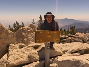
A few pictures. Can't figure out how to sequence stuff on Flickr, but they are numbered.
http://www.flickr.com/photos/40389757@N07/?saved=1
Cheers, and Happy New Year!

Mt. San Jacinto Outdoor Recreation
Hiking, Climbing, Camping, Trail Running, Snowshoeing...
Starting 2010 on a low point - Sitton Peak
13 posts
• Page 1 of 2 • 1, 2
Starting 2010 on a low point - Sitton Peak
![]() by phydeux » Fri Jan 01, 2010 10:07 pm
by phydeux » Fri Jan 01, 2010 10:07 pm
3 of the 5 voices in my head are telling me to "Go for it!"
-

phydeux - Posts: 348
- Joined: Sat May 13, 2006 5:32 pm
- Location: Orange County, CA.
![]() by Sally » Sat Jan 02, 2010 8:06 pm
by Sally » Sat Jan 02, 2010 8:06 pm
Happy New Year, phydeux. Thank you for reminding me to check out the Santa Anas. Sometimes we take the "little" mountains for granted, but they have a lot of beauty too. I have hiked in the Tehaja area off Clinton Keith Road, but have yet to try out the trails starting on the Ortega Hwy. I have resolved to hike every week, and this area is close to home and there are a lot of trails to cover. Also, I have been wanting to do an overnighter in the San Mateo Wilderness. Did you see any nice places to pitch a tent along the way?
Sally
Sally
-

Sally - Posts: 1125
- Joined: Thu Sep 17, 2009 8:27 pm
- Location: Temecula
![]() by phydeux » Sun Jan 03, 2010 9:08 am
by phydeux » Sun Jan 03, 2010 9:08 am
Sally;
There are a few places you could set up a tent, but this is more of a day hike (12 miles RT). I did the whole thing in about 4 1/2 hours, including lounging on the summit and doing the false summit just east of Sitton Pk. Remember its low altitude (starts around 1900 ft and the peak is 3400 ft, not too much higher than the PS Tram's lower station) so its easier on the cardio system, but it'll get really hot back there in late spring/summer.
Not sure if camping is allowed, but if you want to do an overnight trip there are flat areas at the Bear Canyon/Bear Ridge junction about 2 mile in (surrounded by oak trees & shrubs) and at Four Corners (3.5miles in, open country with no trees). You'll have to bring in your own water; Pigeon Springs is unreliable - no flow when I was there on Jan 1. I haven't been in the rest of the San Mateo Wilderness in many years so I can't tell you how good or bad the area is for overnight trips. Besides a 20+ year old book I have that concentrates on trails & fire roads (rather than peaks), I'm not aware of any references or guidebooks available for the area. Might do some exploratory hikes later this winter and spring.
Cheers
3 of the 5 voices in my head are telling me to "Go for it!"
-
phydeux - Posts: 348
- Joined: Sat May 13, 2006 5:32 pm
- Location: Orange County, CA.
![]() by Rumpled » Mon Jan 04, 2010 5:04 pm
by Rumpled » Mon Jan 04, 2010 5:04 pm
I'm pretty sure you can overnight anywhere you choose in the San Mateo, but I'm also pretty sure you need a permit to do it.
As far as guides, somewhere I have "Afoot and Afield in Orange County" by Jerry Schad (sp?). I can't find it anywhere in my house; but I know I own one - I was just looking to get some more info that wasn't in my head.
I believe Jerry has taken on a co-author and updated some of his guides. I think I saw a newer OC one than mine in the Library - or maybe the REI book section? He's outta the San Diego area IIRC and has a handful of publications.
-
Rumpled - Posts: 122
- Joined: Fri Jul 11, 2008 1:15 am
![]() by lilbitmo » Mon Jan 04, 2010 5:23 pm
by lilbitmo » Mon Jan 04, 2010 5:23 pm
Rumpled wrote:I'm pretty sure you can overnight anywhere you choose in the San Mateo, but I'm also pretty sure you need a permit to do it.
As far as guides, somewhere I have "Afoot and Afield in Orange County" by Jerry Schad (sp?). I can't find it anywhere in my house; but I know I own one - I was just looking to get some more info that wasn't in my head.
I believe Jerry has taken on a co-author and updated some of his guides. I think I saw a newer OC one than mine in the Library - or maybe the REI book section? He's outta the San Diego area IIRC and has a handful of publications.
You can sometimes find it in the "Triple AAA" locations as well, that's where I got my newer version of "Afield and Afoot in Orange County" and the San Diego version, call your local one and ask, they give discounts to Triple AAA members.
-

lilbitmo - Posts: 550
- Joined: Sun Feb 03, 2008 11:37 pm
![]() by Sally » Mon Jan 04, 2010 8:53 pm
by Sally » Mon Jan 04, 2010 8:53 pm
Thank you you guys. I have a copy of Jerry Schad's "Afoot & Afield in Orange County." It was copyrighted in 1988 and updated in 1996. It's a bit old but has lots of info.
I am the buyer for hiking books and maps at the store that I work at, but the companies I order from don't carry a map of the San Mateo Wilderness, which is frequently requested. I guess there's always USGS.
Anyhow, I'll be sure and get a permit if I do an overnight.
I am the buyer for hiking books and maps at the store that I work at, but the companies I order from don't carry a map of the San Mateo Wilderness, which is frequently requested. I guess there's always USGS.
Anyhow, I'll be sure and get a permit if I do an overnight.
-
Sally - Posts: 1125
- Joined: Thu Sep 17, 2009 8:27 pm
- Location: Temecula
San Mateo Wilderness Map
![]() by lilbitmo » Tue Jan 05, 2010 5:14 pm
by lilbitmo » Tue Jan 05, 2010 5:14 pm
Best copy I have, sorry
There is a trail that follows the boundry line for "Potrero De La Cienaga" property in the upper right hand corner of this map, it comes off the "Morgan Trial" at that spot on this map where the Morgan Trial touches that property (and is marked out there in the wilderness by a nice sign) it then heads east around the property and quickly turns south west staying just outside and above that property until it comes back around the southern end of the property and connects with the "Tenaja Falls Trail" a mile or so above the falls. I have yet to find this trail on any maps of the area but if you plan to do more than Sitton Peak and want to do a very nice loop hike past the falls you can do so. Enjoy.

There is a trail that follows the boundry line for "Potrero De La Cienaga" property in the upper right hand corner of this map, it comes off the "Morgan Trial" at that spot on this map where the Morgan Trial touches that property (and is marked out there in the wilderness by a nice sign) it then heads east around the property and quickly turns south west staying just outside and above that property until it comes back around the southern end of the property and connects with the "Tenaja Falls Trail" a mile or so above the falls. I have yet to find this trail on any maps of the area but if you plan to do more than Sitton Peak and want to do a very nice loop hike past the falls you can do so. Enjoy.
-
lilbitmo - Posts: 550
- Joined: Sun Feb 03, 2008 11:37 pm
![]() by Rumpled » Wed Jan 06, 2010 9:57 am
by Rumpled » Wed Jan 06, 2010 9:57 am
That looks like it's from the older Afoot and Afield, no?
I checked out the 2006? edition from the library last nite. I don't remember seeing Portrero deo La Cienaga portrayed on the map (and I've never been there personally). I'll have to look again tonite.
The Killen Trail/South Main Divide/Wildomar/Tenaja Road is described as all paved. I remember when it was all dirt. I haven't been much past the Morgan TH since it was paved. I think I prefer it be dirt.
Also, I'm pretty sure the newer version shows the TH for #6 on that map as unavailable. That cherry stem is shown as private property and the text mentions that access to the Clark trail from the East is unavailable.
I need to spend more time in the local mountains.
-
Rumpled - Posts: 122
- Joined: Fri Jul 11, 2008 1:15 am
![]() by phydeux » Wed Jan 06, 2010 7:24 pm
by phydeux » Wed Jan 06, 2010 7:24 pm
Found a few maps on the Cleveland National Forest website. Scroll down a little below the picture of the guy sitting downand you'll notice, in the ACTIVTIES column, two links to "Map of the San Mateo Wilderness" and "Map of Non-Wilderness Areas." Not great maps (no topo relief , no peaks ID'd, and only the size of a basic piece of paper), but it gives you an idea of the trails out there and a short description of each:
http://www.fs.fed.us/r5/cleveland/recreation/
If the link doesn't come up, go the the Cleveland NF page, then click on "Recreation Activities" in the right column and it'll take you to the page linked above.
Cheers.
http://www.fs.fed.us/r5/cleveland/recreation/
If the link doesn't come up, go the the Cleveland NF page, then click on "Recreation Activities" in the right column and it'll take you to the page linked above.
Cheers.
3 of the 5 voices in my head are telling me to "Go for it!"
-
phydeux - Posts: 348
- Joined: Sat May 13, 2006 5:32 pm
- Location: Orange County, CA.
![]() by lilbitmo » Wed Jan 06, 2010 10:45 pm
by lilbitmo » Wed Jan 06, 2010 10:45 pm
Phydeux,
Nice work on finding more maps, add that to the other one and it gives a complete picture of the Cleveland National Forest, San Mateo area. That's the first one I've seen that has the "Tenaja Falls Trail" going all the way around the "Potrero Property" as mentioned above.
Thanks for posting this.
Nice work on finding more maps, add that to the other one and it gives a complete picture of the Cleveland National Forest, San Mateo area. That's the first one I've seen that has the "Tenaja Falls Trail" going all the way around the "Potrero Property" as mentioned above.
Thanks for posting this.
-
lilbitmo - Posts: 550
- Joined: Sun Feb 03, 2008 11:37 pm
13 posts
• Page 1 of 2 • 1, 2
Return to Outdoors-Related Topics
Who is online
Users browsing this forum: No registered users and 3 guests