lilbitmo wrote:A close friend is getting married on Long Island in early June so I'm doing a week in the White Mountains after the wedding and I need as much "Beta" on hiking in the White Mountains as possible.
I need trial maps, hiking distance, trip reports anything you can give me.
I may attempt to do a "Long Day hike of all the summits" from Madison to Esinhower" or more if it's feasable.
I'm considering the Great Gulf Trial if I can get some information about the 1,800 foot wall?
Any information would be appreciated.
Thanks Lilbitmo

I'm a New England transplant, and am very familiar with the NH Whites. Will be visiting back there in April, and will be hiking some of the peaks you mention above.
Start by purchasing the Appalachian Mountain Club (AMC) "White Mountain Guide". It's arguably the best trail guide in the country, in part because it is been under active revision since 1907. It will include paper maps, and you can purchase separately the same maps in Tyvek. AMC Guide will give accurate distances and hiking times. Their publications are available in many locations, including their website,
www.outdoors.org.
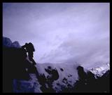
Your "Long Day hike of all the summits" is known as a "Presidential Traverse", as the peaks within that traverse are part of a mountain range by the same name. It is an arduous hike, and those who finish it take 12-15 hours or more. It's usually done from north to south, starting with Madison and ending with Pierce/Clinton, although some include Jackson. Trails in the Whites are rocky and rough, and the weather is unpredictable. Multiple storm tracks converge in that area, along with a dip in the jet stream, which frequently causes high winds and cold temps. It's a good idea to carry some cold weather clothing, like wool hats, mittens, shell gear, and fleece and avoid cotton. Most of the traverse is above treeline. Consequently, pick a day when the weather is good.
Due to the latitude, treeline in the Whites of NH is around 4K', and the climate zone is sub-Arctic/Arctic. Depending upon the year, there's usually some snow in early June, but it has usually retreated to about 3,500' but then. Expect some hard-parked snow/ice from that point to treeline (it melts out above rather rapidly). If you have some traction devices like stabalizers or microspikes it would be a good idea to pack them. Crampons would be overkill.
I've done the Great Gulf Trail. It's about 5K' of elevation gain over 8 miles, most of which occurs in the last two. The trail itself is well-marked most of the way. The steep section follows a brook, so the rocks are wet and sometimes slippery. It usually requires a car spot. While it's an interesting hike in that it's physically challenging, I personally won't invest an entire day of a week-long vacation. Rather, I'd hike Lincoln/Lafayette via the Falling Waters/Old Bridle Path loop, or Moosilauke.
Hope this helps. There's an excellent BB known as "Views from the Top" which has a trail conditions section. It will give you good feedback on snow levels.
Kevin