Re: Bill Ewasko found?
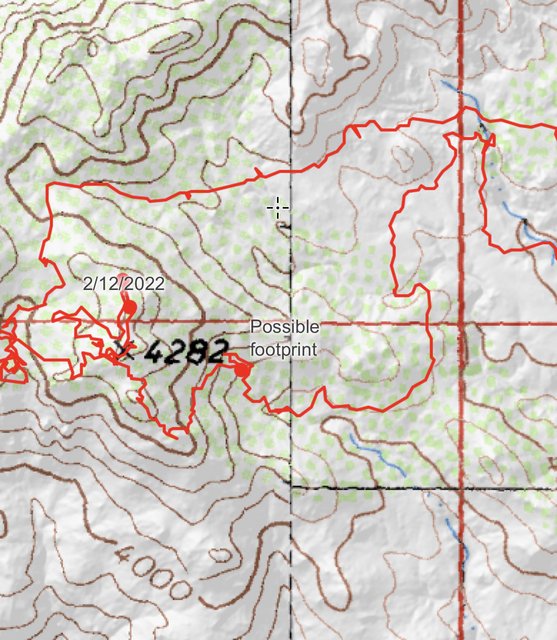
I went out there today to see if I couldn't track down the recovery site, mainly focusing on hill 4282 and the area inside the lines of the helicopter route.
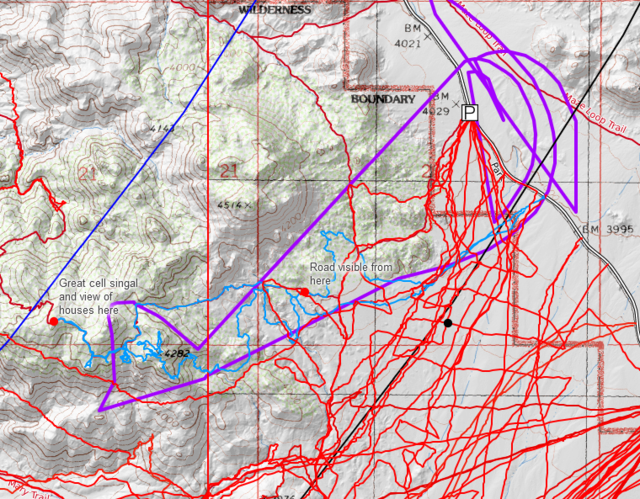
Almost as soon as you are on the Panorama Trail you are able to see Park Blvdto the East. The trail was well marked and easy to follow. First I decided to hike through and see if I could see any obvious tracks departing from the trail. I only found this a couple times and they lead simply to a vista point where a hiker could rest and enjoy the view. I hiked through to a little bit past the western track of the helicopter. From here I had four bars of AT&T service (on my T-mobile phone) and a clear view of the houses at the mouth of Quail Wash, which looked very close.
Westernmost part of my track. Houses clearly visible. Good cell coverage here
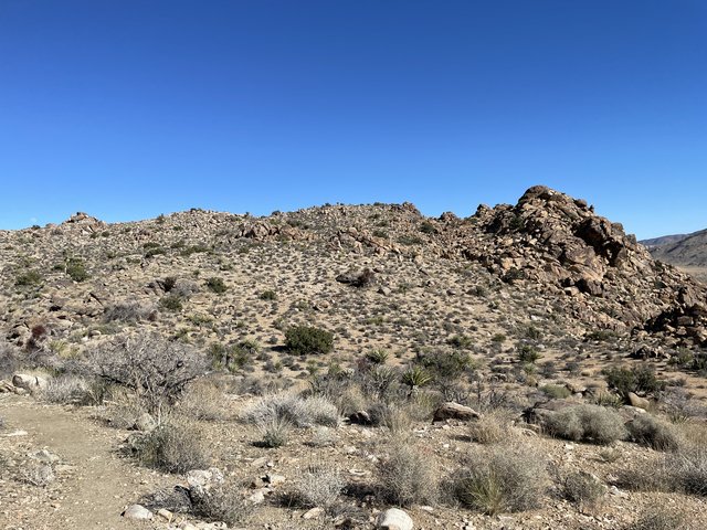
Hill 4282. It is very easy to to summit this hill from the trail
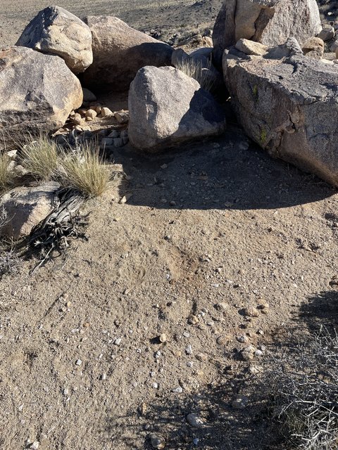
These are the only tracks/disturbances I found on hill 4282. But I would guess they just from hikers.
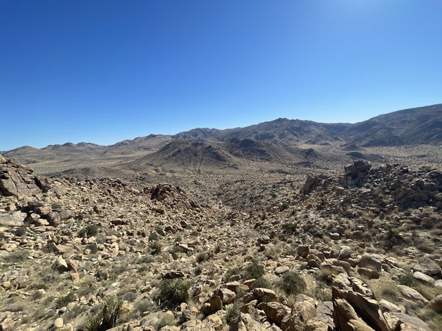
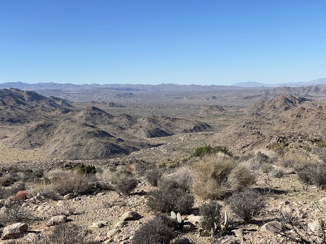
View of Samuelson's Spur, and the mouth of Smith Water Canyon from the Panorama Trail, just west of hill 4282
Some press coverage refers to human remains being found "adjacent" to or "near" the Panorama Trail. I'm not sure if there's much to read into that. But If Bill ever actually was on the PT, he would very clearly see Park Blvd if he were on the easterly side, and he would see houses and have cell signal if he were on the westerly side. Also, it is unfortunate that the helo tracks we have do not appear to be complete. Rather then getting the full circles it flew, they got cut off and were replaced by straight lines. Perhaps it only looks like it was circling 4282 because we're not seeing the full picture.
So, at the end of the day, I didn't find the site. But I did find something much rarer afterward, and that was an empty bar seat at Pappy and Harriet's.
Here's where I store my tracks: https://caltopo.com/m/LL01
Almost as soon as you are on the Panorama Trail you are able to see Park Blvdto the East. The trail was well marked and easy to follow. First I decided to hike through and see if I could see any obvious tracks departing from the trail. I only found this a couple times and they lead simply to a vista point where a hiker could rest and enjoy the view. I hiked through to a little bit past the western track of the helicopter. From here I had four bars of AT&T service (on my T-mobile phone) and a clear view of the houses at the mouth of Quail Wash, which looked very close.
Westernmost part of my track. Houses clearly visible. Good cell coverage here
Hill 4282. It is very easy to to summit this hill from the trail
These are the only tracks/disturbances I found on hill 4282. But I would guess they just from hikers.
View of Samuelson's Spur, and the mouth of Smith Water Canyon from the Panorama Trail, just west of hill 4282
Some press coverage refers to human remains being found "adjacent" to or "near" the Panorama Trail. I'm not sure if there's much to read into that. But If Bill ever actually was on the PT, he would very clearly see Park Blvd if he were on the easterly side, and he would see houses and have cell signal if he were on the westerly side. Also, it is unfortunate that the helo tracks we have do not appear to be complete. Rather then getting the full circles it flew, they got cut off and were replaced by straight lines. Perhaps it only looks like it was circling 4282 because we're not seeing the full picture.
So, at the end of the day, I didn't find the site. But I did find something much rarer afterward, and that was an empty bar seat at Pappy and Harriet's.
Here's where I store my tracks: https://caltopo.com/m/LL01