"Long range shows an amplification pattern which could mean colder air diving from the North. This would bring a storm system possible between September 19-22 stay tuned."
Remember that MachineHead? You said you'll keep an eye on that? This storm system will come true as I said days ago. It's been in my forecast for 10 days now.
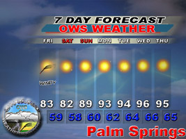
Your storm info can be viewed here.
http://www.ontarioweatherservice.com/avery.html
----------------------
As for the snow in August. I think it was hail. did a write-up on it. Here it is.
"What I saw looked like hail/snow. It could very well have been hail, but it could have been snow as well from the photos. Soundings indicated a 15,500 Foot Freezing level, with 60% RH. This would mean true snow would fall a bit lower due to drier air at that level. More like 13,000 Feet, barely missing the mountains.
Now what about if we had a major storm over the area. The storm was 65,000 Feet Tall. A massive storm for Southern California. This storm probably developed it's own environment around it. A tropical system does much of the same thing, and sense the lower levels were moist, and the air was hot, it would make it more tropical in the storm itself. This would make the updraft explode. Now take that major updraft to 65,000 Feet, and force air down from there in the massive downdraft. -120 degrees at that level or colder.
Pressure differences were 1016mb on the top of the Mountain with even higher, maybe 1025-1030mb pressure above the storm. Much like a hurricane. 9mb-14mb pressure difference would drive winds from the Highest pressure, to the lowest pressure. Cold air advection probably played a great role and the temp on the top of the mountain went below freezing in that downdraft.
As for snow? I'm not quite sure. The updraft was huge in that storm. This means that the result would be the super-cooled temps and forming SOLID ICE. This then would fall down as hail. This hail is probably colder than normal hail being how cold the atmosphere was they came from, hence the reason they are still there today.
If it was snow, the cloud would have to not be as convective to form solid ice. It would result in snow, but my final answer is HAIL, and LOTS OF IT. Someone should go up there and get a sample. It's probably different from the plains, being in a supercooled environment."
Kevin

Mt. San Jacinto Outdoor Recreation
Hiking, Climbing, Camping, Trail Running, Snowshoeing...
Storm system "Avery" is inbound
4 posts
• Page 1 of 1
Storm system "Avery" is inbound
![]() by OntarioWeatherService » Mon Sep 17, 2007 2:51 pm
by OntarioWeatherService » Mon Sep 17, 2007 2:51 pm
www.ontarioweatherservice.com
Admin note: This is a private weather forecasting service and is not associated with National Weather Service or Ontario International Airport.
Admin note: This is a private weather forecasting service and is not associated with National Weather Service or Ontario International Airport.
-
OntarioWeatherService - Posts: 83
- Joined: Tue Sep 11, 2007 2:01 am
![]() by physicslord » Tue Sep 18, 2007 1:31 pm
by physicslord » Tue Sep 18, 2007 1:31 pm
Why should anyone care about a 50% chance of rain and possible snow above 8000 feet?
Am I missing something?
Big deal. It's not going to change anything. We'll still be in a major drought.
Am I missing something?
Big deal. It's not going to change anything. We'll still be in a major drought.
- physicslord
- Posts: 79
- Joined: Wed Sep 12, 2007 1:37 pm
Why care about the weather...
![]() by asabat » Tue Sep 18, 2007 6:20 pm
by asabat » Tue Sep 18, 2007 6:20 pm
Thanks for the heads up - it gives us notice to prepare for storm conditions when hiking this weekend.
- asabat
- Posts: 168
- Joined: Wed Apr 11, 2007 7:47 pm
Re: Storm system "Avery" is inbound
![]() by Perry » Tue Sep 18, 2007 6:51 pm
by Perry » Tue Sep 18, 2007 6:51 pm
OntarioWeatherService wrote:Pressure differences were 1016mb on the top of the Mountain with even higher, maybe 1025-1030mb pressure above the storm.
So you're saying the pressure was higher at higher elevations? Or do you mean ESLP?
-

Perry - Site Admin
- Posts: 1518
- Joined: Mon May 08, 2006 6:01 pm
- Location: Palm Springs, CA
4 posts
• Page 1 of 1
Return to Outdoors-Related Topics
Who is online
Users browsing this forum: No registered users and 32 guests