Perry, saw you on the other forum. If you need a Meteorologist, I'm your man! Don't need these fine people hiking getting killed by high winds knocking stuff around etc etc.
Just let me know man.
Kevin

Mt. San Jacinto Outdoor Recreation
Hiking, Climbing, Camping, Trail Running, Snowshoeing...
Meteorologist.
Meteorologist.
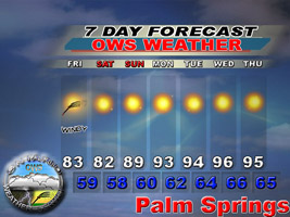
![]() by OntarioWeatherService » Tue Sep 11, 2007 6:31 pm
by OntarioWeatherService » Tue Sep 11, 2007 6:31 pm
www.ontarioweatherservice.com
Admin note: This is a private weather forecasting service and is not associated with National Weather Service or Ontario International Airport.
Admin note: This is a private weather forecasting service and is not associated with National Weather Service or Ontario International Airport.
-
OntarioWeatherService - Posts: 83
- Joined: Tue Sep 11, 2007 2:01 am
![]() by Perry » Tue Sep 11, 2007 7:18 pm
by Perry » Tue Sep 11, 2007 7:18 pm
Post away! But please make it clear that you are not part of National Weather Service so there's no confusion. There are plenty of hikers here who can check the accuracy of anybody's forecasts... and the Long Valley Ranger Station records high/low and precipitation every day. If Michael is interested, I can add a section for weather forecasting and we can see who is the most accurate...
-

Perry - Site Admin
- Posts: 1518
- Joined: Mon May 08, 2006 6:01 pm
- Location: Palm Springs, CA
![]() by OntarioWeatherService » Tue Sep 11, 2007 7:46 pm
by OntarioWeatherService » Tue Sep 11, 2007 7:46 pm
Yeah that section would be cool.
www.ontarioweatherservice.com
Admin note: This is a private weather forecasting service and is not associated with National Weather Service or Ontario International Airport.
Admin note: This is a private weather forecasting service and is not associated with National Weather Service or Ontario International Airport.
-
OntarioWeatherService - Posts: 83
- Joined: Tue Sep 11, 2007 2:01 am
![]() by Perry » Tue Sep 11, 2007 8:07 pm
by Perry » Tue Sep 11, 2007 8:07 pm
I'll talk to Michael and see if he wants to participate. Hopefully it can be a fun competition without any hard feelings. I wouldn't be upset at anybody if they get a forecast wrong, as long as they post in the section titled Weather Forecasting Contest, that way everybody knows that these aren't official announcements from NWS. Hell, I could say it's gonna rain brussel sprouts...I would be wrong, but no big deal. Generally speaking, the other members here are very nice compared to a lot of other forums on the Internet. Given these two factors, I think it would be a positive and entertaining experiment that would relieve some of the tensions on the San Gorgonio board.... If Michael doesn't want to participate, then it would just be you versus NWS, so you would have to copy and paste NWS forecasts into the messages, post your forecast, then we see who is the most accurate.... How does that sound?
-
Perry - Site Admin
- Posts: 1518
- Joined: Mon May 08, 2006 6:01 pm
- Location: Palm Springs, CA
![]() by OntarioWeatherService » Tue Sep 11, 2007 8:09 pm
by OntarioWeatherService » Tue Sep 11, 2007 8:09 pm
Sounds good, where is their forecast for that area at? lol. never looked on their site. NWS
www.ontarioweatherservice.com
Admin note: This is a private weather forecasting service and is not associated with National Weather Service or Ontario International Airport.
Admin note: This is a private weather forecasting service and is not associated with National Weather Service or Ontario International Airport.
-
OntarioWeatherService - Posts: 83
- Joined: Tue Sep 11, 2007 2:01 am
![]() by Perry » Tue Sep 11, 2007 8:31 pm
by Perry » Tue Sep 11, 2007 8:31 pm
This is the closest I can find:
http://www.wrh.noaa.gov/forecast/MapCli ... &map.y=108
That's 8,700 feet.
The ranger station is at 8,400 feet and the tram is at 8,500 feet. Same side of the mountain. The problem is that the tram's equipment does not comply with NOAA standards, and the ranger station doesn't put their observations on the Internet, so you have to actually walk in and get photocopies. I think Anything Weather predicts tram temps for The Desert Sun. Not very well, see here:
http://www.mtsanjacinto.info/viewtopic.php?t=210
(I never got around to graphing w/ LVRS results, but glancing at those numbers, there's something seriously wrong with The Desert Sun forecasts in the winter time. In the summer they seem to be okay.)
Big Bear could be compared more conveniently because NWS gives observations on the Internet, and their equipment most likely complies with NOAA standards.
-
Perry - Site Admin
- Posts: 1518
- Joined: Mon May 08, 2006 6:01 pm
- Location: Palm Springs, CA
![]() by Foleymo » Tue Sep 11, 2007 10:02 pm
by Foleymo » Tue Sep 11, 2007 10:02 pm
Yep, Accuweather provides the data for The Desert Sun's weather page. I work at the paper and I can't tell you how much it ticks me off that Accuweather can't get the mountain temperature forecasts right, especially in the winter. One of these days someone is going to get into trouble believing the forecast and thinking they're prepared for the elements. Hopefully things will be better with Accuweather this winter.
- Foleymo
![]() by OntarioWeatherService » Tue Sep 11, 2007 10:51 pm
by OntarioWeatherService » Tue Sep 11, 2007 10:51 pm
I will see what I can do. Accuweather is not really that good period in Southern California weather, lol. I never use them so I understand.
www.ontarioweatherservice.com
Admin note: This is a private weather forecasting service and is not associated with National Weather Service or Ontario International Airport.
Admin note: This is a private weather forecasting service and is not associated with National Weather Service or Ontario International Airport.
-
OntarioWeatherService - Posts: 83
- Joined: Tue Sep 11, 2007 2:01 am
Things to think about post from SGWA Message Board
![]() by Local Guy » Wed Sep 12, 2007 10:52 am
by Local Guy » Wed Sep 12, 2007 10:52 am
If a true forecast contest is to be run, everyone (or someone) must decide on a set of predetermined reliable verification points, a predetermined deadline for the submission of each forecast, and a predetermined forecast period. As for verification, this is best done with a point that we're all familiar with and that is also an official reporting station with observers trained in taking observations. Penn State runs a national forecast contest every year, although I hear the University of Oklahoma is taking it over this year. Anyway, this is a good place to look to see how they run their forecast contest - rules etc - possibly use it as a model for your own contest. Forecast Contest Rules I participated once and came in 12th out of 615 people for the Corpus Christi period.
Verification points in the middle of the wilderness (which would be nice) won't work here. It's gotta be someplace like Big Bear Lake (or Big Bear City Airport since it's automated and records a true liquid equivalent every time). PS Tram might work too. It has to be someplace with trustworthy measurements.
You also have to decide what elements you want to forecast... temps? precip? (liquid equiv or snowfall or both)? wind gusts? Onset of precip? Duration of precip? You can make it as simple or as complex as you wish (simple is probably better).
If you want to compare your results with weather.com, NWS, or AccuWeather, you're going to have to make sure your forecast are submitted around they same time that all these folks submit theirs, otherwise you are not getting a true comparison since you will have had newer, fresher data to examine that none of these people would have been able to look at when their forecasts were issued.
All things to think about.
- Local Guy
- Posts: 15
- Joined: Wed Sep 12, 2007 10:45 am
![]() by OntarioWeatherService » Wed Sep 12, 2007 12:45 pm
by OntarioWeatherService » Wed Sep 12, 2007 12:45 pm
All points valid, however this is the San G wilderness area. This is the San J area, and forecasting is not reliable up there. This is probably the contest running. Tram station would be the best verification. the highest station.
www.ontarioweatherservice.com
Admin note: This is a private weather forecasting service and is not associated with National Weather Service or Ontario International Airport.
Admin note: This is a private weather forecasting service and is not associated with National Weather Service or Ontario International Airport.
-
OntarioWeatherService - Posts: 83
- Joined: Tue Sep 11, 2007 2:01 am
Return to Outdoors-Related Topics
Who is online
Users browsing this forum: No registered users and 32 guests