It appears the storm has not subsided....how about if we just focus on whether Kevin's weather predictions turn out to be accurate?....
Kevin, this storm that is coming in. What are your predictions of the time period it will be here, high's and low's, precipitation, and maximum wind gust? This would be for Big Bear.
Here is the NWS forecast link, which is updated at least daily:
http://www.wrh.noaa.gov/forecast/MapCli ... -116.94167
Here is a copy of what it says right now:
This Afternoon: Sunny, with a high near 65. South wind around 5 mph.
Tonight: Mostly clear, with a low around 34. South wind between 5 and 15 mph.
Wednesday: Mostly sunny, with a high near 60. South wind between 10 and 15 mph, with gusts as high as 20 mph.
Wednesday Night: A 20 percent chance of rain after 11pm. Partly cloudy, with a low around 29. South wind around 15 mph, with gusts as high as 25 mph.
Thursday: A 40 percent chance of rain, mainly after 11am. Partly sunny, with a high near 52. Southwest wind between 10 and 15 mph, with gusts as high as 25 mph.
Thursday Night: A chance of rain before 11pm, then a chance of snow showers. Some thunder is also possible. Mostly cloudy, with a low around 24. Chance of precipitation is 50%.
Friday: A 50 percent chance of snow showers. Some thunder is also possible. Mostly cloudy, with a high near 48.
Friday Night: A chance of snow showers. Some thunder is also possible. Mostly cloudy, with a low around 19.
Saturday: A chance of snow or rain showers. Some thunder is also possible. Partly sunny, with a high near 56.
Saturday Night: A slight chance of showers. Mostly cloudy, with a low around 22.
Sunday: A slight chance of showers. Partly cloudy, with a high near 66.
Sunday Night: Partly cloudy, with a low around 30.
Monday: Mostly sunny, with a high near 67.
(This is considered "fair use" under the Copyright Act, since we need to copy this data for discussion purposes, given that old forecasts are conveniently deleted from the NWS site.)
Edit: changed to Fawnskin, since that's where the observations are taken.
A note on edits: you'll see a timestamp if somebody has edited their post after a reply. So an unaltered post will have replies but no edit note in small text.

Mt. San Jacinto Outdoor Recreation
Hiking, Climbing, Camping, Trail Running, Snowshoeing...
Meteorologist.
![]() by OntarioWeatherService » Tue Sep 18, 2007 2:30 pm
by OntarioWeatherService » Tue Sep 18, 2007 2:30 pm
I spent so much time on weather forecasting that I really never studied writing and spelling but that's not what matters.
www.ontarioweatherservice.com
Admin note: This is a private weather forecasting service and is not associated with National Weather Service or Ontario International Airport.
Admin note: This is a private weather forecasting service and is not associated with National Weather Service or Ontario International Airport.
-
OntarioWeatherService - Posts: 83
- Joined: Tue Sep 11, 2007 2:01 am
![]() by HikeUp » Tue Sep 18, 2007 2:37 pm
by HikeUp » Tue Sep 18, 2007 2:37 pm
OntarioWeatherService wrote:I spent so much time on weather forecasting that I really never studied writing and spelling but that's not what matters.
I understand that, and I can understand most of what you've written, so I am not trying to criticize. But I'm just trying to understand what your previous post means. If it's irrelevant to the forecast, I apologize.
- HikeUp
- Posts: 203
- Joined: Sun Jul 01, 2007 8:17 pm
- Location: Pasadena, CA
![]() by Perry » Tue Sep 18, 2007 2:45 pm
by Perry » Tue Sep 18, 2007 2:45 pm
Kevin, for the Fawnskin storm comparison this week, would you like to start a new thread?
See how it says:
Last Update: 1:35 pm PDT Sep 18, 2007
Please let me know when you plan to make your forecast, then I'll copy and paste the NWS forecast into a message. As long as it's approximately the same time, then it will be a fair comparison...
See how it says:
Last Update: 1:35 pm PDT Sep 18, 2007
Please let me know when you plan to make your forecast, then I'll copy and paste the NWS forecast into a message. As long as it's approximately the same time, then it will be a fair comparison...
-

Perry - Site Admin
- Posts: 1518
- Joined: Mon May 08, 2006 6:01 pm
- Location: Palm Springs, CA
![]() by OntarioWeatherService » Tue Sep 18, 2007 3:33 pm
by OntarioWeatherService » Tue Sep 18, 2007 3:33 pm
Yeah sure you can develop a thread and say maybe what cities, highs lows, temps, detailed forecast, etc if you want. Not sure how this will be done. My next forecast discussion is due after about 1-2am tomorrow morning. I assume that will be with the NWS AFD of 3am time frame for most correct AFD vs OWS timing.
www.ontarioweatherservice.com
Admin note: This is a private weather forecasting service and is not associated with National Weather Service or Ontario International Airport.
Admin note: This is a private weather forecasting service and is not associated with National Weather Service or Ontario International Airport.
-
OntarioWeatherService - Posts: 83
- Joined: Tue Sep 11, 2007 2:01 am
![]() by Perry » Tue Sep 18, 2007 4:23 pm
by Perry » Tue Sep 18, 2007 4:23 pm
Is anybody else going to be awake then? (Identifiable users.) If somebody besides Kevin copies and pastes the NWS forecast at approximately the same time as Kevin's forecast, then that would give us all something to watch over the next several days... Kevin, if nobody is awake around 3am, would you be willing to do a forecast tomorrow when most of us will be awake? If you could be very specific and give high's/low's, precipitation, and average and maximum wind speeds then we can compare both forecasts to the observations at Fawnskin:
http://www.wrh.noaa.gov/mesowest/getobe ... SC1&num=48
The Big Bear City Airport unfortunately does not give precipitation:
http://www.wrh.noaa.gov/mesowest/getobe ... L35&num=48
So it appears that Fawnskin is the best place for comparing forecasts of Southern California mountains. I think the reason Michael does not want to participate is because he is afraid of being proven wrong. This is like talking about hitting home runs without ever stepping up to the plate.
-
Perry - Site Admin
- Posts: 1518
- Joined: Mon May 08, 2006 6:01 pm
- Location: Palm Springs, CA
![]() by Perry » Tue Sep 18, 2007 4:39 pm
by Perry » Tue Sep 18, 2007 4:39 pm
Here is the link to be watching tonight, NWS forecast for Fawnskin:
http://www.wrh.noaa.gov/forecast/MapCli ... -116.94167
And Kevin's forecast... Could you please be more specific so we have some numbers to compare? These are very vague compared to the NWS page:
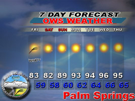
http://www.ontarioweatherservice.com/uwd.html
http://www.ontarioweatherservice.com/avery.html
Then we can compare temps, windspeeds, and precipitation here over the next few days:
http://www.wrh.noaa.gov/mesowest/getobe ... SC1&num=48
http://www.wrh.noaa.gov/forecast/MapCli ... -116.94167
And Kevin's forecast... Could you please be more specific so we have some numbers to compare? These are very vague compared to the NWS page:
http://www.ontarioweatherservice.com/uwd.html
http://www.ontarioweatherservice.com/avery.html
Then we can compare temps, windspeeds, and precipitation here over the next few days:
http://www.wrh.noaa.gov/mesowest/getobe ... SC1&num=48
-
Perry - Site Admin
- Posts: 1518
- Joined: Mon May 08, 2006 6:01 pm
- Location: Palm Springs, CA
![]() by GHOTI » Wed Sep 19, 2007 8:36 am
by GHOTI » Wed Sep 19, 2007 8:36 am
Actually, "ghoti" is a type of Turkish sweet bread made with dates, walnuts, and, the key ingredient, goji berries, which give the bread a distinctive color and a pleasant tartness, as well as its name. It's my favorite hiking snack. (:
- GHOTI
- Posts: 5
- Joined: Fri Sep 14, 2007 9:08 pm
Return to Outdoors-Related Topics
Who is online
Users browsing this forum: No registered users and 36 guests