


Hiking, Climbing, Camping, Trail Running, Snowshoeing...
![]() by scottmac » Sun Dec 16, 2012 9:38 pm
by scottmac » Sun Dec 16, 2012 9:38 pm
![]() by Hikin_Jim » Sun Dec 16, 2012 10:16 pm
by Hikin_Jim » Sun Dec 16, 2012 10:16 pm

![]() by Hikin_Jim » Mon Dec 17, 2012 10:35 am
by Hikin_Jim » Mon Dec 17, 2012 10:35 am
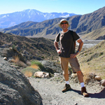
Ah! Interesting. I had never noticed that triangulation point before.scottmac wrote:The Nob is the Nob - here.
![]() by jfr » Mon Dec 17, 2012 8:09 pm
by jfr » Mon Dec 17, 2012 8:09 pm
![]() by scottmac » Mon Dec 17, 2012 11:27 pm
by scottmac » Mon Dec 17, 2012 11:27 pm
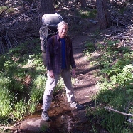
Did you hike up that long ridge in the second photo? It looks too easy to be true.

![]() by Ulysses » Tue Dec 18, 2012 9:44 am
by Ulysses » Tue Dec 18, 2012 9:44 am
![]() by Hikin_Jim » Thu Dec 20, 2012 7:07 pm
by Hikin_Jim » Thu Dec 20, 2012 7:07 pm
The Goat Trestles/Carrizo Gorge hike looks pretty darn cool.jfr wrote:I don't want to hijack this thread (which is already drifting) but there are some funny names for benchmarks way down south in Anza-Borrego, names like Moan, Groan, Gasp, Grunt, Puff, and Windy. I'm pretty sure that they were placed/created back in the early 1900's while they were surveying/building the "Impossible Railroad" through Carrizo Gorge (site of the famous Goat Canyon Trestle). If you've ever hiked down there, then you know that these spots were well-named.
![]() by Hikin_Jim » Thu Dec 20, 2012 7:10 pm
by Hikin_Jim » Thu Dec 20, 2012 7:10 pm
Supposedly, the old road shown on the map is easier travel when heading back to the Middle and South Forks confluence area. No personal experience although I have traveled on that road on the section that leads over to Mission Creek.Ulysses wrote:I went up there a couple weeks ago. Hiked to about where the South Fork splits from the Middle Fork. Interesting place. Mostly X-country travel after you leave the PCT at Red Dome. There were some nice long stretchs of hard packed silt in places along the creek, but in other places it was kind of slow going through the boulders. Plenty of good clear water flowing. Saw more deer and bear tracks than foot prints.
![]() by scottmac » Thu Dec 20, 2012 9:05 pm
by scottmac » Thu Dec 20, 2012 9:05 pm
Return to Outdoors-Related Topics
Users browsing this forum: No registered users and 1 guest