OtherHand, I met you on 12/18/2010. I was the hiker who came back up to look for the 2 hikers who went down the wrong ridge. The immediate descent to the east from Quail mountain heads down a face before splitting into two ridges. It is very easy to drop down the wrong one if you aren't acutely paying attention.
In Bill's case, there's a lot of questions.
1) He seemingly was set on going to Carey's castle. Based on time of the morning phone calls he made and his arrival to Juniper after 10am, did he have a chance to go in between? If not, why did he change his mind?
2) How confident are you that the bandana's is definitely his? In your comments, you don't think he made it to the top of Quail. Combining those two, are you confident that he took the route from Juniper to the bandana, but then veered north / west instead of turning northeast toward the summit?
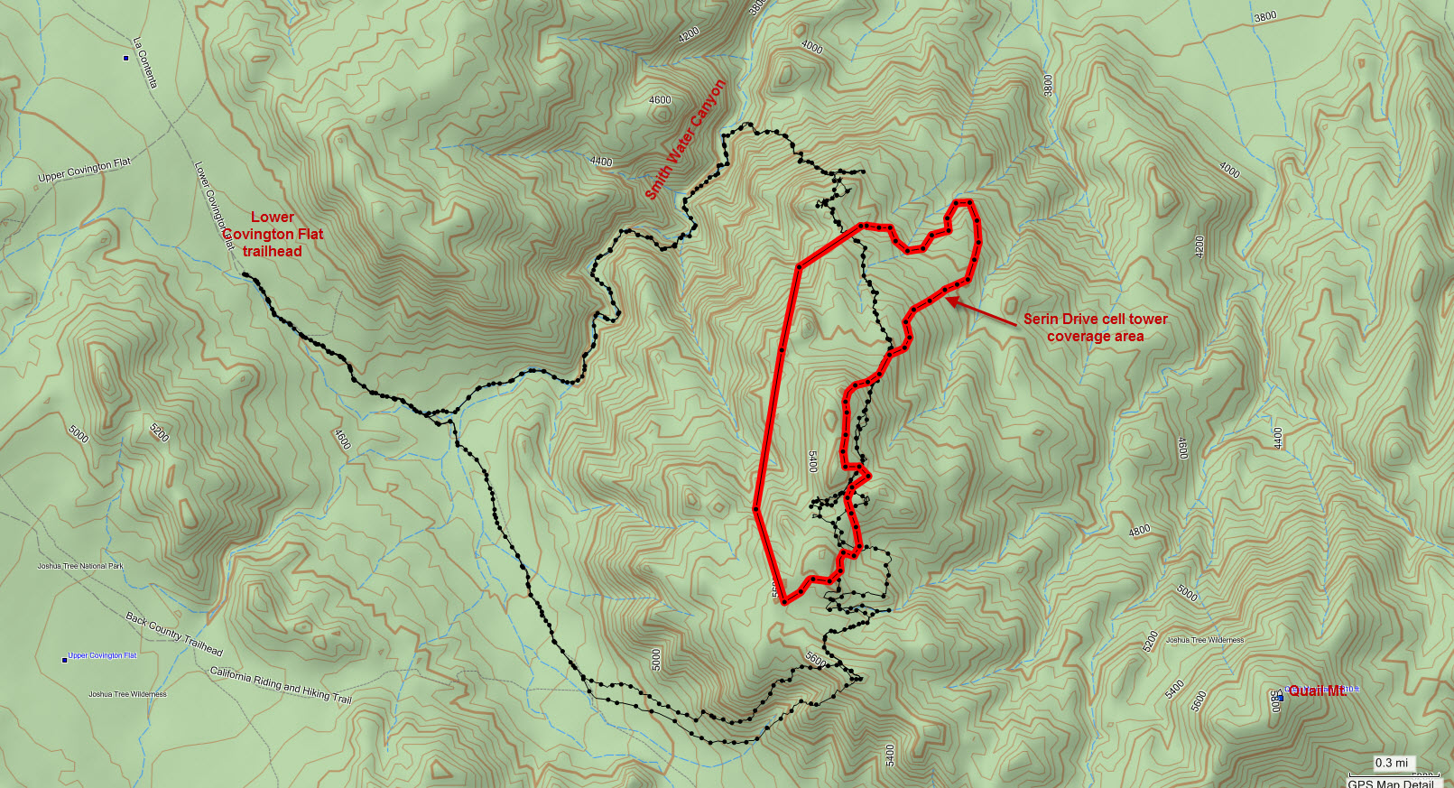
3) What's the potential error in the 10.6 mile ping radius? Is 10.6 miles the predicted distance the ping came from, or the maximum distance? There isn't much searching inside the ring - makes sense to search outside it given where he started, but that's a lot of area left.
In Bill's case, there's a lot of questions.
1) He seemingly was set on going to Carey's castle. Based on time of the morning phone calls he made and his arrival to Juniper after 10am, did he have a chance to go in between? If not, why did he change his mind?
2) How confident are you that the bandana's is definitely his? In your comments, you don't think he made it to the top of Quail. Combining those two, are you confident that he took the route from Juniper to the bandana, but then veered north / west instead of turning northeast toward the summit?
3) What's the potential error in the 10.6 mile ping radius? Is 10.6 miles the predicted distance the ping came from, or the maximum distance? There isn't much searching inside the ring - makes sense to search outside it given where he started, but that's a lot of area left.