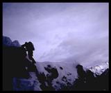
Frank, Keith and I headed for the San Gorgonio summit via the Vivian Creek Trail. Weather forecasts mentioned snow and high winds, but only the high winds materialized -- strong enough above 10000' to make standing difficult at times. Temperatures were comfortable -- mostly low 50s. The snow is disappearing rapidly. There was certainly no need for the ice axes and crampons we carried. There were only a few places where we had to cross modest snow fields. It appears that it'll all be gone soon.
Frank is recovering from a serious long term illness, so we anticipated a modest pace. As things turned out, he needed to turn around by the time we reached the intersection with the Dollar Lake trail. So, we ended up skipping the summit even though it was tantalizingly close. Some things are more important.
Pictures

Mt. San Jacinto Outdoor Recreation
Hiking, Climbing, Camping, Trail Running, Snowshoeing...
Vivian Creek 5-2-09
6 posts
• Page 1 of 1
Vivian Creek 5-2-09
![]() by AlanK » Sun May 03, 2009 9:41 am
by AlanK » Sun May 03, 2009 9:41 am
-

AlanK - Posts: 855
- Joined: Tue May 09, 2006 7:31 am
- Location: Glendale, CA
Re: Vivian Creek 5-2-09
![]() by EnFuego » Tue May 05, 2009 10:35 am
by EnFuego » Tue May 05, 2009 10:35 am
Thanks for the 411 on the Vivian Trail. I'm not sure exactly, but I plan to get up to this area sometime in the next 3 weeks.
And you're right, some things are more important. The mountain will always be there, your friends may not. Glad to see you turned around at the Dollar Lake trail intersection.
And you're right, some things are more important. The mountain will always be there, your friends may not. Glad to see you turned around at the Dollar Lake trail intersection.
If you're not living on the edge,
you're taking up too much room!
you're taking up too much room!
-
EnFuego - Posts: 74
- Joined: Tue Dec 16, 2008 11:27 am
- Location: Seal Beach, Ca
![]() by drndr » Thu May 07, 2009 11:42 am
by drndr » Thu May 07, 2009 11:42 am
Alan,
Nice pics, was looking at your map and noticed your GPS points split at one point. Did you come down a little different at one point on the trail. Trailblazed or are there two pretty cut ways to go. I'm still a rookie to Vivien and I was guessing the split at the top end looks to be around a very distinct ridge/saddle where you make a hard left. Just wondering why the split?
D
"Everywhere is walking distance if you have the time"
- drndr
- Posts: 236
- Joined: Mon Oct 15, 2007 11:10 am
- Location: Riverside
![]() by Hikin_Jim » Thu May 07, 2009 11:58 am
by Hikin_Jim » Thu May 07, 2009 11:58 am
Beautiful photos, Alan.
Backpacking stove reviews and information: Adventures In Stoving
Personal hiking blog: Hikin' Jim's Blog
Personal hiking blog: Hikin' Jim's Blog
-

Hikin_Jim - Posts: 4958
- Joined: Mon Oct 30, 2006 9:12 pm
- Location: Orange County, CA
![]() by asabat » Thu May 07, 2009 12:05 pm
by asabat » Thu May 07, 2009 12:05 pm
drndr wrote:looking at your map and noticed your GPS points split at one point. Did you come down a little different at one point on the trail. Trailblazed or are there two pretty cut ways to go.
Zooming in you can see the trail switchbacks to the south of both of those tracks. I'm guessing the trail is still buried in snow. In snow, everyone just goes straight up. The track on the ridge to the north would be a nice way to go.
- asabat
- Posts: 168
- Joined: Wed Apr 11, 2007 7:47 pm
![]() by AlanK » Sat May 09, 2009 12:09 pm
by AlanK » Sat May 09, 2009 12:09 pm
drndr wrote:Nice pics, was looking at your map and noticed your GPS points split at one point. Did you come down a little different at one point on the trail. Trailblazed or are there two pretty cut ways to go. I'm still a rookie to Vivien and I was guessing the split at the top end looks to be around a very distinct ridge/saddle where you make a hard left. Just wondering why the split?
Above High Creek, we stayed well to the left of the switchbacks, which seemed to still have a lot of snow. Those are my least favorite switchbacks anywhere -- way too long for what they accomplish. Any excuse to go another way is welcome in my book. But I believe that one can easily follow them at this point.
We came back in the gully below the ridge we followed up because one of my friends wanted the gentler downhill.
-
AlanK - Posts: 855
- Joined: Tue May 09, 2006 7:31 am
- Location: Glendale, CA
6 posts
• Page 1 of 1
Return to Outdoors-Related Topics
Who is online
Users browsing this forum: No registered users and 2 guests