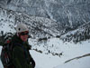
I am going on a hike up San Gorgonio next week, Tuesday, Wednesday and Thursday, and I have a few questions I hope someone can help me with.. I will be taking South Fork trail to Dollar Lake trail up to the summit.. my plans are hiking to Dollar Lake camp, spend the night, summit on Wenesday, camp again at Dollar Lake camp, and come back down Thursday...
#1- Dollar Lake and South Fork Meadows are my only two water sources up there? (besides melting snow)
#2- Has anyone been up the South Fork trail to Dollar Lake trail recently? What was the snowpack like?
#3- I know bear canisters are highly recommonded by the rangers, and its not a problem carrying one, I just wanted tpo know how many of you agree?
And hopefully the storm coming in next week won't be a big one...

Mt. San Jacinto Outdoor Recreation
Hiking, Climbing, Camping, Trail Running, Snowshoeing...
South Fork trail to Dollar Lake to Summit
7 posts
• Page 1 of 1
South Fork trail to Dollar Lake to Summit
![]() by NewbieZach » Fri Apr 03, 2009 10:04 am
by NewbieZach » Fri Apr 03, 2009 10:04 am
- NewbieZach
- Posts: 15
- Joined: Sun Mar 29, 2009 10:38 am
- Location: Riverside, CA
Re: South Fork trail to Dollar Lake to Summit
![]() by ajwoodzy » Fri Apr 03, 2009 11:46 pm
by ajwoodzy » Fri Apr 03, 2009 11:46 pm
NewbieZach wrote:I am going on a hike up San Gorgonio next week, Tuesday, Wednesday and Thursday, and I have a few questions I hope someone can help me with.. I will be taking South Fork trail to Dollar Lake trail up to the summit.. my plans are hiking to Dollar Lake camp, spend the night, summit on Wenesday, camp again at Dollar Lake camp, and come back down Thursday...
#1- Dollar Lake and South Fork Meadows are my only two water sources up there? (besides melting snow)
#2- Has anyone been up the South Fork trail to Dollar Lake trail recently? What was the snowpack like?
#3- I know bear canisters are highly recommonded by the rangers, and its not a problem carrying one, I just wanted tpo know how many of you agree?
And hopefully the storm coming in next week won't be a big one...
Sounds like a good trip
They are the most reliable ones at least...The actual South Fork Creek (its actually the South Fork of the Santa Ana River) runs along the trail for awhile-that should have alot of water in it. But with this time of year, I wouldn't be worried to much about water...there should be quite a few streams running all over the place. And if not, you can always melt snow. Dollar Lake should be full and may still be iced over. This is a helpful link http://www.howlingduck.com/cgi-local/di ... er_data.pl
I would just use bear bags...Its alot cheaper and easier (well maybe not the easier part).
-
ajwoodzy - Posts: 68
- Joined: Thu Jul 10, 2008 11:43 am
- Location: Temecula
![]() by NewbieZach » Sat Apr 04, 2009 6:03 am
by NewbieZach » Sat Apr 04, 2009 6:03 am
Alez,
Thank you so much for the information. It will help immensely. The website with water lvels/flow is pretty sweet, thank you!!
Thank you so much for the information. It will help immensely. The website with water lvels/flow is pretty sweet, thank you!!
- NewbieZach
- Posts: 15
- Joined: Sun Mar 29, 2009 10:38 am
- Location: Riverside, CA
![]() by zippetydude » Sat Apr 04, 2009 8:00 pm
by zippetydude » Sat Apr 04, 2009 8:00 pm
Unless you are on the Vivian Creek Trail, I think you have close to zero chance of a bear encounter.
As far as water, the little seasonal streams are usually down low, below the snow, so yes, your water sources are as you have said. However, they're only about 4 miles apart, and you won't be going all that much farther if you go for the peak, so I think water will be an easy problem to solve.
I've seen postings that people use almost as much water in the winter as they do in the summer . . . maybe for washing dishes, but not for drinking! When it's hot, I might go through just under a gallon on a day trip up to the peak and back. On a cold day, I use less than half that.
Melting it is pesky if you're away from your camp stove, but if you just do an up-and-back trip up to the peak from a camp at Dollar Lake, I doubt you'll have trouble. Besides, when you're hiking uphill and you stop and grab a mouthful of snow, it won't lower your body temp because of how much effort you're expending, so you can supplement your water supply effortlessly.
Hope you guys have a ton of fun. I'll be hitting the peak in the next few weeks - hope we see each other up there.
z
-

zippetydude - Posts: 2751
- Joined: Tue May 09, 2006 5:40 am
![]() by NewbieZach » Sun Apr 05, 2009 11:07 am
by NewbieZach » Sun Apr 05, 2009 11:07 am
Z-Dude,
Thank you also for the info!!! Hopefully we will run into each other sometime, we are always looking for someone to hike with.. What route are you planning on taking up to the peak?
Thank you also for the info!!! Hopefully we will run into each other sometime, we are always looking for someone to hike with.. What route are you planning on taking up to the peak?
- NewbieZach
- Posts: 15
- Joined: Sun Mar 29, 2009 10:38 am
- Location: Riverside, CA
Re: South Fork trail to Dollar Lake to Summit
![]() by Hikin_Jim » Thu Apr 09, 2009 7:55 pm
by Hikin_Jim » Thu Apr 09, 2009 7:55 pm
I thought it odd that there were no posts yet in 2009, so I checked with AstroZomby who maintains that page. He says everything's fine and that in 2008, no posts were made until late April.ajwoodzy wrote:...This is a helpful link http://www.howlingduck.com/cgi-local/di ... er_data.pl
Hopefully, people will start posting again soon.
Re bear canisters -- I probably would bring one for the Vivian Creek Trail. For the rest of the trails, I usually just bring an Ursack.
Backpacking stove reviews and information: Adventures In Stoving
Personal hiking blog: Hikin' Jim's Blog
Personal hiking blog: Hikin' Jim's Blog
-

Hikin_Jim - Posts: 4958
- Joined: Mon Oct 30, 2006 9:12 pm
- Location: Orange County, CA
7 posts
• Page 1 of 1
Return to Outdoors-Related Topics
Who is online
Users browsing this forum: No registered users and 2 guests