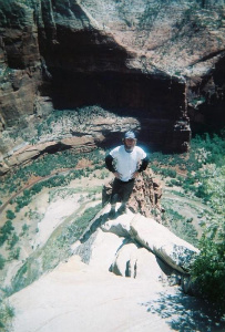
There are four standard routes up Baldy. I'm with Alan in that my favorite is the Northern approach, but I usually drive to the ridge top trailhead instead of going up Acorn Canyon from Wrightwood. I've listed the four basic routes below along with some map links with points plotted on them. You can also go totally XC up San Antonio Ridge and various other hard core routes, but I list only the four standard routes.
1. Devil's Backbone A = trailhead in Manker Flats. B = Baldy Notch which can be arived at either via the service road or the ski lift. C = the Devil's backbone. D = summit of Mt. San Antonio (A.K.A. Mt. Baldy).
2. Ski Hut Trail (A.K.A. Baldy Bowl Trail). A = trailhead in Manker Flats (same as route 1). B = point where you turn off of service road. C = the Sierra Club hut (sometimes open, sometimes locked). D = the ridge you traverse to from the hut. E = summit of Mt. San Antonio (A.K.A. Mt. Baldy).
3. Mt. Baldy Trail (A.K.A. Bear Flat Trail, A.K.A. "Baldy from the Village" trail, A.K.A. Bear Canyon Trail). A = Ranger Station in Baldy Village. B = Bear Flat. C = "hard scrabble" (loose rock) area of trail (along much of the ridge). D = summit of Mt. San Antonio (A.K.A. Mt. Baldy).
4. "Other Devil's Backbone" route (A.K.A. "Baldy from the North" route). A = "Overacheiver's" Trailhead in Wrightwood. Note that there are parking restrictions on Acorn Canyon and that you can't park at the end of the road. You can park in the vicinity of the intersection of Finch and Acorn Canyon. B = Point where the trail from Acorn Canyon summits Blue Ridge. C = Primary trailhead on Blue Ridge Road. Note that Blue Ridge Road is subject to seasonal closure. D = Pine Mtn. E = Dawson Peak. F = Dawson - Baldy Saddle, the "saddle of despair" (you lose a lot of elevation between Dawson and Baldy all of which must be regained in order to summit Baldy. You also have to re-climb Dawson on your way back. Though this is a shorter route than from the village, some consider this to be the most challenging of the four routes, particularly if you start from Wrightwood. The northern route is cross country (although there is a use trail) from Dawson - Baldy saddle to the summit. G = summit of Mt. San Antonio (A.K.A. Mt. Baldy).

Mt. San Jacinto Outdoor Recreation
Hiking, Climbing, Camping, Trail Running, Snowshoeing...
What is your favorite route up Mt. Baldy?
23 posts
• Page 2 of 3 • 1, 2, 3
![]() by Hikin_Jim » Wed Mar 04, 2009 6:22 pm
by Hikin_Jim » Wed Mar 04, 2009 6:22 pm
Backpacking stove reviews and information: Adventures In Stoving
Personal hiking blog: Hikin' Jim's Blog
Personal hiking blog: Hikin' Jim's Blog
-

Hikin_Jim - Posts: 4958
- Joined: Mon Oct 30, 2006 9:12 pm
- Location: Orange County, CA
![]() by mark2812 » Thu Mar 05, 2009 1:29 pm
by mark2812 » Thu Mar 05, 2009 1:29 pm
Another route to the summit is via Register Ridge, which branches off the Manker Flats (Ski Hut) trail. Just past the register box on the trail, you take a right hand turn up the ridge...My pal and I did it last Sunday, there is snow on the way up and we def used our crampons, snow shoes and ice axes,,,It was my first trip on this route, and I loved it.
Once you get toweard the top - you hit the devils backbone trail , then take a left up to the summit of Baldy. We really had a blast, though we did take our times and we did have all of the necessary gear, which we definitely used.
Once you get toweard the top - you hit the devils backbone trail , then take a left up to the summit of Baldy. We really had a blast, though we did take our times and we did have all of the necessary gear, which we definitely used.
- mark2812
- Posts: 25
- Joined: Mon Sep 18, 2006 4:23 pm
![]() by EnFuego » Fri Mar 06, 2009 2:07 pm
by EnFuego » Fri Mar 06, 2009 2:07 pm
stobbart wrote:Thanks for the replies. I think I will be trying this bear flat trail sometime in April.
Stobbart - if you still want some company, I'll join ya. I've done most of the other trails, but not Bear Flat. County me in. PM me to get contact info.
If you're not living on the edge,
you're taking up too much room!
you're taking up too much room!
-
EnFuego - Posts: 74
- Joined: Tue Dec 16, 2008 11:27 am
- Location: Seal Beach, Ca
![]() by FIGHT ON » Fri Mar 06, 2009 3:58 pm
by FIGHT ON » Fri Mar 06, 2009 3:58 pm
When enough of this snow is gone I have plans to go from the west. Through Iron Mountain across the San Antonio Ridge. Butterflies!!!
A leg of the "Rick Kent Special" iyw.
I have a few friends that will join me that have crossed it so at least I won't die all alone! Can't wait!
A leg of the "Rick Kent Special" iyw.
I have a few friends that will join me that have crossed it so at least I won't die all alone! Can't wait!
-

FIGHT ON - Posts: 971
- Joined: Fri Feb 08, 2008 1:23 pm
- Location: Trousdale Parkway
YOU?
![]() by FIGHT ON » Sat Mar 07, 2009 6:30 am
by FIGHT ON » Sat Mar 07, 2009 6:30 am
Zé wrote:Fight On, what's your pace gonna be like for the SA ridge? I might join you if you don't mind.
My pace? Slower than yours!
Zé wrote:How about we do manker flats-baldy-iron-baldy-manker flats?
YOU? AFTER ALL THOSE MEAN THINGS YOU SAID ABOUT ME?
You can go, It would be fun! But, You just can't see me.
I mainly want to pass the gun sight notch part. I have this mental block of that spot and wanna break it. Wanna link the hikes on both sides of the ridge! would be sooo cool!
After reading Kent's crazy day hike from Heaton Flats I also wanna experience in part what it took to do that. (no way am I gonna do that whole hike) but it would be fun to get to the top of Baldy, be dead tired, then Look, (NOT HIKE) down toward Manker Flats. and IMAGINE going all the way down and back up AGAIN!.
To do Kent's entire hike would be, over the top!
Actually depending how scary it is to pass the notch (that last part of that ridge on the west side of Las Flores Canyon was my limit) I may just go down to Manker from there or to the Village but it would be so cool to make it back to Heaton! That would be my plan. when the snow is gone.
-
FIGHT ON - Posts: 971
- Joined: Fri Feb 08, 2008 1:23 pm
- Location: Trousdale Parkway
![]() by Blooty » Wed Mar 11, 2009 7:58 pm
by Blooty » Wed Mar 11, 2009 7:58 pm
I like Ice House to the Devils Backbone to the summit, down through Bear Meadow, lunch at the Baldy Lodge, then bumm a ride to Ice House.
No man can climb out beyond the limitations of his own character.
-- John Morley
-- John Morley
-

Blooty - Posts: 125
- Joined: Wed Aug 06, 2008 1:03 pm
23 posts
• Page 2 of 3 • 1, 2, 3
Return to Outdoors-Related Topics
Who is online
Users browsing this forum: No registered users and 3 guests