


I was a little worried about water, and rightfully so. Here's Santa Anita Canyon at the first crossing above the falls. Bone dry.

Basically, there are major stretches of stream bed that are completely dry, typically sandy or gravelly sections. In those spots where there is exposed bedrock, there is flowing water. Not a lot, but there is flow.

After about four miles, one reaches Spruce Grove, which is actually a very nice spot, and there's water right by the camp. Water flow is actually fairly decent at Spruce Grove.

The trail is in decent shape for the most part, but there is one big tree (45" diameter?) down over the trail shortly before "Halfway Rest" as one climbs the Sturtevant Trail towards Mt. Wilson.

Anyone know anyone on a trail crew that works this area? May be Dave L? Position per my GPS is:
34.2263, -118.0480
(11S 0403471E 3787748N)
Speaking of Halfway Rest, didn't there used to be a bench there?
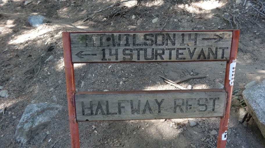
No bench now, but that may just be my poor memory that suggests that there ever was one.
Of course if one persists, one does eventually reach the top. The little viewing area off to the right (ENE) of the trail is worth visiting.

I think the above viewpoint must be the "Echo Rock" referred to by this trailhead sign atop Mt Wilson.

On my my GPS track of the Chantry Flat - Mount Wilson Loop, the viewpoint is represented by the small red binoculars symbol.
The spigots atop Mt. Wilson are dispensing their liquid gold, but there is a warning sign.

Apparently they haven't done all the required water quality testing. That's not necessarily an indication of a problem, but drink at your own risk. I drank some with no apparent ill effects.
Finally, we reached the pavilion. I had plenty of food, so I didn't patronize the Cosmic Cafe. This time.

Now, notice the bear can on my lap. No, that isn't just idle training weight. There is a "problem bear" in the area who has been raiding people's food. Apparently he's on to the whole bear bag thing according to some Boy Scouts we had talked to who had spent the night at Hoegees.
Per hikers we talked to, the creek is dry at Hoegees, but supposedly there is water further up Winter Creek per a cabin owner I spoke to. That's where he gets his water, so I imagine he knows what he's talking about.
Having enjoyed Mt. Wilson's charm, we began our decent. The trailhead begins on the west side of the big parking lot west of the pavilion.

The trailhead is marked by a sign, but the trail is some 30 or so feet north of the sign.

Winding our way down the mountain, we returned to Chantry Flats, where we enjoyed celebratory snacks on "the deck" of the Adams Pack Station. I always try to stop by and throw them some business. And it is fun to sit out on the deck.
OTHER WATER INFO
The blue dots on my my GPS track of the Chantry Flat - Mount Wilson Loop are GPS waypoints that represent water.
Waypoint 24 is a small spring on the Winter Creek Trail. It's flowing, but just barely.

Waypoint 25 is San Olene Canyon. No real flow, but there was a smallest of trickles and a small pool (really small) just above the trail.

HJ

