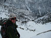
Hi everyone. I just went up Saturday. The snow is just patchy until just before Dry Lake, then is pretty much solid up to about 11000'. It's consolidated but not icy right now, and getting to the peak was easy without snowshoes or crampons, just trail runners and hiking poles.
Of course, the trail is invisible above Dry Lake, so the direct route up the ravine, then over to the eastern-most chute and onto the ridge proved the simplest route. It looks so easy from Dry Lake, but every time I do it, I suffer. It's very steep for a very long time, and I have to stop and gasp for air on a regular basis. Makes me appreciate the trail!
z

Mt. San Jacinto Outdoor Recreation
Hiking, Climbing, Camping, Trail Running, Snowshoeing...
TR of trail conditions South Fork to San Gorgonio peak
6 posts
• Page 1 of 1
TR of trail conditions South Fork to San Gorgonio peak
![]() by zippetydude » Sun Apr 19, 2009 9:37 am
by zippetydude » Sun Apr 19, 2009 9:37 am
-

zippetydude - Posts: 2751
- Joined: Tue May 09, 2006 5:40 am
Re: TR of trail conditions South Fork to San Gorgonio peak
![]() by FIGHT ON » Sun Apr 19, 2009 10:41 am
by FIGHT ON » Sun Apr 19, 2009 10:41 am
zippetydude wrote:It's very steep for a very long time, and I have to stop and gasp for air on a regular basis.
What did you expect? If that route was easy or started and finished at a lower elevation, everybody would have been there with you.
At what elevation do you notice a difference. (You don't gasp and stop as much like that on Skyline do you?)
-

FIGHT ON - Posts: 971
- Joined: Fri Feb 08, 2008 1:23 pm
- Location: Trousdale Parkway
![]() by zippetydude » Sun Apr 19, 2009 7:32 pm
by zippetydude » Sun Apr 19, 2009 7:32 pm
No. Skyline has ample oxygen.
You had an interesting observation and an interesting question.
You mentioned that otherwise everyone would be out there with me. I notice this myself - it never ceases to amaze me that there are millions of people within, say, 50 to 100 miles, and I find myself alone at the peak most weekends throughout the spring, summer and fall. (In the winter, I find myself alone when I turn around at 9000 or 10,000'!) Where is everybody? It's hard, but not that hard. Do the mountains hold a strong attraction for just a few crazy people (like the ones on this board)?
About altitude, I never notice it before 10k. After that, it depends on pace. When I'm doing a summer trail run on San G, I won't really notice it at all unless I'm trying for a quick time to the top. In the winter, going up the chute, I definitely notice it around 10,500 to 11,000. I get dizzy, even when I'm breathing fast.
On Whitney, I don't notice it til Trail Crest, and then it's like I've been doing shots with Tequila. I'll be running along, (say, near the Windows) and think, "That's a big rock there next to the trail up ahead. Better not hit that." I don't normally have thoughts like that, so that's my first clue. Then, having created this clever plan of avoidance, I'll slam into it with my shoulder as I pass, and think, "What the heck is wrong with me?!" It's kinda funny, it's make a great video if someone could lie in wait and I didn't know they were filming. I can hear them now, "Didn't you see that big rock? Man, you ran right into it!"
On the way down, oxygen does not seem to be any issue at all.
How about you?
z
-
zippetydude - Posts: 2751
- Joined: Tue May 09, 2006 5:40 am
![]() by FIGHT ON » Sun Apr 19, 2009 8:30 pm
by FIGHT ON » Sun Apr 19, 2009 8:30 pm
I've only been dizzy twice. Once at around 11 going up gorgonio and along the last long switchback before trail crest. But I get really winded all the time no matter what hike I do. I'm a proud bonker remember?
As far as crazy goes ya you are but smart and fit enough to know how far you can go and when to go etc. to keep safe. It's cool that you do that. I would take hiking up and down the tallest peak in so cal on a beautiful day w/o seeing anyone as a sign of something special. Hey wait? did you get a permit??
oh noooooooooooooooooooooooooooooooooooooooooooo i gotta go now.
-
FIGHT ON - Posts: 971
- Joined: Fri Feb 08, 2008 1:23 pm
- Location: Trousdale Parkway
![]() by zippetydude » Mon Apr 20, 2009 12:02 pm
by zippetydude » Mon Apr 20, 2009 12:02 pm
Of course I got a permit! Mill Creek Ranger Station uses the same intelligent system that they use up at Long Valley, so I can self-issue a permit for any trail that's open. If there are not permits for the trail I was planning on, that tells me that trail is already at capacity (Vivian often is during the summer) so I just pick one that's available and do that trail instead. Smart system.
z
z
-
zippetydude - Posts: 2751
- Joined: Tue May 09, 2006 5:40 am
Re: TR of trail conditions South Fork to San Gorgonio peak
![]() by ajwoodzy » Tue Apr 21, 2009 10:47 pm
by ajwoodzy » Tue Apr 21, 2009 10:47 pm
zippetydude wrote:Hi everyone. I just went up Saturday. The snow is just patchy until just before Dry Lake, then is pretty much solid up to about 11000'. It's consolidated but not icy right now, and getting to the peak was easy without snowshoes or crampons, just trail runners and hiking poles.
Of course, the trail is invisible above Dry Lake, so the direct route up the ravine, then over to the eastern-most chute and onto the ridge proved the simplest route. It looks so easy from Dry Lake, but every time I do it, I suffer. It's very steep for a very long time, and I have to stop and gasp for air on a regular basis. Makes me appreciate the trail!
z
I went up Firday....and did Charlton, Little Charlton, Jepson and San Gorgonio.....the snow is disappearing fast
-
ajwoodzy - Posts: 68
- Joined: Thu Jul 10, 2008 11:43 am
- Location: Temecula
6 posts
• Page 1 of 1
Return to Outdoors-Related Topics
Who is online
Users browsing this forum: Google [Bot] and 2 guests