Deer Springs, Devil's Slide Loop

General Palm Springs area.

Deer Springs, Devil's Slide Loop

Postby Ellen » Thu Jun 23, 2011 11:04 am

Howdy All :)

Met CalicoKat Jim and Norma in Idyllwild on Mon June 20 and arranged the car shuttle. We headed up Deer Springs -- my first time on the bottom part of this trail. I warned Jim and Norma about Bug Hades and they came armed with DEET. When we reached the Strawberry junction to take a short fuel break, we were enveloped in clouds of gnats. Jim applied DEET while walking in circles and Norma and I did the same while spinning, swinging and screaming :lol:

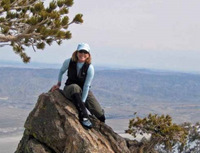
The streams on Deer Springs are just heavenly right now. For our next fuel break at the stream crossing before Little Round Valley, I wore a wet bandana over my face to ward off the gnats. Proceeded up the Never Ending Switchbacks :? up to the junction and took a quick breather before scrambling up the rocks. We had the summit to ourselves and enjoyed a leisurely lunch. It was beautiful on top -- slight breeze and no bugs 8) Headed down and bagged Miller before proceeding to Wellman's divide and cienega.

When we reached the Strawberry junction, we spied two empty water bottles beneath the wilderness boundary sign :evil: Packed them out, as well as an orange peel. By the time we reached Saddle Junction, both Norma and I had barking dogs. Although I love Devil's Slide, sometime it seems to take forever to get down (reminds me of the descent down the switchbacks from Lone Pine lake to Whitney Portal). Finally, we arrived at Jim's truck. I enjoyed a great meal at the Mexican restaurant across from the ranger station before heading home. Another wonderful day in the wilderness with friends.

Miles of smiles,
Ellen

Ellen
 
Posts: 2578
Joined: Thu Mar 29, 2007 9:38 am
Location: Riverside, CA

Postby ortegajenkins » Thu Jun 23, 2011 3:00 pm

Hey Ellen,

Are there any spots to fill up with water between Strawberry Junction and Little Round Valley? I am heading out for roughly 30 miles on Saturday and wanted to identify a few fill up locations. The map shows a seasonal creek near Little Round Valley. How is the water flow?

Thanks, Happy Trails
Eric
ortegajenkins
 
Posts: 2
Joined: Thu Jun 23, 2011 2:49 pm

Postby Hikin_Jim » Thu Jun 23, 2011 3:01 pm

ortegajenkins wrote:Hey Ellen,

Are there any spots to fill up with water between Strawberry Junction and Little Round Valley? I am heading out for roughly 30 miles on Saturday and wanted to identify a few fill up locations. The map shows a seasonal creek near Little Round Valley. How is the water flow?

Thanks, Happy Trails
Eric
Ellen can post more, but there should be a lot of water up there right now. We've had a good year, water wise.

You should be able to find water in the Deer Springs area, in several side streams past the junction of the PCT and the trail to LRV, as well as where the trail crosses the stream en route to LRV. In fact, I bet the stream in LRV is flowing well enough to collect water from.

HJ
Backpacking stove reviews and information:  Adventures In Stoving
Personal hiking blog: Hikin' Jim's Blog
User avatar
Hikin_Jim
 
Posts: 4958
Joined: Mon Oct 30, 2006 9:12 pm
Location: Orange County, CA

Postby ortegajenkins » Thu Jun 23, 2011 3:06 pm

Much appreciated!
ortegajenkins
 
Posts: 2
Joined: Thu Jun 23, 2011 2:49 pm

Re: Deer Springs, Devil's Slide Loop

Postby Hikin_Jim » Thu Jun 23, 2011 3:11 pm

Ellen wrote: Norma and I did the same while spinning, swinging and screaming :lol:
Oh, for a video cam! :lol:

HJ
Backpacking stove reviews and information:  Adventures In Stoving
Personal hiking blog: Hikin' Jim's Blog
User avatar
Hikin_Jim
 
Posts: 4958
Joined: Mon Oct 30, 2006 9:12 pm
Location: Orange County, CA

Postby Ellen » Thu Jun 23, 2011 5:37 pm

Howdy Eric :)

As HJ pointed out, you have numerous choices for water on the Deer Springs trail between the Strawberry junction and Little Round Valley (LRV) :D Personally, I wouldn't even bother to filter or treat -- the streams are flowing that well -- even the stream at the entrance to LRV.

If you don't mind me asking, what is the route for your 30 mile hike?

Miles of smiles,
Ellen
Ellen
 
Posts: 2578
Joined: Thu Mar 29, 2007 9:38 am
Location: Riverside, CA

Re: Deer Springs, Devil's Slide Loop

Postby Ellen » Thu Jun 23, 2011 5:39 pm

Howdy HJ :)

I commented on that very point as we were applying the DEET -- it had to be amusing to watch.

Hikin_Jim wrote: Oh, for a video cam! :lol: HJ


Miles of smiles,
Ellen
Ellen
 
Posts: 2578
Joined: Thu Mar 29, 2007 9:38 am
Location: Riverside, CA

Postby NormaR » Fri Jun 24, 2011 4:34 pm

yep, the gnats on the Deer Springs Trail were certainly gnasty and made for a rather unpleasant and gnearly unbearable ascent, but the three of us deet laden hikin' fools persevered and were rewarded with a very gnice day hike in the SJW.

turns out i had never (i'll stop the silent g's here) hiked the Deer Springs Trail before, i had never descended the Devil's Slide Trail either, nor had i seen the beauty of Wellman's Cienaga, tagged Miller Peak and most surprisingly i had never hiked Mount San Jacinto in the summer. :shock: as we descended the south slope of San J on the summer trail i was in awe of the beautiful alpine green view of conifers, chinauqpin and manzanita. it was only then i realized i have only done snow hikes of San J and had never seen this slope in anything other that a white coat. i didn't even know that there was a summer trail since we always make the direct shot up the slope to Miller saddle.

so the gnasty gnat filled beginning of this 18.5 mile loop ended up being a quite gnice alpine hike in the summertime beauty of the San Jacinto Wilderness. it's about time! :D

Three hikin' fools at 10,834
Image

A rare sighting of the elusive San J Longhorn
Image

My first time seeing the summer trail and this view in green
Image

Cascading springs at Wellman's Cienaga
Image

Cooling our soles on the wet trail south WC
Image

Corn Lily
Image

Finishing out the hike with a view of one of my favorite places to rock climb. Lily Rock aka Tahquitz and Tahquitz Peak
Image

Tahquitz Peak fire lookout
Image

Lily Rock
Image

What a beautiful day in the SJW! :D
Image

rest of my pix are here:
https://picasaweb.google.com/ryan.norma ... 5MileLoop#
User avatar
NormaR
 
Posts: 216
Joined: Thu Dec 13, 2007 5:22 pm
Location: Ventura County, CA

Postby tinaballina » Fri Jun 24, 2011 4:39 pm

Great pics!
User avatar
tinaballina
 
Posts: 1107
Joined: Tue Jan 08, 2008 11:21 am
Location: Riverside

Postby Ellen » Mon Jun 27, 2011 8:46 am

Howdy Norma,

It was absolutely delightful to hike with you and Jim -- the company made the bugs bearable.

Note to self -- never pose like a longhorn again :lol:

Miles of smiles,
Ellen
Ellen
 
Posts: 2578
Joined: Thu Mar 29, 2007 9:38 am
Location: Riverside, CA

Next

Return to Mt. San Jacinto & Santa Rosa Mountains

Who is online

Users browsing this forum: Baidu [Spider] and 6 guests