TR: Camping in Tamarack Valley Thursday May 26, 2011

General Palm Springs area.

TR: Camping in Tamarack Valley Thursday May 26, 2011

Postby jfr » Mon May 30, 2011 4:21 pm

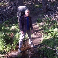
Three of us backpacked to Tamarack Valley via the Tram last Thursday, May 26th. The forecast was for wind, but it wasn't bad down in the trees. We set up camp, then climbed Cornell Peak, which had some crunchy snow on the exposed north side. On Friday we day-hiked in the early morning and bagged both Miller and SJ peaks. The main trail to the peak was clear of snow along the exposed east-facing slope but there was plenty under the trees where it jogs in under the Jean Peak saddle and also down the hill toward Round Valley from Wellman Divide. Some of the less-experienced day-hikers were having route-finding trouble in these two areas. The snow softened and the water began to flow everywhere as the day went by. I've never seen the mountain so wet! We did a lot of off-trail travel, through the [sensitive area] so my feet got a bit soggy, but I didn't care. It was great to be back on San Jacinto, and I'm glad the snow is finally melting! All of you snow-lovers will have to wait until next winter for your icy fix. :)

Overly descriptive Trip Report and, as always, far too many photos and videos in the Slideshow.
User avatar
jfr
 
Posts: 145
Joined: Sun Jul 12, 2009 11:10 am
Location: 32N 117W

Postby Hikin_Jim » Mon May 30, 2011 6:46 pm

Nice photos! Love the one with the guy silhouetted.

I almost always take the Sid Davis Drainage up to Tam Valley. It's steeper, but if you're headed to Tam, it's a lot faster. I wouldn't exactly call it a trail though.

I also almost never head to Wellman Divide anymore unless I just want to enjoy the view. The trail from Tam Valley makes so much more sense.

And I rarely take the final switchback any more en route to San J Peak. I just head up Miller Ridge. In the summer, you can still find pieces of the old trail. They've done several diversions (Wellman Divide and that final major switchback) to make it harder to get to the peak so as to keep the traffic down. It's about 12 miles RT from the tram going to Wellman Divide and doing the final switchback. It's about 9 miles RT from the tram going up the Sid Davis Drainage, then taking the old trail from Tam Valley, using the regular trail to go to Miller Saddle, and then taking Miller Ridge up to the summit. You do miss the summit hut though taking that route.

HJ
Backpacking stove reviews and information:  Adventures In Stoving
Personal hiking blog: Hikin' Jim's Blog
User avatar
Hikin_Jim
 
Posts: 4958
Joined: Mon Oct 30, 2006 9:12 pm
Location: Orange County, CA

Postby lesper4 » Fri Jun 03, 2011 10:11 am

Do you have a map of said route? It sounds like a good option after skyline.
lesper4
 
Posts: 117
Joined: Thu Sep 16, 2010 10:12 am
Location: S Cali Fontana

Postby Hikin_Jim » Fri Jun 03, 2011 10:32 am

lesper4 wrote:Do you have a map of said route? It sounds like a good option after skyline.
It is a good option for turning a Skyline into a C2C. The overall route up the Sid Davis route, through Tam, up the old trail from Tam, to Miller Saddle, and then direct to the peak is the shortest, most direct route.

Basically, the Sid Davis route stays in the drainage when the main trail to Round Valley crosses the creek (Point "A"). If you cross the creek, you're off route. Stay in the drainage through the steep area ("B"). When you start flattening out, keep right (approx. "C") and start diverging from the stream bed. You should go right through the eastern most camp sites ("E"). As you go through the Tam camp sites, you need to bend even further right heading towards "F." Meet the old trail near the bend in the first switch back ("G"). The nav from "C" to "G" is a little tricky, but not undoable if you're familiar with map and compass work. The old trail is pretty followable through point "H". After "H", it's harder to follow unless you really know what to look for. Usually, I just start heading up the drainage as shown by points "I" through "L". Meet the main trail coming from Wellman Divide at "L". Take the main trail to Miller Saddle ("M"). Miller Saddle is just a bit farther than the end of the great switch back. When the trail switches back, you keep going straight a bit more so that you'll get into the saddle. From the saddle, head straight up the east ridge of San Jac. There is an old trail if you've got sharp eyes. Finally, hit the peak at "P".

That's it. Shave off about 1.5 mi each way.

HJ
Backpacking stove reviews and information:  Adventures In Stoving
Personal hiking blog: Hikin' Jim's Blog
User avatar
Hikin_Jim
 
Posts: 4958
Joined: Mon Oct 30, 2006 9:12 pm
Location: Orange County, CA


Return to Mt. San Jacinto & Santa Rosa Mountains

Who is online

Users browsing this forum: No registered users and 9 guests