I'll be doing C2C this Saturday, 5/5 and starting really early...again the only concern I have is the route-finding on the very steep part just before Long Valley (this is just what I have heard on the forum). Or is it not that difficult?
Does anyone have any pictures of this section? Or any photos for that matter? If so, can you please post a link to them in this thread? Otherwise my email is thephotomatt@gmail.com.
Oh, and does anyone know if there is much ice/snow up to the summit right now?
Thanks,
Matt

Mt. San Jacinto Outdoor Recreation
Hiking, Climbing, Camping, Trail Running, Snowshoeing...
C2C question
4 posts
• Page 1 of 1
C2C question
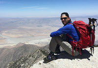
![]() by mattytreks » Wed May 02, 2007 8:36 am
by mattytreks » Wed May 02, 2007 8:36 am
-
mattytreks - Posts: 104
- Joined: Sun Apr 01, 2007 12:25 pm
- Location: San Diego, CA
![]() by magikwalt » Wed May 02, 2007 10:25 am
by magikwalt » Wed May 02, 2007 10:25 am
The route finding shouldn't be that difficult right now. Besides shaping up to be a busy Saturday with about 5 different parties on the trail, the orange dot clean up hasn't gotten to the section you are worried about. That section is probably about 400ft of elevation gain where the trail goes faint in places. Irritating but not threatening.
I went to the summit last Sunday and snow remained in one or two ten foot sections under the trees below 10,000ft. Nothing after that. Last night I caught the 6:00pm tram up and went out to Wellmans Divide for the sunset. There was no snow at all and only one damp spot. We do have high wind warnings up for the next couple days but no moisture is expect between now and the weekend.
No snow on the trail at all so its lite weight hikers on the feet and no winter gear required.
-

magikwalt - Posts: 766
- Joined: Tue Nov 14, 2006 3:18 pm
- Location: Palm Springs
![]() by mattytreks » Wed May 02, 2007 10:43 am
by mattytreks » Wed May 02, 2007 10:43 am
Wow Magikwalt, sounds like there should be a number of people on the trail Saturday...since I'm a first time C2C'er, I will appreciate seeing other people on the trail for some good company and to make sure I dont take a wrong turn and end up in Tijuana 
Cant wait!
Cant wait!
-
mattytreks - Posts: 104
- Joined: Sun Apr 01, 2007 12:25 pm
- Location: San Diego, CA
route finding
![]() by guest » Wed May 02, 2007 11:05 am
by guest » Wed May 02, 2007 11:05 am
Hi,
The trail is not hard to follow, if you pay attention. There are sections where people have made "chickenshit" trails,(10ft. shortcuts) ones that don't do anything but make it look bad.
Once in the trees, you'll be heading up what we call the Rocky Ridge, it heads towards the top of the mountain (west).
After a couple hundred vetical (approx.) of this, you'll head into the Traverse, where the trail heads more north, across the face of the mt.).
Trail has a couple 30 yd downhills, then you'll hit a few rocky drainages, which you have to pay attention, but there are a few ducks & spots.
Only go up 10 ft. or less on these,(if at all) then back to a traverse (NW) heading again.
Once you hit the big, huge granite monolith (Coffman's Crag, 20-30 mins from Long Valley), the trail is a series of 20-30 ft. long switchbacks that rise steeply, but there many to choose from, as people attempt to stay off the snow, when it's there, and others are too tired to pay attention & wonder all over he place, but just keep heading up, you'll find your way.
If you wander too far left or right, you'll know it, it gets even steeper.
(I'll probably be on the trail Sat, with an approx. Long Valley summit of 10:30, I go hard & don't stop).
ss
- guest
- Posts: 782
- Joined: Fri Oct 27, 2006 3:27 pm
4 posts
• Page 1 of 1
Return to Mt. San Jacinto & Santa Rosa Mountains
Who is online
Users browsing this forum: No registered users and 77 guests