The climb to tram promise I made myself never left me, which brought my brother in law Art and I to the museum parking lot on the morning of October 16, 2010. Following recommendations to the letter we hit the trail at 4:02am. We had encountered about 10 other people in the parking lot at the same time, so it was fun to see the morning unfold like so many trip reports I had read. (I introduced myself to many but found none of them were regulars from this forum. I think SDs C2C2C the weekend before had occupied most of the forum members so this was an off weekend for most people here)
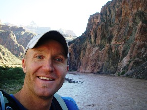
And we were off. The steepness was there, again, just like other trip reports. I immediately was in love with the track on my GPS as it had to guide me several times early on. (Thanks for the tip Norris!) I also renewed my love affair with my hiking poles on the steep grade, which were only a recent purchase. One person gave me advice in the parking lot and it proved to be great that morning and through the majority of the hike. He said when you are given a choice, go right. I found this to be true well more than 9 out of 10 times. In my excitement at the parking lot I forgot to get pictures but 20 minutes in we soon noticed someone moving fast our way. He stopped and we found he was from Long Beach, but originally from Holland, so he unofficially was named LongBeachHolland by my hiking partner. While he took our pictures I noticed he was a poster child for minimalism with only a waistpack, while we were poster children for over prepared, weighted down skyline noobs
 . He soon zoomed on up, while we continued our less zoomy pace.
Picnic tables – check !
Long valley rock – check !
No water rock – check !
Scary, but very accurate warning sign – check !
Again, after almost a year of reading trip reports it was a bit surreal to watch all these things unfold in front of me. Especially the way they would suddenly enter my field of view because of the window effect of the headlamp.
The goal of course was to get to get as high as possible before the sun came out because I was worried about the higher heat. Personally I was loving the dark, but my brother in law was less then enthused about it. The sun came up but we were protected by a ridgeline for awhile. Once we came out of that ridgeline the sun was well above the horizon and I started into my “cant move while its hot period”. From somewhere around 3700 feet to around 5500 I was pretty miserable. Direct sunlight, heat, humidity, no shade and no breeze just makes me go fetal. I know lots of Palm Springs locals and they were all complaining about the higher than average temperatures, so I should have adjusted with an early leave time. I relied on my brother in law to remind me to keep our electrolyte routine going. I was never at risk for collapsing or anything dramatic like that, but I was at risk for using too much water, and considering I knew the heat problem should have brought more. I just kept pushing ahead, quietly and very slowly, as I didn’t want to waste energy and water talking which I think it concerned Art, sorry bro.
I hit Florians 2 hour mark at 4hs20mins

Flatrock was a funny sight as I don’t remember ever seeing a picture of it, but I knew it as soon as I saw it. I mean, it’s a big, flat rock ! I also had the statement “the hike doesn’t start until after flatrock” stuck in my head. But for me flatrock was very welcome as we picked up a breeze and I could see trees ahead – shade !
It was steep, but I was getting my energy back, or perhaps I was stealing it from my hiking partner. He now started pushing up against a wall. As my bar went up, his went down, like we were sharing some central energy reserve and it was my turn to suck up the reserves. I was watching my heart rate monitor carefully and pushing right up against my limit, but felt like I had lots more energy. And I enjoyed the steep grade as I could just lean forward into my hiking poles and involve my arms more in the hike. This also became the big gel experimental period as I eat very little when I hike, but I normally don’t hike this long. My hiking partner was getting real boosts out of varied gels and I was just eating peanut butter and chocolate gels as I take any excuse I can to eat peanut butter.
And before we knew it we were hiking in……Seattle! Trees, lots of them, maybe a bit redder than Seattle, but certainly not Palm Springs anymore. I recognized the “ice chutes” immediately, although sans ice I could see how they would be quite scary in the winter. I tried to visualize how quickly I could get an ice axe into the snow before I hit something sharp, and it didn’t look good so I would need work before doing this in the winter. Looking forward for Coffmans Crag I was distracted by a rather pleasant blue as somebody had created a Christmas tree. At this point we noticed someone ‘falling’ forward down the trail, in a near half run. It turns out it was LongbeachHolland (our new official photographer) making his ‘run’ down skyline. Not surprisingly, he had summited and was on his way back down. He explained that since the tram started charging hikers he now protests them and just goes back down skyline. I told him I would gladly take out a second mortgate to pay for the tram ride down as there was no way in hell I was walking back down skyline

He took our pictures again and then I watched in awe for a moment as he skipped, jogged and skidded down the trail
Cofmans Crag was next and it was stunning and demanded my attention. No picture on the web did it justice and I just had to marvel at it for awhile. So the Skyline rule book said straight up at Coffmans Crag, and up we went. I knew we were close and Art called out more hikers coming down. I noted the air-jordan something or other shoes on them and said no, its people from the tram. Another few feet and we were in Long Valley !
More surrealism in Long Valley for me, since I played in Long Valley for years in the winter and summer, with my family and as a cub scout, and now I was back some 35 years later! My brother in law and I were also just a bit high from the experience as we had just hiked to the tram, something that looks insurmountable from Palm Springs.
After refilling our water and stumbling around Long Valley for awhile we decided we wanted to finish with a run at the summit. But now we were pushing on 4pm. We did the math and realized that if we rushed up to the peak, we could barely make it back for the last tram. I reset my GPS as I was using it to set a 2.5 mph pace up to the summit. We hit it hard but try as we might we had to call our adventure just before 6pm. My GPS showed just a hair short of 10,000 feet. It simply had gotten too late and too cold and the sun was fading fast. We could have made it but then we would have had just two and a half hours to make it back to the tram, in the dark on very tired feet and knees. The adventurer gene got its ass kicked in that moment by the responsible family man gene *sigh*. But the adventurer gene was still triumphant on the day !
Tram arrival, 8:18pm.
My thanks to everyone on this forum. You made the hike interesting and safe with all your great posts and enthusiasm for San Jacinto.
Some numbers:
My GoWearFit recorded:
6928 calories burned for the day (my normal average is 3348)
5783 calories burned specifically during the Total hike
3671 calories burned just during the skyline portion
2088 calories burned just during the (near – 10,000) Summit attempt
3.13 METS average on the day (my normal average is 1.46)
3.83 METS average during the Total Hike
3.54 METS average during the skyline portion
4.49 METS average during the (near) Summit attempt
46,400 steps total during this day. (my normal average in a day is 12,075)
45,399 total steps taken on the hike.


 . My next skyline, likely October of 2011, I am going to watch the heat so much more carefully.