Eric and I did our 7th C2C today. We picked a very nice day for it. It was 79 degrees when we left the end of Ramon Dr. at 4:42 AM and dropped as we gained altitude, at least until the sun came up after about an hour. It was 67 in Long Valley, which we hit at 9:21, and 59 at the summit, which we hit at 11:45. We had a nice leisurely lunch on top and got back to the tram as 2:22.
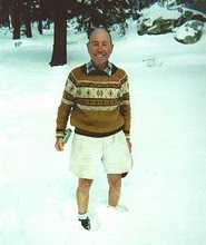
Snow was not really a factor. There was none on the trail at all until heading towards Wellman Divide. There were occasional patches the rest of the way, but most of the trail is clear.
For people interested in logistics of thie hike, we spent the night before at the Motel 6 near the end of Ramon. It is convenient but not the quietest place we've ever been. We also had no trouble bumming a ride back to our car -- that always seems to work if I make the request just as the tram is arriving at the lower station. Oh, and they seem to be pretty rigorous about charging for the trip down. That practice does not seem to be a fluke, nor does it seem likely to go away.
We saw 5 other people on various parts of the hike below Long Valley, and heard evidence of a couple of others coming up from the Museum. The trail to San J from the Tram was very popular, as was the summit.
http://alank.smugmug.com/gallery/1482471
C2C update 5-20-06
11 posts
• Page 1 of 2 • 1, 2
C2C update 5-20-06
Last edited by AlanK on Mon May 22, 2006 9:03 am, edited 1 time in total.
-

AlanK - Posts: 855
- Joined: Tue May 09, 2006 7:31 am
- Location: Glendale, CA
c2c update
Thanks for the update and trip report Alan. I will be taking a group up c2c this coming Saturday and some of them will be wondering about snow conditions up to the peak for the last stretch. We will be starting more than two and a half hours sooner than you did to make up for a much slower time.
. Please visit my website at www.hiking4health.com for more information especially the Links.
http://cys-hiking-adventures.blogspot.com
http://cys-hiking-adventures.blogspot.com
-

Cy Kaicener - Posts: 2236
- Joined: Tue May 09, 2006 3:50 am
- Location: Rialto, California, USA
Re: c2c update
Cy Kaicener wrote: We will be starting more than two and a half hours sooner than you did to make up for a much slower time.
I'm so out-of-shape that I'd have to leave on Thursday. LOL.
- Snowhiker
- Posts: 42
- Joined: Tue May 09, 2006 11:20 pm
- Location: Surprise, AZ
Re: c2c update
Snowhiker wrote:Cy Kaicener wrote: We will be starting more than two and a half hours sooner than you did to make up for a much slower time.
I'm so out-of-shape that I'd have to leave on Thursday. LOL.
You could leave at midnight. I have done that once and didn't get to the peak until noon - a full twelve hours. What better way to get in shape after you recover
. Please visit my website at www.hiking4health.com for more information especially the Links.
http://cys-hiking-adventures.blogspot.com
http://cys-hiking-adventures.blogspot.com
-

Cy Kaicener - Posts: 2236
- Joined: Tue May 09, 2006 3:50 am
- Location: Rialto, California, USA
Anonymous wrote:This reply is a little late but last time my friends and I did C2C we left at 11:30pm and got passed up at the base of Coffman's Crag by a couple guys who started around 4am...yeah we felt really slow at that point...
Whoops, this was me, forgot to log in, sorry!
-

TRumble24 - Posts: 41
- Joined: Sun Jun 11, 2006 12:15 pm
- Location: Morongo Valley, CA
Alan K - C2C update 5-20-06
Alan,
5AM to noon. 7 hours for 17 miles and about 10k vertical. I'm confident I can keep up those figures, but I'm wondering how long you think it will take for a 1st timer to negotiate the terrain. I've been to the top of Jacinto, but never via this route.
I plan on taking the afternoon of 6/23 to get acquainted w/the trailhead. I'm planning on starting at about 5AM 6/24. I'm wondering how hard the trail really is to follow, for an experienced desert hiker who is familiar with the area, but not the trail.
Any input would be greatly appreciated. I've done some research, and I feel confident, but I'd love to know what you think.
- ferris
Alan K - C2C update 5-20-06
And Cy, your input would be much appreciated as well...for what I believe are obvious reasons.
- ferris
ferris -- The trail is pretty easy to follow except for a short section over rocky terrain on the final approach to Long Valley. Early on, just remember to go uphil at any forks. After that, there is not much choice until that rocky section. The first time we did the hike, we hooked up with a fellow who was hiking at our pace about 2 miles below Long Valley. He had done the hike before, so we hardly noticed any iffy sections. On subsequent trips, we have had no trouble, but do pay close attention as we approach Long Valley. We both think that the trail has become easier to follow over the past 4 years (the duration of our experience with the hike).
I don't think that route finding should slow you down much. A map and/or GPS can certainly help if you are at all unsure. I would be happy to send a map with the route and/or waypoints.
You're right -- Cy will undoubtedly have some helpful advice as well.
I don't think that route finding should slow you down much. A map and/or GPS can certainly help if you are at all unsure. I would be happy to send a map with the route and/or waypoints.
You're right -- Cy will undoubtedly have some helpful advice as well.
-

AlanK - Posts: 855
- Joined: Tue May 09, 2006 7:31 am
- Location: Glendale, CA
Skyline Trail
Ferris - I agree with Alan about the trail being pretty easy to follow except for the last 800 feet where little stone markers or ducs will help you out. Perry,s website also has useful information and a map.
http://www.geocities.com/cactus2clouds/skyline.html
I would start at 3 am so that you will be half way up before the sun starts getting hot. The hotter it is the slower you will go and the more water you will have to carry.
http://www.geocities.com/cactus2clouds/skyline.html
I would start at 3 am so that you will be half way up before the sun starts getting hot. The hotter it is the slower you will go and the more water you will have to carry.
. Please visit my website at www.hiking4health.com for more information especially the Links.
http://cys-hiking-adventures.blogspot.com
http://cys-hiking-adventures.blogspot.com
-

Cy Kaicener - Posts: 2236
- Joined: Tue May 09, 2006 3:50 am
- Location: Rialto, California, USA
11 posts
• Page 1 of 2 • 1, 2
Return to Mt. San Jacinto & Santa Rosa Mountains
Who is online
Users browsing this forum: No registered users and 53 guests
