Saturday morning Mark and I got dropped of on Pineview rd. in freezing weather wearing shorts. And every other peice of clothing we had. Snow on the ground and windy.
Within a couple of miles we were completely out of the snow and warm enough.
The hike was easy to follow everywhere other than where we had gone down into the canyon too early. If you are doing the trail from up top and going down, you'll come to a sign after a few miles that splits the trail between the ridgetop route or the canyon route. I would take the ridge top route, the canyon route has thorns and bites. Other than that, the trail is very easy to follow.
The weather never got hot and other than that first frozen mile or two, it couldn't have been better. Over half of the trip really made me think I was walking through the cowboy days.
It was a great hike thanks Mark.
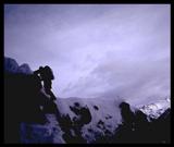
photos http://bluerail.smugmug.com/gallery/736 ... 4095_fGRff

Mt. San Jacinto Outdoor Recreation
Hiking, Climbing, Camping, Trail Running, Snowshoeing...
Pines to Palms/Palm Canyon
22 posts
• Page 1 of 3 • 1, 2, 3
Pines to Palms/Palm Canyon
![]() by bluerail » Sun Feb 15, 2009 8:24 pm
by bluerail » Sun Feb 15, 2009 8:24 pm
-

bluerail - Posts: 2108
- Joined: Thu Dec 11, 2008 10:30 am
- Location: La Quinta
Desert Hike
![]() by lilbitmo » Sun Feb 15, 2009 9:16 pm
by lilbitmo » Sun Feb 15, 2009 9:16 pm
Nice Pictures, my kind of hiking cold but not completely freezing.
I'll have to drive out and do that one soon, take a break from the high country.
I'll have to drive out and do that one soon, take a break from the high country.
-

lilbitmo - Posts: 550
- Joined: Sun Feb 03, 2008 11:37 pm
![]() by Marknhj » Sun Feb 15, 2009 9:59 pm
by Marknhj » Sun Feb 15, 2009 9:59 pm
It was a beautiful day and very enjoyable hike. My shins attest to Steve's advice to not drop down into the Canyon too early, they're pretty sliced and diced...
The only people we saw all day were a small group coming up the Canyon, lead by Udi. Cy - he asked us to say hi.
The only people we saw all day were a small group coming up the Canyon, lead by Udi. Cy - he asked us to say hi.
- Marknhj
- Posts: 179
- Joined: Thu Feb 07, 2008 12:03 pm
- Location: Palm Springs
Nice cows
![]() by halhiker » Sun Feb 15, 2009 10:44 pm
by halhiker » Sun Feb 15, 2009 10:44 pm
I've seen those cattle before. I had a picture of them in my shop once that said, "BLM definition of wildlife".
Great pictures. I was up on 74 yesterday and driving down past palm canyon I thought you guys had gone Saturday and wondered how it went. Sounds like you had a great time.
Thanks for sharing the pictures!
Great pictures. I was up on 74 yesterday and driving down past palm canyon I thought you guys had gone Saturday and wondered how it went. Sounds like you had a great time.
Thanks for sharing the pictures!
-

halhiker - Posts: 1260
- Joined: Mon Oct 16, 2006 12:00 pm
- Location: La Quinta, CA

![]() by Yichus » Mon Feb 16, 2009 10:06 am
by Yichus » Mon Feb 16, 2009 10:06 am
Hi Kevin,
I was part of the group that Mark mentioned. It took us about 5 1/2 hours to hike from the Trading Post in the Indian Canyons to Pine View Road off Highway 74.
According to our GPS, the hike was 15.4 miles, with a gain of 4,535 ft. The trail is clearly marked, so you shouldn't have any trouble following it.
Mark and Steve: It was nice seeing you guys on the trail. Unlike you, we didn't encounter cattle, though we certainly saw plenty of excremental evidence of their presence.
Hope this helps.
Rob
- Yichus
- Posts: 61
- Joined: Tue Sep 05, 2006 4:25 pm
- Location: Loma Linda, CA
![]() by EnFuego » Mon Feb 16, 2009 10:26 am
by EnFuego » Mon Feb 16, 2009 10:26 am
Very nice pictures. I too, need to find a day to hed out that way. Maybe a weekend and try to hit 2 or3 of the deserts favorite hikes.
Thanks for sharing.
Thanks for sharing.
If you're not living on the edge,
you're taking up too much room!
you're taking up too much room!
-
EnFuego - Posts: 74
- Joined: Tue Dec 16, 2008 11:27 am
- Location: Seal Beach, Ca
![]() by bluerail » Mon Feb 16, 2009 10:10 pm
by bluerail » Mon Feb 16, 2009 10:10 pm
Kevin,
I think you could do the trip both ways reasonably if you started up top early morning before sun up and possibly didn't bother going down into indian canyon at that final 1-2 mile point. that would definitely turn it into a workout and not so much of a walk. Good idea.
The trail is absolutely easy to follow, just the ridge/canyon option at the south end that I mentioned.Other than that, it's a sidewalk trail through a very cool landscape.
I'm sure it would be great to run...like I said, sidewalk.
-
bluerail - Posts: 2108
- Joined: Thu Dec 11, 2008 10:30 am
- Location: La Quinta
![]() by bluerail » Tue Feb 17, 2009 8:59 pm
by bluerail » Tue Feb 17, 2009 8:59 pm
Kevin,
Pineview dr. is where we started. It is just east of the dirt road that goes up Santa Rosa Mountain, and west of Pinyon Flats on Hwy. 74. I believe it shows up on maps. The other group that did the trail left their vehicles there while they hiked. Pineview dr. is about a block long and dead ends. The trail starts there and is obviuos.
Sorry we weren't able to end up on the trail at the same time. Maybe sometime soon. Maybe JoPond ? I want to do that from Indian Canyons up. I'm shooting for the 28th. Hope you have a good hike. Are you going down and back up?
-
bluerail - Posts: 2108
- Joined: Thu Dec 11, 2008 10:30 am
- Location: La Quinta
22 posts
• Page 1 of 3 • 1, 2, 3
Return to Mt. San Jacinto & Santa Rosa Mountains
Who is online
Users browsing this forum: No registered users and 10 guests