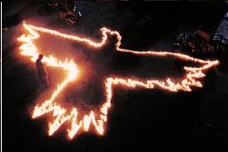
BACK TO BACK TO BACK TO ????????

General Palm Springs area.

snow bad...crampons needed for easter sunday?

Postby michael » Tue Mar 02, 2010 5:42 pm

Hey everyone!

I hear talk of a multi-skyline easter sunday?

Historically, is the snow bad on easter sunday? Need crampons or will trekking poles suffice?

Just planning ahead..though i probably wont try it if crampons are needed...not after seeing that pic of Fern on the snow. :shock:

Impressive!
michael T.
User avatar
michael
 
Posts: 37
Joined: Fri Oct 30, 2009 6:02 pm

Re: Back to back to back to

Postby imike » Tue Mar 02, 2010 6:58 pm

Cy Kaicener wrote:It be here and lots of luck going down more than once :shock:
http://www.summitpost.org/mountain/rock ... ain-1.html
The average steepness is 1000 feet per mile which means that some areas are a lot steeper than this.


... I try to train on trails averaging 1000 ft per mile, with grade sections over 1600' per mile... and if my shoulders are in good shape, I augment with 45-75 pound packs... If the c2c trail gains 8,000' over the initial 11 miles, that suggests more of a 750' average... with the final five mile section averaging less than 400'... are there some longer flat areas that raise the grade in certain areas?
...out early, up and away. It does not get better.
imike
 
Posts: 26
Joined: Wed Oct 21, 2009 2:18 pm
Location: New Mexico

Re: Back to back to back to

Postby imike » Tue Mar 02, 2010 7:03 pm

Cy Kaicener wrote:It be here and lots of luck going down more than once :shock:
http://www.summitpost.org/mountain/rock ... ain-1.html
The average steepness is 1000 feet per mile which means that some areas are a lot steeper than this.


ah, the other hike hits the 1000' per mile level. It looks as if it may be substantially off trail. I like the 1000' per mile idea, but for the necessary speed needed to fit 20,000' into 24 hours I need to be able to run a goodly bit of the route. I practice running on 1000-1400' sections (down) but with the benefit of a cleared trail... stable rock and clear path. this mountain sounds like a fun hike, but not a great choice for multiples...?
...out early, up and away. It does not get better.
imike
 
Posts: 26
Joined: Wed Oct 21, 2009 2:18 pm
Location: New Mexico

Postby bluerail » Tue Mar 02, 2010 7:25 pm

what kind of monster are you ?
User avatar
bluerail
 
Posts: 2108
Joined: Thu Dec 11, 2008 10:30 am
Location: La Quinta

Postby » Tue Mar 02, 2010 8:32 pm

i'm telling you this is your hike :)

first half going up is a "warm up" of say 3000 ft in 4.5 miles. then 3500 ft in 2.5 miles. Some sections averaging over 2500 ft / mile.

But if you see those two guys in the first picture, RUN AWAY!
 
Posts: 552
Joined: Mon Jun 09, 2008 8:41 pm

Re: Back to back to back to

Postby » Tue Mar 02, 2010 8:35 pm

imike wrote:ah, the other hike hits the 1000' per mile level. It looks as if it may be substantially off trail. I like the 1000' per mile idea, but for the necessary speed needed to fit 20,000' into 24 hours I need to be able to run a goodly bit of the route. I practice running on 1000-1400' sections (down) but with the benefit of a cleared trail... stable rock and clear path. this mountain sounds like a fun hike, but not a great choice for multiples...?


depends on your definition of "off trail" :lol:

there is a clear path all the way up. some brush hugging parts of the for little bits but nothing that will slow you down.

I would also suggest Baldy from the Village, but 3x that would still leave you 2000 ft short.

 
Posts: 552
Joined: Mon Jun 09, 2008 8:41 pm

Postby imike » Tue Mar 02, 2010 9:04 pm

Zé wrote:i'm telling you this is your hike :)

first half going up is a "warm up" of say 3000 ft in 4.5 miles. then 3500 ft in 2.5 miles. Some sections averaging over 2500 ft / mile.

But if you see those two guys in the first picture, RUN AWAY!


looks from the map that the hike begins around 2,000' and ends around 7800' for a total gross gain of 5800'... if it really is all uphill, then there is an overall average of around 750' per mile. If there is downhill mixed into the climb, then an additional 700' somewhere (upper section?). or, someone used a GPS to determine gain (never very accurate... from 15-400% error rate) The 2500' climbing sections would be interesting! I'll check it out when I am out there this spring... thanks!
...out early, up and away. It does not get better.
imike
 
Posts: 26
Joined: Wed Oct 21, 2009 2:18 pm
Location: New Mexico

Postby imike » Tue Mar 02, 2010 9:13 pm

bluerail wrote:what kind of monster are you ?


old... a bit brain dead... sometimes prone to over the top trail endurance training (last June put in 100,000' accumulated elevation gain... most with weighted packs... up to 85# pack last year on trails averaging 1000' per mile). I'm slow, but tend to warm up after 10-12 hours on the trail... best effort was 6 loops on Guadalupe Peak in texas... hoping to do 7 loops this fall.
...out early, up and away. It does not get better.
imike
 
Posts: 26
Joined: Wed Oct 21, 2009 2:18 pm
Location: New Mexico

Postby » Tue Mar 02, 2010 9:39 pm

imike wrote:looks from the map that the hike begins around 2,000' and ends around 7800' for a total gross gain of 5800'... if it really is all uphill, then there is an overall average of around 750' per mile. If there is downhill mixed into the climb, then an additional 700' somewhere (upper section?). or, someone used a GPS to determine gain (never very accurate... from 15-400% error rate) The 2500' climbing sections would be interesting! I'll check it out when I am out there this spring... thanks!


2000' to 8000', plus ups and downs gives ~ 6600 on the way up and another 500 on the way back.

I dunno what GPS gives 400% error rate, that would suck! mine is pretty good and I do my own filtering / analysis, the 7100 figure is pretty accurate.
 
Posts: 552
Joined: Mon Jun 09, 2008 8:41 pm

Postby imike » Wed Mar 03, 2010 6:43 am

Zé wrote:
imike wrote:
2000' to 8000', plus ups and downs gives ~ 6600 on the way up and another 500 on the way back.

I dunno what GPS gives 400% error rate, that would suck! mine is pretty good and I do my own filtering / analysis, the 7100 figure is pretty accurate.


all GPS units have that error factor... the range becomes greater over routes with more flat sections. The more consistent the up or down the more accurate the readings... so, there is an accumulated 600' of down on the uphill section... quite a bit... I look forward to hitting the trail in April. Sounds as if that elevation will not present any snow issues... thanks again
...out early, up and away. It does not get better.
imike
 
Posts: 26
Joined: Wed Oct 21, 2009 2:18 pm
Location: New Mexico

PreviousNext

Return to Mt. San Jacinto & Santa Rosa Mountains

Who is online

Users browsing this forum: No registered users and 3 guests

cron