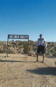
The track was for the guy who wanted directions, the gps coordinates for the trail head I start at would be easy for him to find. You can also get an idea of what the hike is like. The 1100ft gain to the top with in 1.5 miles is more elevation gain per mile then most "real hikes".
Also believe it or not but people do get lost on that trail.

Mt. San Jacinto Outdoor Recreation
Hiking, Climbing, Camping, Trail Running, Snowshoeing...
Bump and Grind
32 posts
• Page 2 of 4 • 1, 2, 3, 4

 by DSSAR guy » Thu Apr 08, 2010 4:39 pm
Here's an idea. Some time in the near future we organize a bump and grind race from legacy parking lot. Every one puts in $10, I'm sure we can get enough people to meet up and have a good size prize.
- DSSAR guy
- Posts: 51
- Joined: Mon Jan 18, 2010 11:08 pm
- Location: Indio
by bluerail » Thu Apr 08, 2010 6:34 pm
"Most of the sar's on that trail are when people don't turn around once they get to the top and the follow the trail to the west for hour's looking for the end."
Hey !! I've done that a few times..had a wonderful time, went more southwestish though,up over the top of the hill, end up in cat canyon/cahuilla hills..really beautiful back up in there towards Haystack and above Magnesia
Hey !! I've done that a few times..had a wonderful time, went more southwestish though,up over the top of the hill, end up in cat canyon/cahuilla hills..really beautiful back up in there towards Haystack and above Magnesia
Last edited by bluerail on Sun Apr 11, 2010 6:51 pm, edited 1 time in total.
-

bluerail - Posts: 2108
- Joined: Thu Dec 11, 2008 10:30 am
- Location: La Quinta
Run, run as fast as you can
by halhiker » Thu Apr 08, 2010 11:48 pm
I guess the reasons I hike are to enjoy the beauty of the wilderness, the serenity of nature and the discoveries of the soul that are found in exploring new and exciting places filled with mystery.
I should be happy that those whose main hiking motivation is getting a better time have B & G. It keeps them further away from the places I like to go.
Somehow I feel they're missing something important but maybe we just like different things.
I used to try to hike a trail as fast a possible and maybe I'm just getting old but now I try to spend as much time as possible on a trail. There's just too much to see to speed right past it.
Slow hiking. That's my new slogan.
I should be happy that those whose main hiking motivation is getting a better time have B & G. It keeps them further away from the places I like to go.
Somehow I feel they're missing something important but maybe we just like different things.
I used to try to hike a trail as fast a possible and maybe I'm just getting old but now I try to spend as much time as possible on a trail. There's just too much to see to speed right past it.
Slow hiking. That's my new slogan.
-

halhiker - Posts: 1260
- Joined: Mon Oct 16, 2006 12:00 pm
- Location: La Quinta, CA
32 posts
• Page 2 of 4 • 1, 2, 3, 4
Return to Mt. San Jacinto & Santa Rosa Mountains
Who is online
Users browsing this forum: Baidu [Spider] and 29 guests