The Seven Summits of San Jacinto -- Trip Report

General Palm Springs area.

The Seven Summits of San Jacinto -- Trip Report

Postby Hikin_Jim » Tue Jul 30, 2013 9:06 pm

Well, now that the Mountain Fire is 100% contained and hopefully behind us, I thought I'd go ahead and put together my trip report for my recent Seven Summits of San Jacinto peak bagging fest and exploratory trip.

As usual, I've got lots of maps listing things like all the peaks on my route:
Image

Detailed route descriptions and photos:
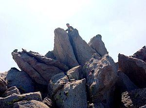
Image

Great views:
Image

And lovely flora:
Image

Have a read when you get the chance.

Regards,

HJ
Backpacking stove reviews and information:  Adventures In Stoving
Personal hiking blog: Hikin' Jim's Blog
User avatar
Hikin_Jim
 
Posts: 4958
Joined: Mon Oct 30, 2006 9:12 pm
Location: Orange County, CA

Seven Peaks

Postby Wildhorse » Wed Jul 31, 2013 6:55 am

What a wonderful hike.

I feel melancholy reading your report, even while these places did not burn. I feel so sad after the fire. But, it is not just that. The exploratory backpacking way you approached this hike, as much as the fire, gives me that feeling because I love these mountains too and I always want to linger in the high country, to see it closely, in detail, and patiently while I am enjoying its physical challenges.

Thank you for bringing back the route information and the photos. I have been to all except Folly, but by different routes. I am particularly interested in following your route to Marion someday and in finding the route you found coming down from Jean towards Wellman's Divide. Several years ago, my wife and I attempted something like that route starting at Wellman's Divide, but never found a nice way through the brush.
Wildhorse
 
Posts: 548
Joined: Tue Oct 19, 2010 1:11 pm

Postby arocknoid » Wed Jul 31, 2013 8:04 am

Thanks for the well-crafted writeup of a marvelous walkabout.

You have captured Essence of Teh Seven with your own perspective and mellow voice in probably one of the last expansive TRs before the fire.

Like so many others, I am anxious to get back up there, and hopeful that the changes won't be too devastating. (additional reports indicate that the fire intensity moderated, and it became less of a crown fire, more of a creeping / understory fire, which bodes well.)

Thanks again for the pics and prose, and taking the time and energy for the writeup. Definitely archival.

kind regards,
arocknoid
User avatar
arocknoid
 
Posts: 342
Joined: Thu Aug 26, 2010 11:36 pm

Re: Seven Peaks

Postby Hikin_Jim » Wed Jul 31, 2013 9:39 am

Wildhorse wrote:What a wonderful hike.
Really, it was. This is some great territory. I feel like we all owe it to ourselves to get off the confines of the trails and do some real hiking, that is off trail hiking. There is nothing so liberating as an off trail high country ramble. And the terrain here is particularly suitable.


I am particularly interested in following your route to Marion someday and in finding the route you found coming down from Jean towards Wellman's Divide. Several years ago, my wife and I attempted something like that route starting at Wellman's Divide, but never found a nice way through the brush.
My route to Marion worked surprisingly well. I was quite pleased.

I haven't quite got the route down to Wellman Divide from Jean Peak yet. I need some more work on that one.

I also want to work out the route down from Jean-San Jacinto Saddle to where the old Tamarack Trail comes in.

HJ
Backpacking stove reviews and information:  Adventures In Stoving
Personal hiking blog: Hikin' Jim's Blog
User avatar
Hikin_Jim
 
Posts: 4958
Joined: Mon Oct 30, 2006 9:12 pm
Location: Orange County, CA

Postby Hikin_Jim » Wed Jul 31, 2013 8:39 pm

arocknoid wrote:Thanks for the well-crafted writeup of a marvelous walkabout.

You have captured Essence of Teh Seven with your own perspective and mellow voice in probably one of the last expansive TRs before the fire.

Like so many others, I am anxious to get back up there, and hopeful that the changes won't be too devastating. (additional reports indicate that the fire intensity moderated, and it became less of a crown fire, more of a creeping / understory fire, which bodes well.)

Thanks again for the pics and prose, and taking the time and energy for the writeup. Definitely archival.

kind regards,
arocknoid
Well, thank you. Hopefully the three posts that trip helped contribute to en toto or in part are indeed worth referring to:

Is Marion Mountain "Wrong" on the USGS Topo?
Water Sources of the San Jacinto Mountains -- West Side
The Seven Summits of San Jacinto

HJ
Backpacking stove reviews and information:  Adventures In Stoving
Personal hiking blog: Hikin' Jim's Blog
User avatar
Hikin_Jim
 
Posts: 4958
Joined: Mon Oct 30, 2006 9:12 pm
Location: Orange County, CA

Postby Ulysses » Thu Aug 01, 2013 11:17 am

Great trip report Jim. Thanks for sharing. Love the Lemon Lily pictures.

I went up Shirley to and Jean from Wellmans Divide a couple of weeks ago (just before the fire). Pretty straight forward and minimal brush.

Which route up Marion would you say has less brush: the route you went up via Deer Springs Trail camp, or from the east via Wellmans Cienega?

Did you go directly from the summit of SJ to get to Folly?
Ulysses
 
Posts: 279
Joined: Mon May 03, 2010 6:16 pm
Location: Idyllwild

Postby Hikin_Jim » Thu Aug 01, 2013 1:46 pm

Ulysses wrote:Which route up Marion would you say has less brush: the route you went up via Deer Springs Trail camp, or from the east via Wellmans Cienega?
The route up from Deer Springs Crossing/Camp definitely had less brush. Brush was almost non existent.

Did you go directly from the summit of SJ to get to Folly?
Yes, pretty much directly down the west ridge of SJ. In my opinion, the route from SJ to Folly is one of the most fun class 2 routes in Southern California.
Image

HJ
Backpacking stove reviews and information:  Adventures In Stoving
Personal hiking blog: Hikin' Jim's Blog
User avatar
Hikin_Jim
 
Posts: 4958
Joined: Mon Oct 30, 2006 9:12 pm
Location: Orange County, CA

Postby tekewin » Fri Aug 02, 2013 6:47 pm

What a great trip report and photos. First class, Hikin Jim. Well done.
User avatar
tekewin
 
Posts: 95
Joined: Mon Apr 01, 2013 5:19 pm
Location: United States

Postby Hikin_Jim » Fri Aug 02, 2013 8:41 pm

Thanks. I had pretty good material to work with. :)

HJ
Backpacking stove reviews and information:  Adventures In Stoving
Personal hiking blog: Hikin' Jim's Blog
User avatar
Hikin_Jim
 
Posts: 4958
Joined: Mon Oct 30, 2006 9:12 pm
Location: Orange County, CA

Postby towbradley » Sat Aug 03, 2013 7:13 am

Once again, its awsome to put your trip in my minds eye as i read your trip and photos report. Looking forward to getting back into the mountains tommorrow with my son. We're taking one of my sons friends up to a camp for people with special needs, then we're planning to go up a trail south of bigbear lake to view san gragornio. Never done this, and dont know if theres even a trail for this, but we'll see. If anyone has an idea of such a trail, please share.
towbradley
 
Posts: 106
Joined: Sat Apr 13, 2013 10:23 pm

Next

Return to Mt. San Jacinto & Santa Rosa Mountains

Who is online

Users browsing this forum: Baidu [Spider] and 6 guests