I have an older map that shows a trail from the Tamarack trail camp going northwest to intersect the trail to the summit just below Miller Peak. However, I have read that this trail is "closed" or no longer in use. Has anyone been on tis trail? If so, what is the condition...overgrown, hard to follow,etc??
I am trying to put together a loop hike from Tamarack to Cornell to San Jac and then back to Tamarack to camp. Can someone point me to a GPS route that I might download?
Thanks in advance for your advice...this board is full of great info!

Mt. San Jacinto Outdoor Recreation
Hiking, Climbing, Camping, Trail Running, Snowshoeing...
Trail from Tamarack to San Jac
7 posts
• Page 1 of 1
Trail from Tamarack to San Jac
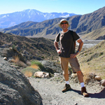
![]() by grumble » Thu Jun 19, 2008 7:13 am
by grumble » Thu Jun 19, 2008 7:13 am
- grumble
- Posts: 4
- Joined: Thu Jun 19, 2008 7:07 am
- Location: San Diego, CA
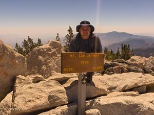
![]() by scottmac » Thu Jun 19, 2008 7:40 am
by scottmac » Thu Jun 19, 2008 7:40 am
I found myself on this trail on a recent trip down from the summit (April, with snow obscuring some of the main trail back to Wellman). I tried to follow it up but lost it, then I followed it down and lost it near the Tamarack campground, but did locate the campground and proceeded to Round Valley campground.
Here is some info from last year ...
http://www.mtsanjacinto.info/viewtopic. ... t=tamarack
Here is some info from last year ...
http://www.mtsanjacinto.info/viewtopic. ... t=tamarack
-
scottmac - Posts: 125
- Joined: Mon Mar 31, 2008 7:33 pm
- Location: Palm Springs
![]() by Hikin_Jim » Mon Jun 23, 2008 11:40 am
by Hikin_Jim » Mon Jun 23, 2008 11:40 am
Backpacking stove reviews and information: Adventures In Stoving
Personal hiking blog: Hikin' Jim's Blog
Personal hiking blog: Hikin' Jim's Blog
-

Hikin_Jim - Posts: 4958
- Joined: Mon Oct 30, 2006 9:12 pm
- Location: Orange County, CA
![]() by Rumpled » Wed Aug 13, 2008 3:28 pm
by Rumpled » Wed Aug 13, 2008 3:28 pm
On my little hike to SJ on Sunday, I brought along a copy of a USGS map with this trail and a state park map without this trail. I also had a map with GPS track where a group did ~7 peaks in one day using part of that trail. (Got that from summitpost I think?)
I'd considered using that trail on the return to make a loop; but based upon Ellen and others' reports here - I decided not to.
I'd waypointed from the USGS map the spot of the trail junction on my GPS. When I got to that location; there was a duck there and a faint trail heading down what is to become Long Valley Creek.
I'm curious as well and might check it out if/when I make another trip there.
-
Rumpled - Posts: 122
- Joined: Fri Jul 11, 2008 1:15 am
![]() by halhiker » Thu Aug 14, 2008 12:35 am
by halhiker » Thu Aug 14, 2008 12:35 am
Rumpled wrote:On my little hike to SJ on Sunday, I brought along a copy of a USGS map with this trail and a state park map without this trail. I also had a map with GPS track where a group did ~7 peaks in one day using part of that trail. (Got that from summitpost I think?)
I'd considered using that trail on the return to make a loop; but based upon Ellen and others' reports here - I decided not to.
I'd waypointed from the USGS map the spot of the trail junction on my GPS. When I got to that location; there was a duck there and a faint trail heading down what is to become Long Valley Creek.
I'm curious as well and might check it out if/when I make another trip there.
Whoa. There's a duck up there? I must rid the wilderness of this abomination.
-

halhiker - Posts: 1260
- Joined: Mon Oct 16, 2006 12:00 pm
- Location: La Quinta, CA
7 posts
• Page 1 of 1
Return to Mt. San Jacinto & Santa Rosa Mountains
Who is online
Users browsing this forum: No registered users and 15 guests