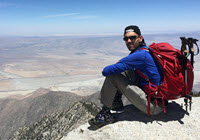
I searched this forum and forgive me in advance if I missed the answer to this - Anyone know of GPS Waypoints/Coordinates for the C2C? I plan on hiking this with some friends May 21st. It has been years since I did this hike. The first attempt a person in our party snapped her achilles tendon, so we had to carry her back down. We made it on our second attempt a year later. This time I am leading it, and don't really want to get us off track. Planning on starting at end of Ramon Rd. Does anyone have the GPS/Garmin route/file they could point me to? I remeber getting turned around a bit off trail near the top towards the Tram before. Any help appreciated. Looks like this is a great forum of information!!!