hello all,
I am developing an iPhone game called hypothermia!
If anyone here has pictures of any place on San Jacinto I would love to be able to include them in the game. All of my pictures are old and black-and-white from the late 70s.
In the late 70s I was living in Snow Creek and a member of Riverside Mountain rescue. My girlfriend and I made a board game we called hypothermia, based on some of the backcountry rescues and stupid events that we heard about in the state park.
The game consisted of a winter hike from the Palm Springs aerial tramway to the peak of Mount San Jacinto. Along the way various things could happen to the players. If you landed on a hypothermia square you picked a hypothermia card these could be anything from, you fall in an icy creek to wearing too much cotton. You would then pick a rescue card which could be anything from:
you grit your teeth and push on
extra large ranger finds you and put you in his backpack, start over
Riverside Mountain rescue find you but you hassle them you're out.
And of course the worst one: They find you next spring.
Anyway any good images or stories forward them to me and they might be included in the first or the second version of the game.
Tony

Mt. San Jacinto Outdoor Recreation
Hiking, Climbing, Camping, Trail Running, Snowshoeing...
IPhone game
7 posts
• Page 1 of 1
IPhone game
 by classvtony » Wed Jul 15, 2009 8:00 am
-
classvtony - Posts: 40
- Joined: Wed Jul 15, 2009 7:49 am
- Location: Nevada City, CA
by Perry » Wed Jul 15, 2009 9:44 pm
Tony, when I first saw your subject I thought you were a spammer. 
"And he knows those computers better than anybody, all those computers, those vote-counting computers. And we ended up winning Pennsylvania like in a landslide, so, it was pretty good, it was pretty good, so thank you to Elon!"
-Donald Trump
-Donald Trump
-

Perry - Site Admin
- Posts: 1525
- Joined: Mon May 08, 2006 6:01 pm
- Location: Palm Springs, CA
Re: IPhone game
by Cobber99 » Wed Jul 22, 2009 3:16 pm
classvtony wrote:If anyone here has pictures of any place on San Jacinto I would love to be able to include them in the game.
I have a few pictures of the area here - have at it:
http://www.flickr.com/photos/cobber99/c ... 238627464/
-

Cobber99 - Posts: 20
- Joined: Sun Aug 05, 2007 11:04 pm
- Location: Palm Springs, CA
Winter Game
by lilbitmo » Thu Jul 23, 2009 11:23 am
Do you mean like "White Out Conditions" at the summit in the Winter?

Where you have to get within three feet of the Summit Sign to see it?

And you cannot make out Cornell from the approach to Round Valley?

Or would you prefer sunny day shots going up the face of Miller looking west?

Or that long gaze down at the Banning Pass as your other escape route?

I have many many more if you want, send me a private message and I will upload all of them and send you a link to photobucket?
Lilbitmo
Where you have to get within three feet of the Summit Sign to see it?
And you cannot make out Cornell from the approach to Round Valley?
Or would you prefer sunny day shots going up the face of Miller looking west?
Or that long gaze down at the Banning Pass as your other escape route?
I have many many more if you want, send me a private message and I will upload all of them and send you a link to photobucket?
Lilbitmo
-

lilbitmo - Posts: 550
- Joined: Sun Feb 03, 2008 11:37 pm
Hey thanks a lot!
by classvtony » Mon Jul 27, 2009 8:31 am
this is terrific, exactly what I need. A few pictures from summer on the trail would be great also.
So when the players are in the summer version pictures can pop up at various locations on the trail and a description of where the picture was taken would really be helpful.
Anyways, it's really fun making this game and only one or two of the hypothermia events are made up. There's just no end to the stupid backcountry tricks that the flatlanders provide.
I also have an iPhone avalanche inclinometer in the works which will come out before the game.
So when the players are in the summer version pictures can pop up at various locations on the trail and a description of where the picture was taken would really be helpful.
Anyways, it's really fun making this game and only one or two of the hypothermia events are made up. There's just no end to the stupid backcountry tricks that the flatlanders provide.
I also have an iPhone avalanche inclinometer in the works which will come out before the game.
-
classvtony - Posts: 40
- Joined: Wed Jul 15, 2009 7:49 am
- Location: Nevada City, CA
Re: Hey thanks a lot!
by Cobber99 » Mon Jul 27, 2009 10:05 am
classvtony wrote:this is terrific, exactly what I need. A few pictures from summer on the trail would be great also.
So when the players are in the summer version pictures can pop up at various locations on the trail and a description of where the picture was taken would really be helpful.
Anyways, it's really fun making this game and only one or two of the hypothermia events are made up. There's just no end to the stupid backcountry tricks that the flatlanders provide.
I also have an iPhone avalanche inclinometer in the works which will come out before the game.
My Flickr albums have each photo geotagged so if you need a particular section of the trail, you can check the Flickr map like this:
http://www.flickr.com/photos/cobber99/s ... 59052/map/
Such a cool feature!
-
Cobber99 - Posts: 20
- Joined: Sun Aug 05, 2007 11:04 pm
- Location: Palm Springs, CA
Hypothermia!
by classvtony » Wed Aug 05, 2009 9:04 am
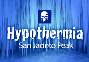
This is just the first screen and the first go around for the graphics.
http://files.me.com/tloro/t7fd8v
It occurs to me that if anyone here has an iPhone and you and would like to be in on testing the game let me know.
Once it is in beta I just send you the application and a little file that allows your phone to load only this application through iTunes.
Be an iPhone developer! Or at least a beta test droid.
Actually if my other projects were half as much fun as this I would do this full time.
http://files.me.com/tloro/t7fd8v
It occurs to me that if anyone here has an iPhone and you and would like to be in on testing the game let me know.
Once it is in beta I just send you the application and a little file that allows your phone to load only this application through iTunes.
Be an iPhone developer! Or at least a beta test droid.
Actually if my other projects were half as much fun as this I would do this full time.
-
classvtony - Posts: 40
- Joined: Wed Jul 15, 2009 7:49 am
- Location: Nevada City, CA
7 posts
• Page 1 of 1
Return to Mt. San Jacinto & Santa Rosa Mountains
Who is online
Users browsing this forum: No registered users and 4 guests